Map size in jpg-format: 12.2184MiB
Click to open in high resolution (open in new tab).
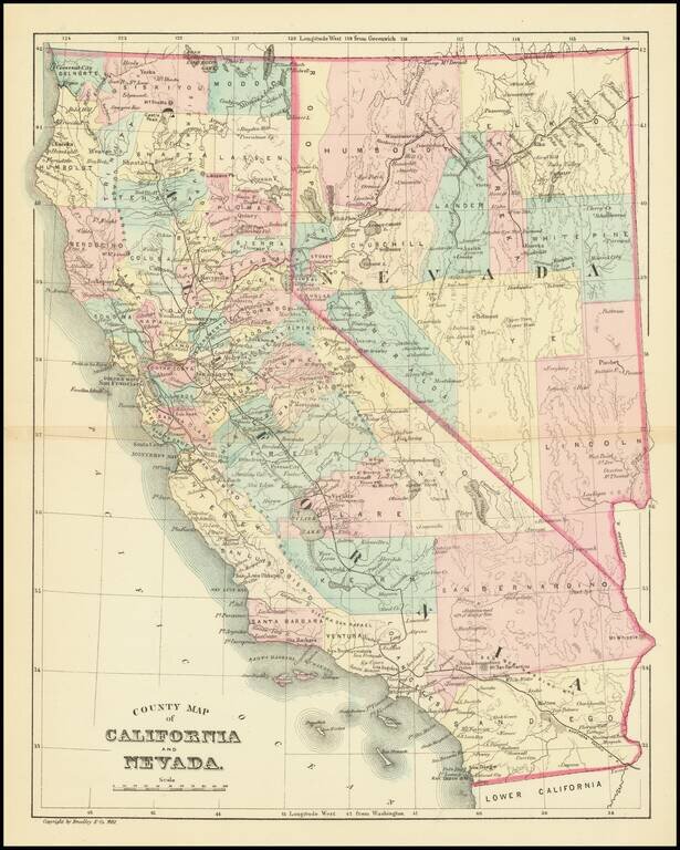
Detailed map of California & Nevada, published by William Bradley.
The map is colored by counties.
Pre-dates the formation of a number of Southern California Counties, including Orange, Riverside and Imperial Counties.
If you are a student, write to us in telegram: @antiquemaps and indicate what material you need and for what work you need a map in high detail. We are ready to provide material on special terms. For students only!

![Mexique par Th. Duvotenay…1843 [Republic of Texas]](/map/small/67925.jpg)
