logo

1875. Specialkarte von Australien in 9 Blattern. Nach Original & Officielen Quellen Von A. Petermann 1875

  • Specialkarte von Australien in 9 Blattern.  Nach Original & Officielen Quellen Von A. Petermann 1875

Specialkarte von Australien in 9 Blattern. Nach Original & Officielen Quellen Von A. Petermann 1875 information:

Year of creation: 
Resolution size (pixels): 
 29872x24673 px
Disk Size: 
 120.681MiB
Number of pages: 
 1
Place: 
 Gotha

Print information. Print size (Width x height in inches):
Printing at 72 dpi 
  414.89 х 342.68
Printing at 150 dpi 
 199.15 х 164.49
Printing at 300 dpi 
 99.57 х 82.24

An example of detailing the file of this map of in a printable high-resolution:

Click to open in high resolution (open in new tab).
Attention! this is just the central piece (central area 960x960 px) of the map file!
This is an example, so that you can see and study the level of detail of a given map. The entire Map will be fully available after payment!

Specialkarte von Australien in 9 Blattern.  Nach Original & Officielen Quellen Von A. Petermann 1875

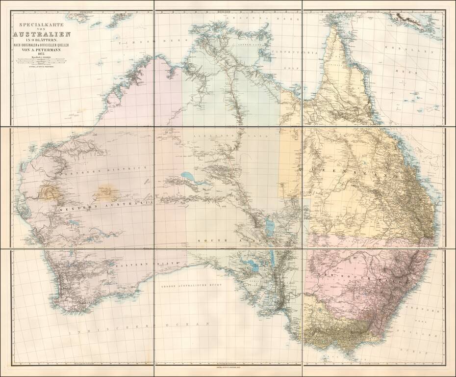
Scarce 9 sheet map of Australia, published by Augustus Petermann.

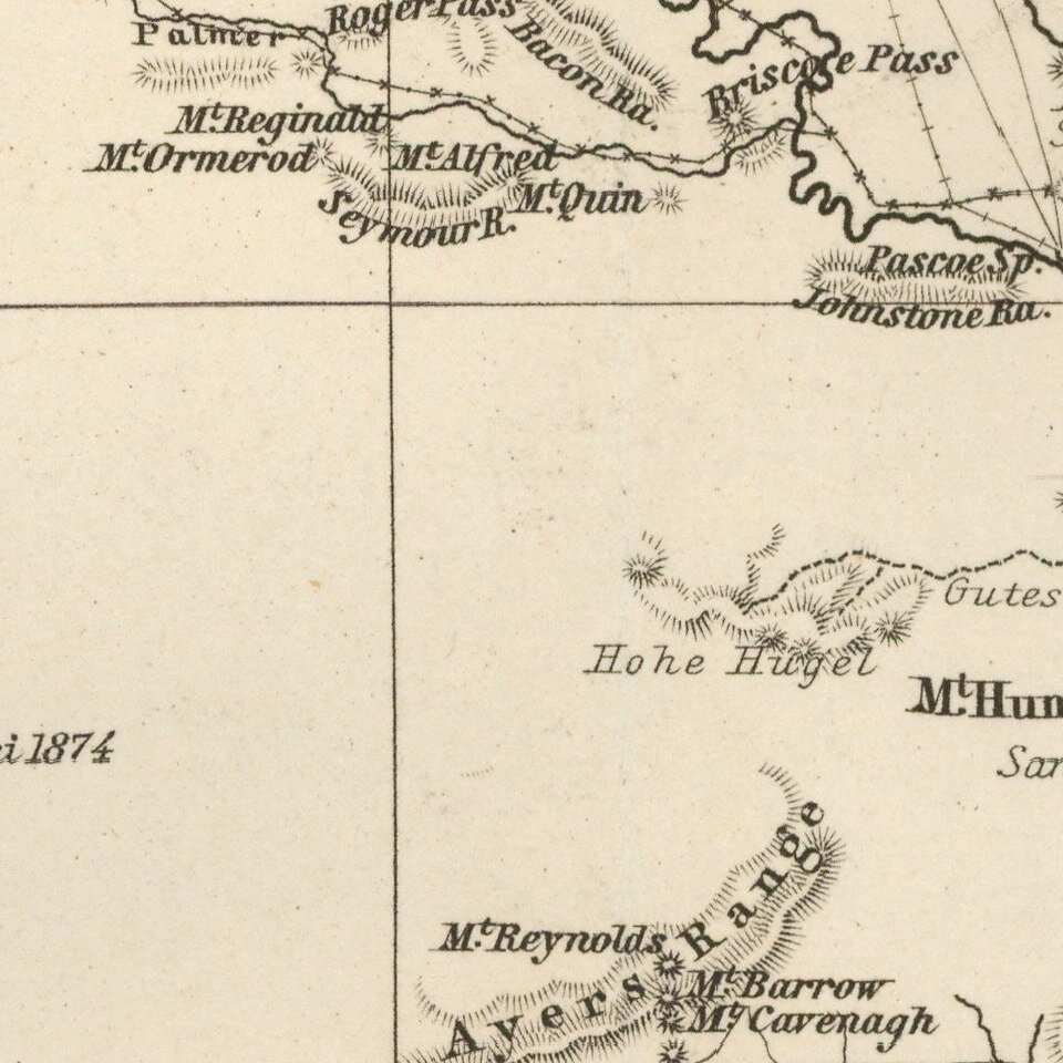
Large map of Australia showing towns, river system, railways and telegraph lines and county boundaries.

The map features the routes taken by a number of important overland explorers, during a time period when the interior parts of Australia were still largely unknown.

Relief shown by hachures and spot heights with annotations on vegetation.

Tooley, R.V. (Australia) 1531

Special conditions for students!

If you are a student, write to us in telegram: @antiquemaps and indicate what material you need and for what work you need a map in high detail. We are ready to provide material on special terms. For students only!

Item information:

Year of creation:
Size:
29872x24673 px
Disk:
120.681MiB
Number of pages:
1
Place:
Gotha
Author:
Augustus Herman Petermann.
$21.99

Related item