Map size in jpg-format: 2.97293MiB
Click to open in high resolution (open in new tab).
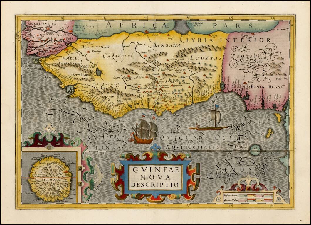
Gorgeous map of the West African Coast from Rio Senego (Senegal) to Cape Lopez, just below the equator, and includes Guinea with parts of Benin and Lybia. Detailed inset of St. Thomas.
The map reflects the Portuguese exploration and mapping of the region. The map is one of six new maps of Africa to be included in Hondius' first edition of Mercator's Atlas. Fine example.
If you are a student, write to us in telegram: @antiquemaps and indicate what material you need and for what work you need a map in high detail. We are ready to provide material on special terms. For students only!
![[Wall Map] West-Indische Paskaert waer in de graden der breedde over weder zyden vande middelyn wassende so vergrooten dat die geproportioneert syn tegen hunne nevenstaende graden de lengde.](/map/small/60169.jpg)
![[The First Maps in a la poupée Printed Color] Cartes en Couleur des Lieux Sujets aux tremblements de Terre Dans toutes les parties du Monde Selon le Sisteme de l’impulsion Solaire](/map/small/52293op.jpg)
