Map size in jpg-format: 1.0432MiB
Click to open in high resolution (open in new tab).
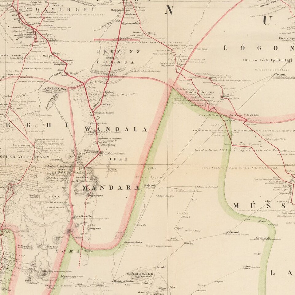
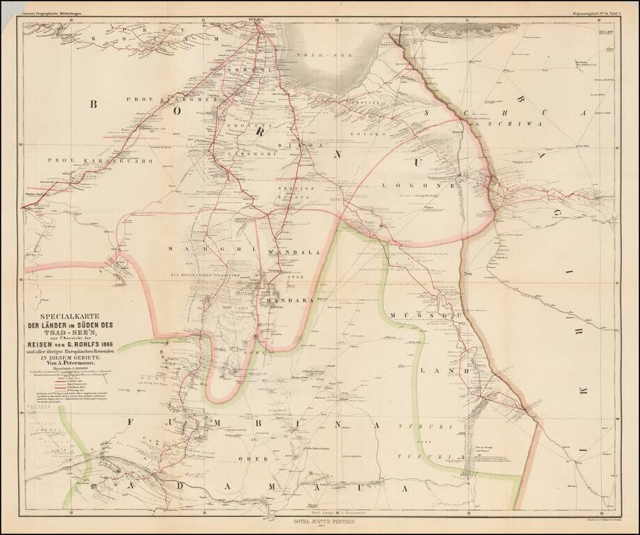
Scarce map of central Africa, illustrating the region to the south of Lake Chad, focusing on the explorations of Gerhard Rohlfs.
The map identifies the routes of a number of explorers, including:
The map translates as "Special map of the countries in the South Of Lake Chad, illustrated the travels of C. Rohlfs 1866 and other European travelers in this area."
If you are a student, write to us in telegram: @antiquemaps and indicate what material you need and for what work you need a map in high detail. We are ready to provide material on special terms. For students only!


