logo

1868. Carte de L'Ocean Atlantique Meridional dressee par Robiquet Hydrographe . . .1868

  • Carte de L'Ocean Atlantique Meridional dressee par Robiquet Hydrographe . . .1868

Carte de L'Ocean Atlantique Meridional dressee par Robiquet Hydrographe . . .1868 information:

Year of creation: 
Resolution size (pixels): 
 25189x17024 px
Disk Size: 
 60.343MiB
Number of pages: 
 1
Place: 
 Paris
Author: 

Print information. Print size (Width x height in inches):
Printing at 72 dpi 
  349.85 х 236.44
Printing at 150 dpi 
 167.93 х 113.49
Printing at 300 dpi 
 83.96 х 56.75

An example of detailing the file of this map of in a printable high-resolution:

Click to open in high resolution (open in new tab).
Attention! this is just the central piece (central area 960x960 px) of the map file!
This is an example, so that you can see and study the level of detail of a given map. The entire Map will be fully available after payment!

Carte de L'Ocean Atlantique Meridional dressee par Robiquet Hydrographe . . .1868

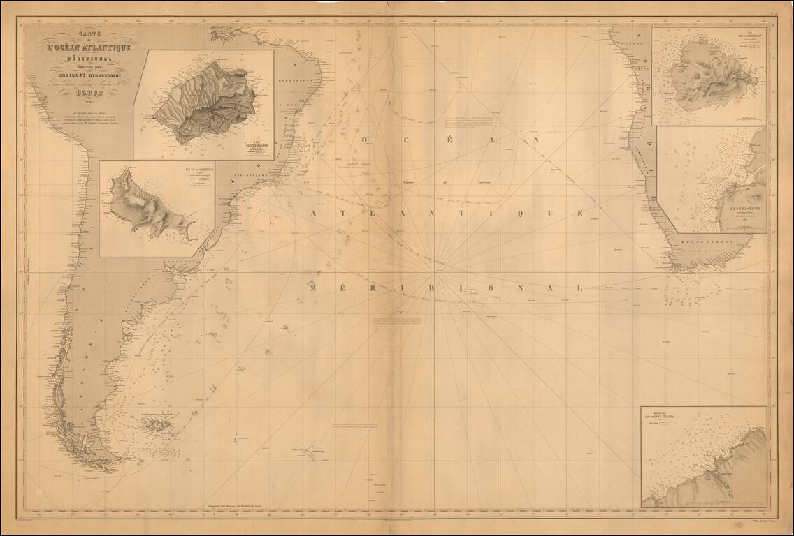
Scarce French sea chart of the South Atlantic, published by Aime Robiquet.

The chart covers most of South America, the southern part of Africa and insets of Sainte Helene, the Island of Trinidad, the Island of Ascencion and the area around Georgetown, Ascencion.

The chart is annotated to show the tracks of an a trip around Cape Horn.


Special conditions for students!

If you are a student, write to us in telegram: @antiquemaps and indicate what material you need and for what work you need a map in high detail. We are ready to provide material on special terms. For students only!

Item information:

Year of creation:
Size:
25189x17024 px
Disk:
60.343MiB
Number of pages:
1
Place:
Paris
Author:
Aime Robiquet.
$21.99

Related item