logo

1882. Lower Egypt In 4 Sheets. Compiled at the Intelligence Branch War Office, from the original French Survey in 1818 by M. Jacotin, from the manuscript of Mahmud Bey and from the most recent information.

  • Lower Egypt In 4 Sheets.  Compiled at the Intelligence Branch War Office, from the original French Survey in 1818 by M. Jacotin, from the manuscript of Mahmud Bey and from the most recent information.

Lower Egypt In 4 Sheets. Compiled at the Intelligence Branch War Office, from the original French Survey in 1818 by M. Jacotin, from the manuscript of Mahmud Bey and from the most recent information. information:

Year of creation: 
Resolution size (pixels): 
 40451x27165 px
Disk Size: 
 232.612MiB
Number of pages: 
 1
Place: 
 London
Author: 

Print information. Print size (Width x height in inches):
Printing at 72 dpi 
  561.82 х 377.29
Printing at 150 dpi 
 269.67 х 181.1
Printing at 300 dpi 
 134.84 х 90.55

An example of detailing the file of this map of in a printable high-resolution:

Click to open in high resolution (open in new tab).
Attention! this is just the central piece (central area 960x960 px) of the map file!
This is an example, so that you can see and study the level of detail of a given map. The entire Map will be fully available after payment!

Lower Egypt In 4 Sheets.  Compiled at the Intelligence Branch War Office, from the original French Survey in 1818 by M. Jacotin, from the manuscript of Mahmud Bey and from the most recent information.

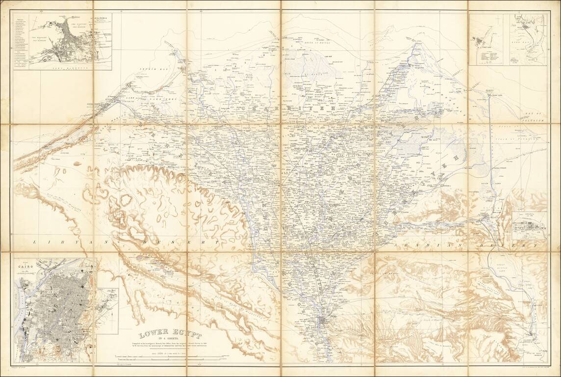
Egypt During the Anglo-Egyptian War

Detailed military reconnaissance map of the Lower Nile Delta, published by the British War Department.

The map extends from Cairo in the South, to Alexandria and Port Said in the north, and includes significant topographical information.

At the lower left is a large city plan of Cairo, with a plan of Alexandria at the top left and a plan of Ismaila at the lower right.

The map depicts the region during the The British Conquest of Egypt, also known as Anglo-Egyptian War, which was fought in 1882 between Egyptian and Sudanese forces under Ahmed ‘Urabi and Great Britain. It ended a nationalist uprising against the Khedive Tewfik Pasha and established firm British influence over Egypt at the expense of the Egyptians, the French and the Ottoman Empire, which retained only nominal authority.


Special conditions for students!

If you are a student, write to us in telegram: @antiquemaps and indicate what material you need and for what work you need a map in high detail. We are ready to provide material on special terms. For students only!

Item information:

Year of creation:
Size:
40451x27165 px
Disk:
232.612MiB
Number of pages:
1
Place:
London
Author:
War Office.
$29.99

Related item