Map size in jpg-format: 31.4534MiB
Click to open in high resolution (open in new tab).
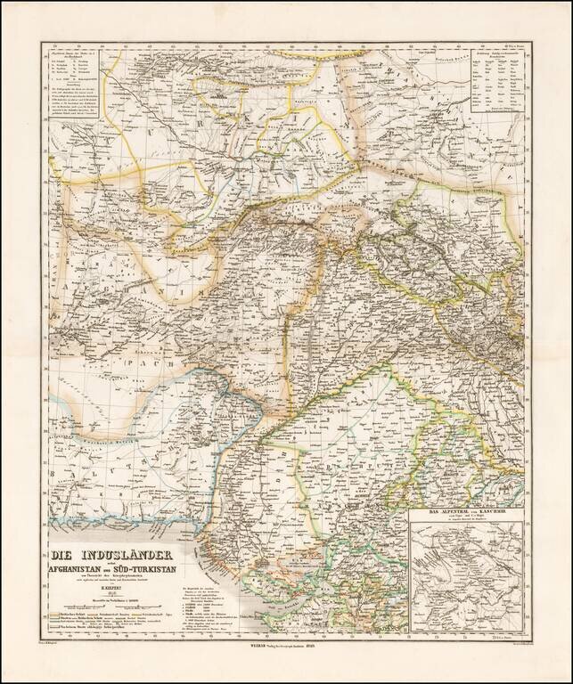
Striking map of Central Asia, published in Weimar by Heinrich Kiepert.
The map extends from Afghanistan and Balutschistan in the west to Kaxgar, Jarkand, Delhi and Northwestern India.
The map encompasses much of the modern day Pakistan, Afghanistan, Turkmenistan, Tajikistan and parts of southern Uzbekistan and Krygystand.
The map illustrates the remarkable labrynth of roads in the region, connecting major cities, including the Silk Route.
Includes a large inset of the Kashmir region.
If you are a student, write to us in telegram: @antiquemaps and indicate what material you need and for what work you need a map in high detail. We are ready to provide material on special terms. For students only!

![[Europe, Mediterranean, Asia Minor and the Persian Empire]](/map/small/43558.jpg)
