Map size in jpg-format: 1.29931MiB
Click to open in high resolution (open in new tab).
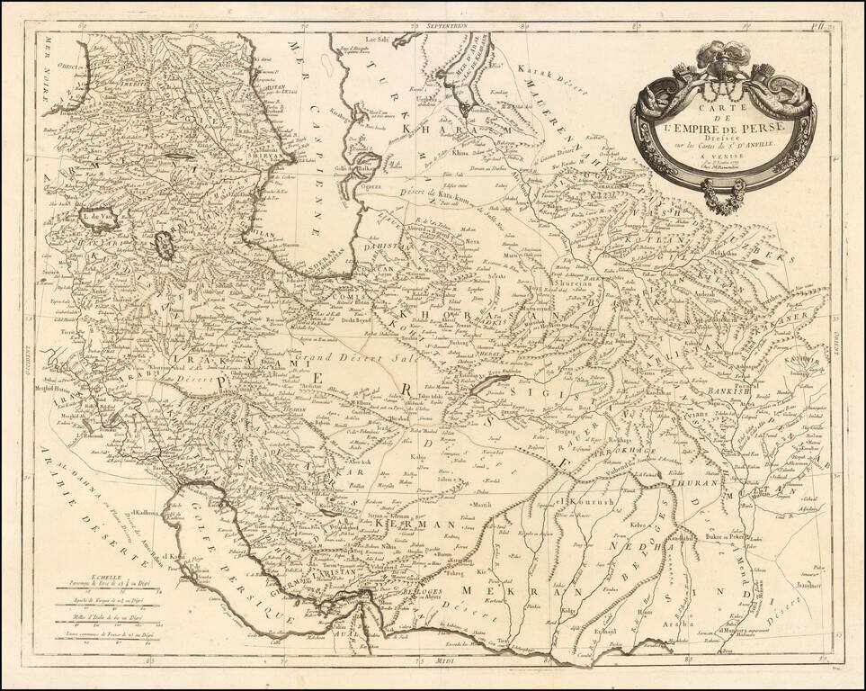
Remondini's edition of the Santini map of the Persian Empire
Detailed map of the Persian Empire extending north to the Caspian Sea and Uzbekistan, and from Armenia and the Persian Gulf in the west to the Indus River and the Karachi area in the east. The map was published in Venice by Santini.
The map includes a large decorative cartouche.
One of the best maps of the Persian Empire to appear in an atlas in the late 18th century.
Paolo Santini (1729-1793) was an Venetian engraver known especially for his religious prints and fine cartographic engravings. He published in Venice and may have a been a member of the clergy. In his maps, he largely adopted and adapted the work of his French counterparts, especially the brothers de Vaugondy.
If you are a student, write to us in telegram: @antiquemaps and indicate what material you need and for what work you need a map in high detail. We are ready to provide material on special terms. For students only!

![[Europe, Mediterranean, Asia Minor and the Persian Empire]](/map/small/43558.jpg)
