logo

1792. Carte De La Perse De L'Armenie De La Natolie & De L'Arabie . . . MDCCXCII

  • Carte De La Perse De L'Armenie De La Natolie & De L'Arabie . . . MDCCXCII

Carte De La Perse De L'Armenie De La Natolie & De L'Arabie . . . MDCCXCII information:

Year of creation: 
Resolution size (pixels): 
 14526x12461 px
Disk Size: 
 55.6852MiB
Number of pages: 
 1
Place: 
 Amsterdam
Author: 

Print information. Print size (Width x height in inches):
Printing at 72 dpi 
  201.75 х 173.07
Printing at 150 dpi 
 96.84 х 83.07
Printing at 300 dpi 
 48.42 х 41.54

An example of detailing the file of this map of in a printable high-resolution:

Click to open in high resolution (open in new tab).
Attention! this is just the central piece (central area 960x960 px) of the map file!
This is an example, so that you can see and study the level of detail of a given map. The entire Map will be fully available after payment!

Carte De La Perse De L'Armenie De La Natolie & De L'Arabie . . . MDCCXCII

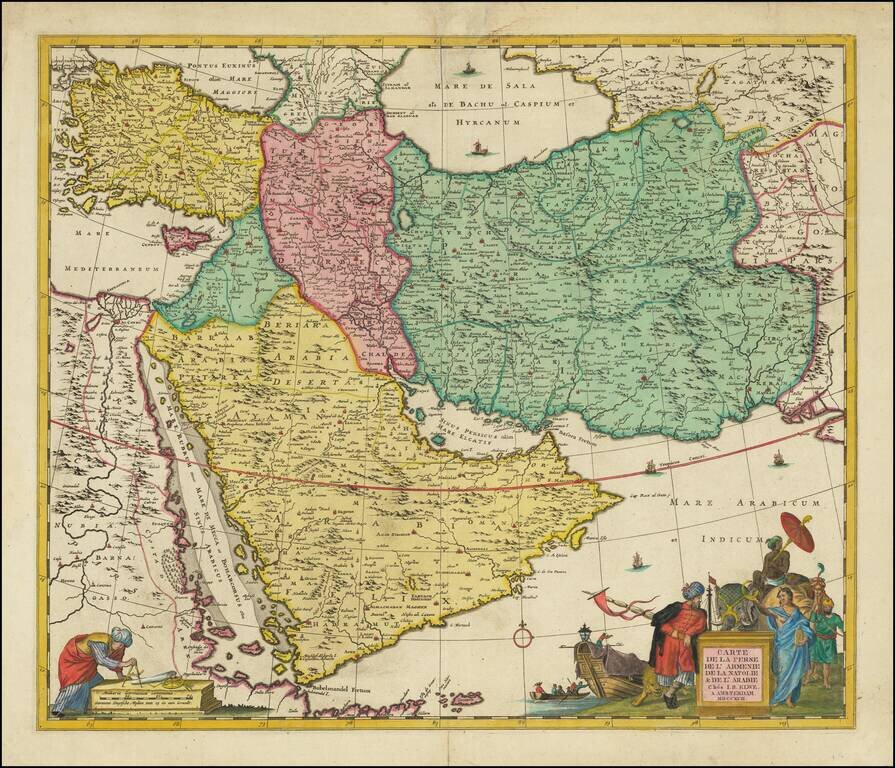
Scarce decorative map of the region bounded by the Saudi Peninsula, Red Sea, Nile River, Cyprus, Asia Minor, the Gulf of Aden, Indian Ocean, Armenia, the Caspian Sea, Afghanistan and the Indian Ocean, centered on the Persian Gulf.

Includes two attractive cartouches, ships at sea and marvelous geographical detail within the map.

One of the few available Dutch maps to mention Armenia in the title of the map and one of the most detailed of the region.


Special conditions for students!

If you are a student, write to us in telegram: @antiquemaps and indicate what material you need and for what work you need a map in high detail. We are ready to provide material on special terms. For students only!

Item information:

Year of creation:
Size:
14526x12461 px
Disk:
55.6852MiB
Number of pages:
1
Place:
Amsterdam
Author:
Jan Barend Elwe.
$14.99

Related item