logo

1856. Carte du Golfe du Bengale et des Cotes de L'Hindoustan Dressee d'apres les Travaux les plus recents par Robiquet Hydrographe . . . 1855.

  • Carte du Golfe du Bengale et des Cotes de L'Hindoustan Dressee d'apres les Travaux les plus recents par Robiquet Hydrographe . . . 1855.

Carte du Golfe du Bengale et des Cotes de L'Hindoustan Dressee d'apres les Travaux les plus recents par Robiquet Hydrographe . . . 1855. information:

Year of creation: 
Resolution size (pixels): 
 25122x17435 px
Disk Size: 
 65.4383MiB
Number of pages: 
 1
Place: 
 Paris
Author: 

Print information. Print size (Width x height in inches):
Printing at 72 dpi 
  348.92 х 242.15
Printing at 150 dpi 
 167.48 х 116.23
Printing at 300 dpi 
 83.74 х 58.12

An example of detailing the file of this map of in a printable high-resolution:

Click to open in high resolution (open in new tab).
Attention! this is just the central piece (central area 960x960 px) of the map file!
This is an example, so that you can see and study the level of detail of a given map. The entire Map will be fully available after payment!

Carte du Golfe du Bengale et des Cotes de L'Hindoustan Dressee d'apres les Travaux les plus recents par Robiquet Hydrographe . . . 1855.

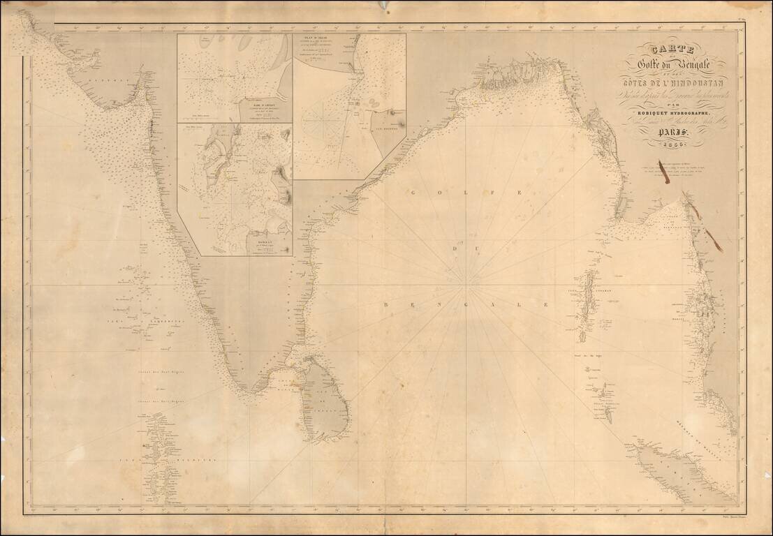
Scarce French sea chart of India and the west coast of Malaysia, etc., published in Paris by Robiquet.

Includes large inset maps of:

  • Bombay
  • Amerst
  • Akiab (Sittwe, Myanmar)

Includes pencil annotations showing a voyage of the coast of Coromandel across the Gulf of Bengal.


Special conditions for students!

If you are a student, write to us in telegram: @antiquemaps and indicate what material you need and for what work you need a map in high detail. We are ready to provide material on special terms. For students only!

Item information:

Year of creation:
Size:
25122x17435 px
Disk:
65.4383MiB
Number of pages:
1
Place:
Paris
Author:
Aime Robiquet.
$21.99

Related item