Map size in jpg-format: 3.20215MiB
Click to open in high resolution (open in new tab).
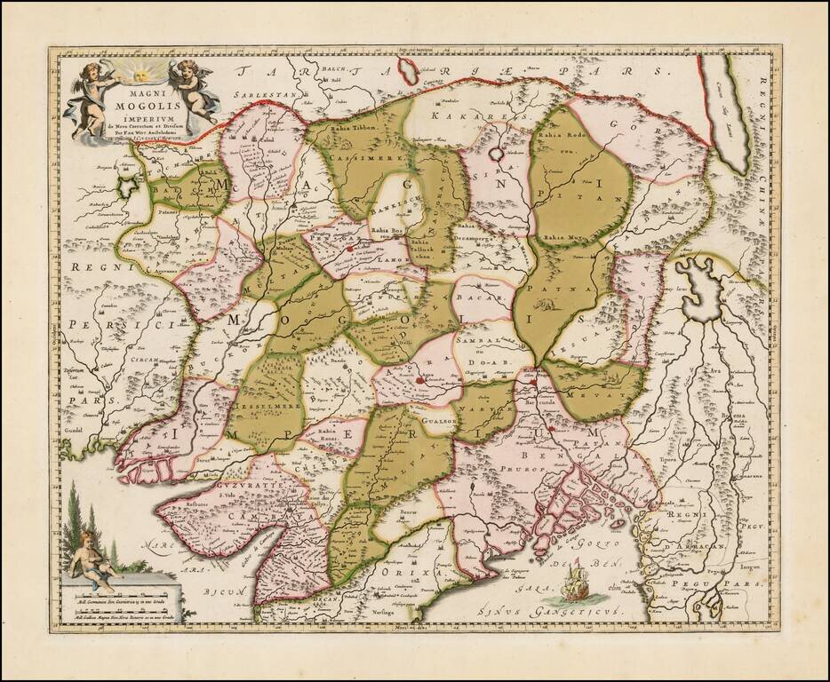
An attractive map of the region bounded by northern India, Pakistan, Afghanistan and Bangladesh and extending inland up the Ganges and Indus Rivers to Tartary and the Himalayas, including Katmandu, Kabul and other legendary cities along the great trading route.
Extends south to include a large portion of India, including Narsinga, Orixa Decan, etc. Elephants shown roaming the Ganges and camels east of Kabul. Decorative cartouches and sailing ships. The map was originally issued by De Wit, circa 1690.
The Covens & Mortier edition of this map is quite rare on the market, this being only the second example we have seen in more than 20 years.
If you are a student, write to us in telegram: @antiquemaps and indicate what material you need and for what work you need a map in high detail. We are ready to provide material on special terms. For students only!

![Il Disegno Della Terza Parte Dell' Asia [Gastaldi's Wall Map of SE Asia with extra panels!]](/map/small/30554hbp.jpg)
