Map size in jpg-format: 29.0659MiB
Click to open in high resolution (open in new tab).
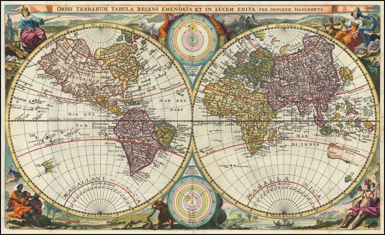
A World Map Unknown To Rodney Shirley
This rare double hemisphere map of the world is among the earliest maps to depict both of Abel Tasman's Voyages to Australia and New Zealand and among the earliest to depict the New Zealand and Australian Coastlines, based upon a confirmed visit.
The cartographical features follow Jan van Doetecum’s world map engraved for Merula’s Cosmographiae universalis (1605;), with changes in the southern hemisphere of the globe according to more recent discoveries; whereas the decorative elements surrounding the two hemispheres is copied from Visscher’s world map from around 1663.
Dancker Danckerts published 3 world maps in about 1660, this being the second. His first world map Orbis terrarum typus de integro (c. 1660) was drawn on an oval shape. This map updates the projection of the world to a depiction in twin hemispheres. In the gussets are two schemes that show the helio and geocentric world view.
The decoration surrounding the two hemispheres is identical to Nicolaes J. Visscher's Second Bible World Map, c. 1663 (Shirley 431), hence the date of the map. With Dutch back text. - Danckerts produced his world maps for the Statenbijbel editions in close competition with the far more successful Nicolaes Janszoon Visscher, which is why copies of Danckert's world maps are much less common.
If you are a student, write to us in telegram: @antiquemaps and indicate what material you need and for what work you need a map in high detail. We are ready to provide material on special terms. For students only!


