Map size in jpg-format: 30.8351MiB
Click to open in high resolution (open in new tab).
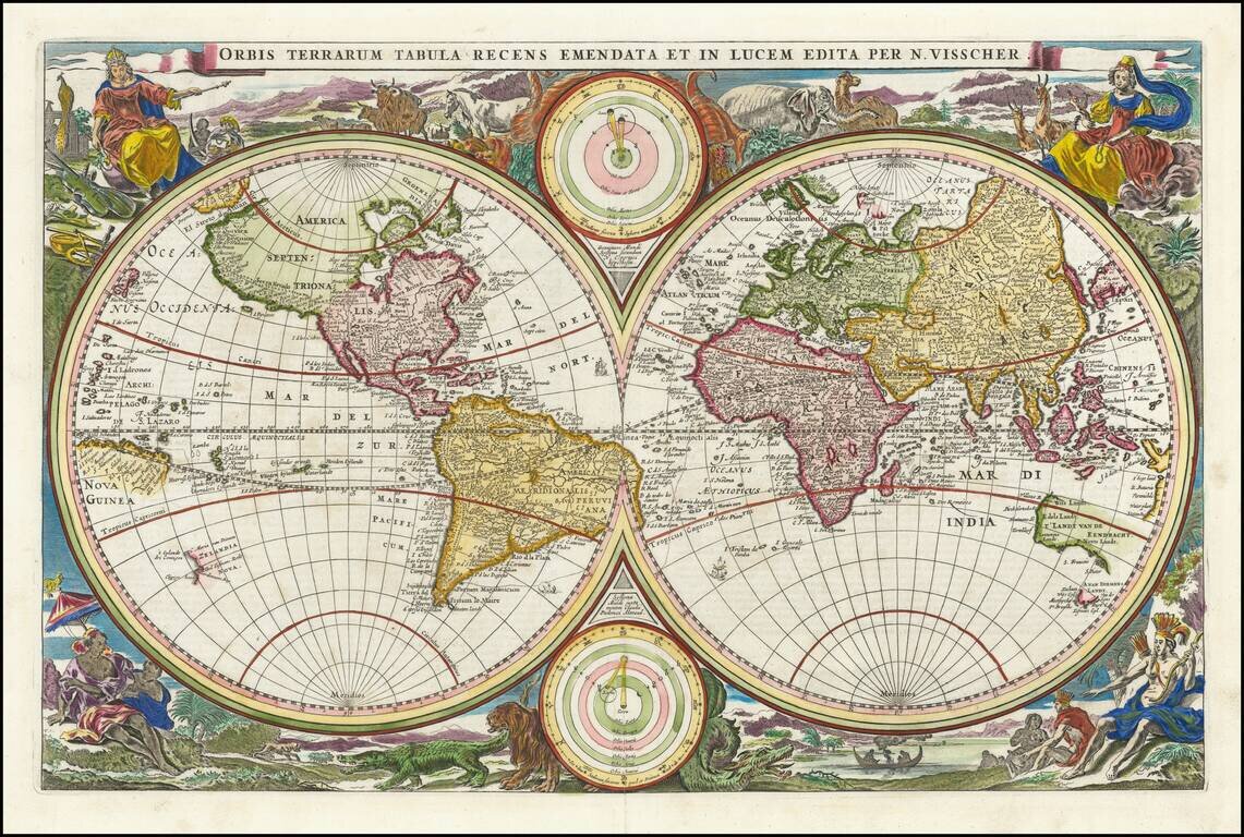
Scarce first state of Visscher's double hemisphere map of the world, which includes many of the great 17th Century cartographic myths and errors.
A massive land extension north of California reaches nearly to Asia and shows the Straits of Anian and NW Passage, with dozens of early place names on the NW Coast, including Quivira Regnum, which appears twice (one just opposite the Straits of Anian and once just east of the Rio Grande River.
North America is misconfigured in a manner similar to early world maps by Hondius. A partial New Zealand and Australia both appear. The tracks of Magellan's circumnavigation are shown, along with other cartographic misconceptions.
Four allegorical female figures represent the four continents (Europe, Asia, America and Africa), along with exotic allegorical scenes.
The present map is Visscher's second world map to appear in a Bible, after his map of 1657. /gallery/detail/31240
The map exists in 2 states, this first state and a second state, which includes a note granting Visscher a 15-year privilege, which appears directly below the title. The map was prepared for an Elzevir Bible. As noted by Shirley, "the allegorical scenes in the corners are ... presented in a more polished and artistic fashion."
Visscher's Bible map was probably the single most copied world map of the 17th and 18th Century, with a number of different engravers copying the cartography and decorative elements for nearly 100 years. Per Shirley, it also appeared in some of De Wit's early atlases.
If you are a student, write to us in telegram: @antiquemaps and indicate what material you need and for what work you need a map in high detail. We are ready to provide material on special terms. For students only!


