Map size in jpg-format: 134.578MiB
Click to open in high resolution (open in new tab).
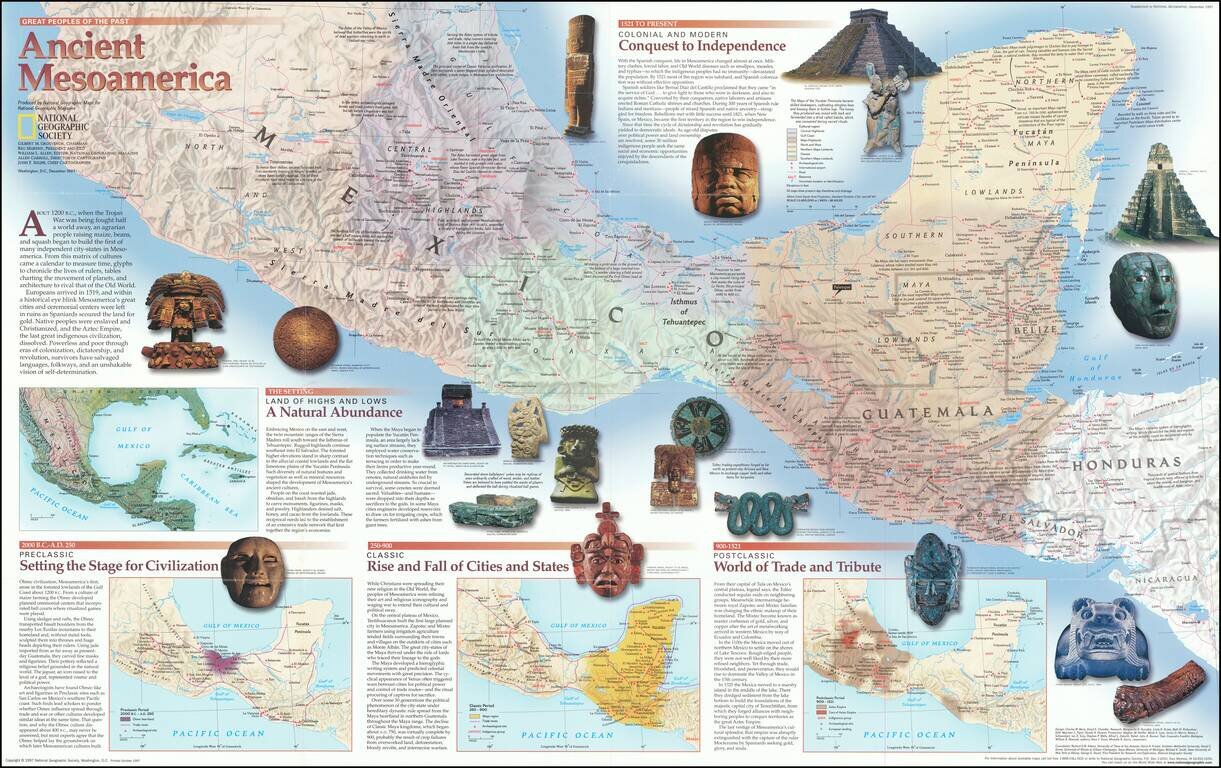
Fascinating pictorial map that portrays the pre-colonial history of Central America from southern Mexico to Nicaragua. Map itself shows the region, with information on cities, trade routes, topography, and the economies of each area. Insets detail the Pre- Post- and Classic histories and geopolitical dynamics of the region. Includes reproductions of famous artifacts from each civilization, from Aztec calendar stones to Mayan temples. Extensive notes on cities and areas of particular historical interest.
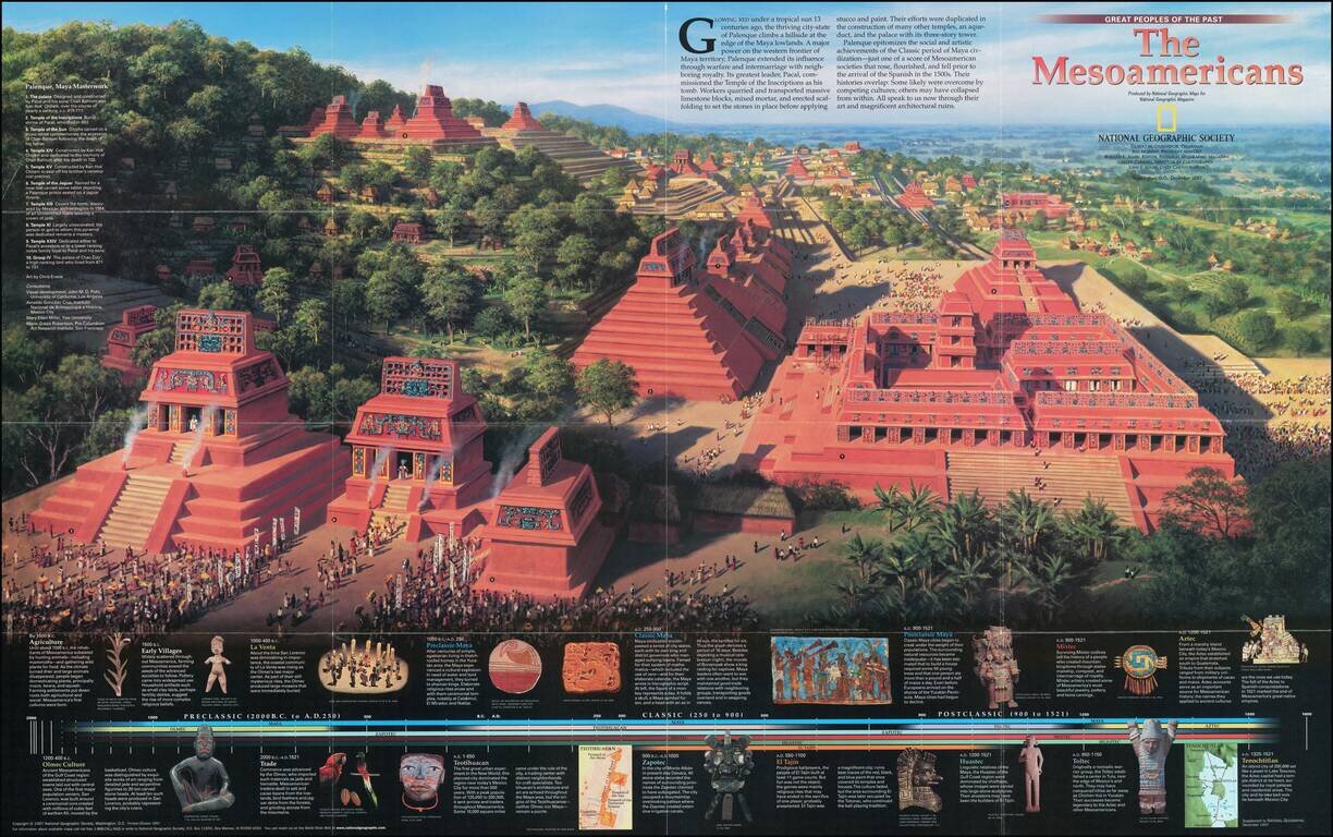
Overleaf includes a portrayal of the 8th Century city of Palenque, in addition to a timeline of the dominant factions in the region.
A great tool for teaching or simply for appreciating the history of this dynamic and diverse region.
If you are a student, write to us in telegram: @antiquemaps and indicate what material you need and for what work you need a map in high detail. We are ready to provide material on special terms. For students only!


![Map of Mexico, Central America, and the West Indies [Insets of Bermuda, Sandwich Islands, Jamaica and Panama Railroad]](/map/small/69133.jpg)