Map size in jpg-format: 1.33044MiB
Click to open in high resolution (open in new tab).

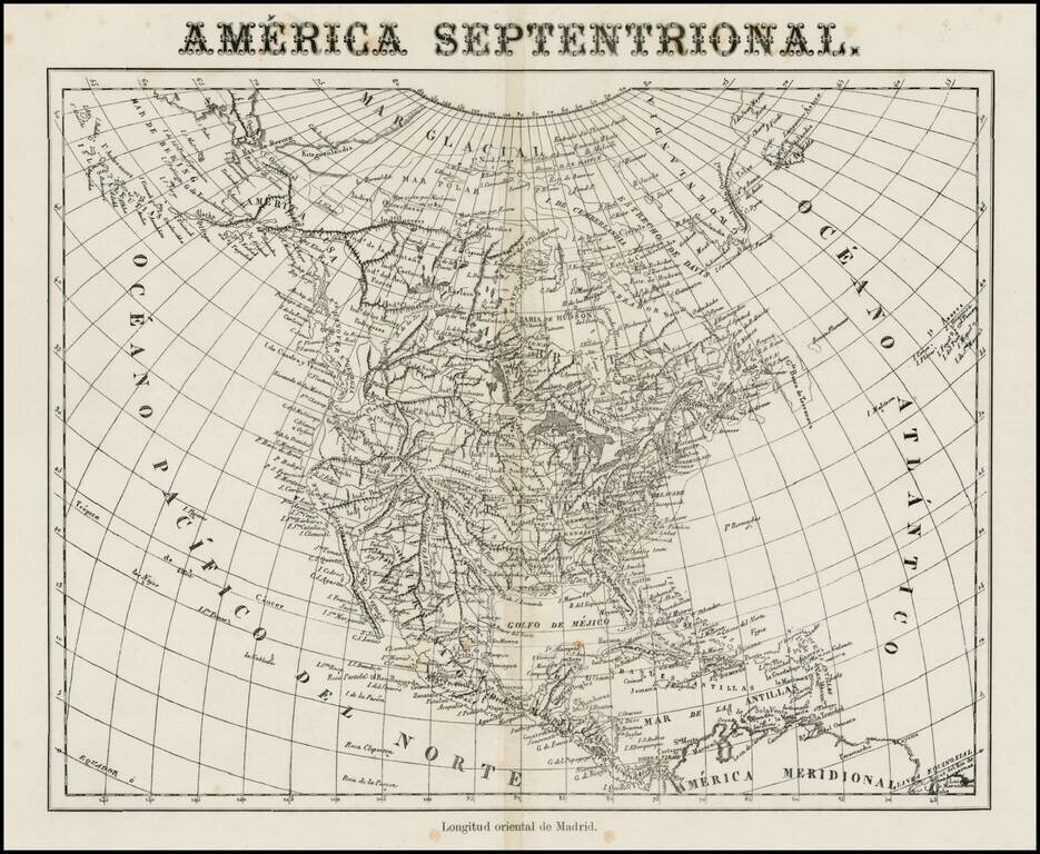
Very unusual Spanish map of North America, apparently issued some time in the middle of the 19th Century.
While the paper suggests that it was published in the 2nd half of the 19th Century, the map's cartography is circa 1830, showing Russian America, no Territories west of the Mississippi River, Mountain ranges running from the Pacific to the Rocky Mountains, and a host of other features which would suggest the map was published shortly after Lewis & Clark.
Lots of place names on the West Coast and many Indian Tribes located in the West. The map shows the Longitude from Madrid, another very unusual feature.
A terrific and apparently rare map of the Transmississippi West.
If you are a student, write to us in telegram: @antiquemaps and indicate what material you need and for what work you need a map in high detail. We are ready to provide material on special terms. For students only!


![[Signed Political Satire Artwork] Vietnam ... Vietnam ... Vietnam ...](/map/small/68726.jpg)