Map size in jpg-format: 803380B
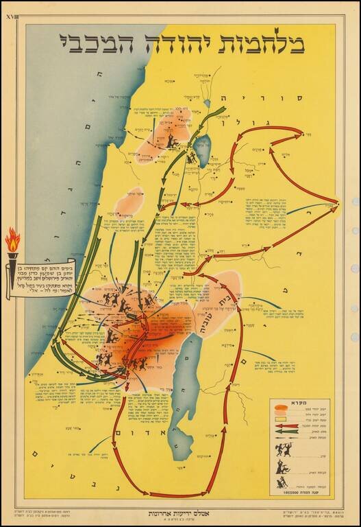
The map describes the story of Chanukah and the battles that the Maccabees fought to gain back their freedom. The Maccabees and the militants attacked each other from various hidden positions in the forests and hills of the region. The key at the bottom right of the map outlines the symbols for the battles and pathways taken by the Maccabees and illustrates the topographical details of the area.
Today, Chanukah is an eight-day Jewish celebration that commemorates the rededication during the second century B.C. of the Second Temple in Jerusalem, where according to legend, Jews had risen up against their Greek-Syrian oppressors in the Maccabean Revolt.
The map was published in Tel Aviv by Israeli newspaper Yedioth Ahronoth (The Israeli Times), which was founded in 1939.
If you are a student, write to us in telegram: @antiquemaps and indicate what material you need and for what work you need a map in high detail. We are ready to provide material on special terms. For students only!
![Patriarchatus Antiocheni Geographica Descriptio . . . [shows Cyprus]](/map/small/54177.jpg)
![[Sinai Peninsula] (Ottoman Turkish Language Sinai and Palestine Campaign Map)](/map/small/54465.jpg)