Map size in jpg-format: 7.97558MiB
Click to open in high resolution (open in new tab).
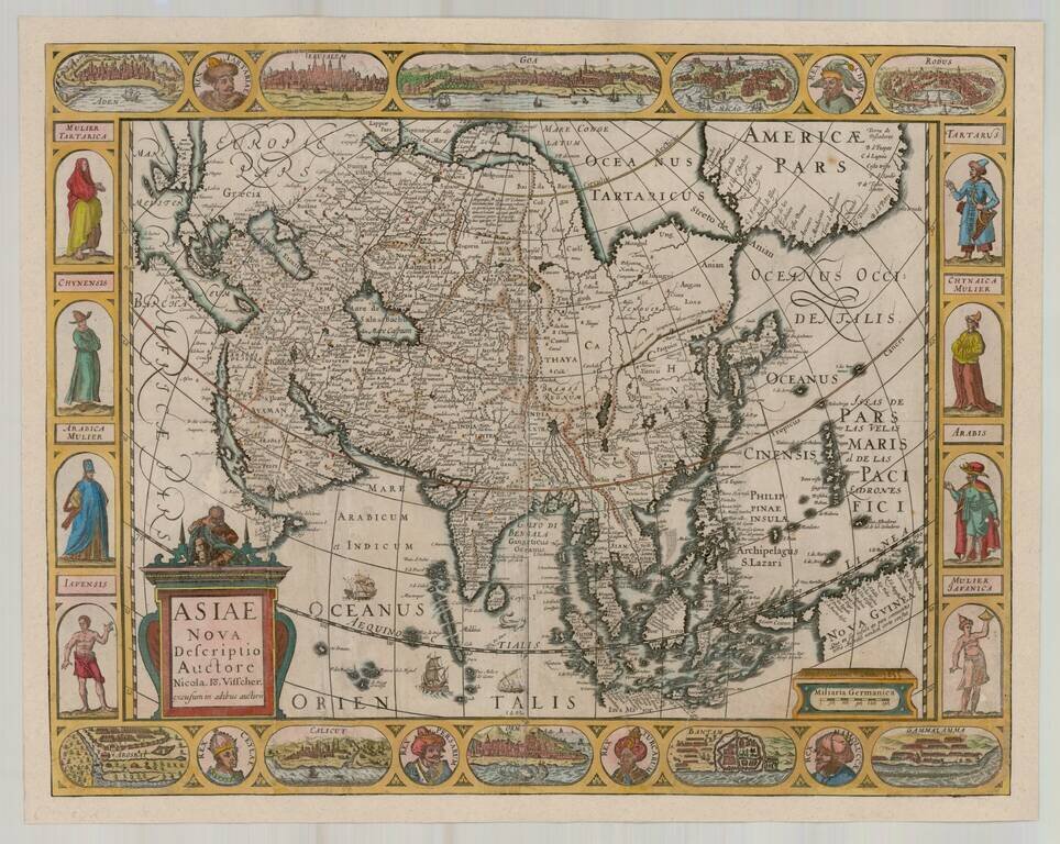
Rare separately issued Carte-a-figures map of Asia, published by Claes Jansson Visscher.
The map includes 8 costumed figures in side-borders, 10 bird's-eye-views of cities in upper and lower borders.
The map is a later issue of Petrus Kaerius's map of 1614. Korea is shown as an island. The Great Wall of China is also shown. Oversized Philippines.
If you are a student, write to us in telegram: @antiquemaps and indicate what material you need and for what work you need a map in high detail. We are ready to provide material on special terms. For students only!

![[Eastern Hemisphere Globe Gores] (Nova et integra universi Orbis descriptio)](/map/small/54480.jpg)
