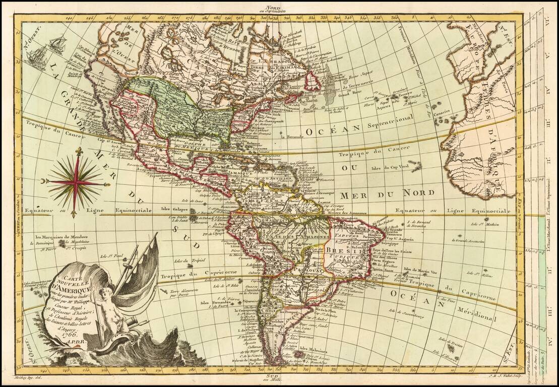
Interesting map of America, published in Paris by Brion de la Tour. Featuring an unknown Northwest Coast, River of the West, Straits of Juan De Fuca and other early details. Includes 16 ships and decorative cartouche. Ornate decorative border.
Fine old color example of the first state of this scarce map of America, published in Paris. Includes a massive Bay of the West, curious depiction of Florida and an unusual wide projection of North America. California is still baed upon de L'Isle's...
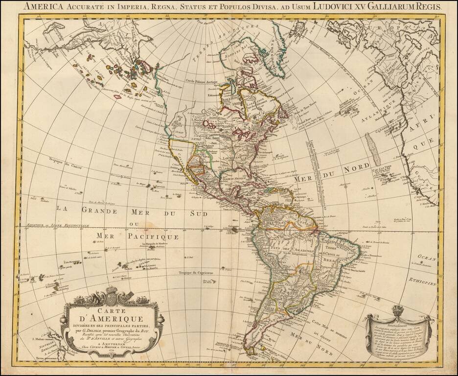
Rare Late State of De L’Isle's Map of America, Showing the Sea of the West and Recent Russian Discoveries A Covens & Mortier state of De L’Isle’s map of the Americas, with revisions to 1774. The map borrows from many contemporary sources,...

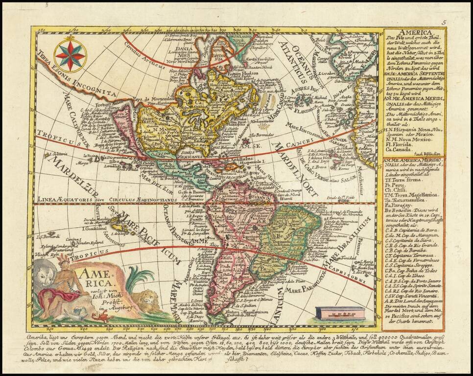
Scarce map of the Western Hemisphere, with California as an Island. Issued in his: Orbis Sensualium Picti Pars Prima ... Norimbergae : In Bibliopolio Joh. Andr. Endt. Anno Salutis, MDCCLXXXI (1777). Orbis Sensualium Pictus, a school geography, was...
![L'Amerique divisee en ses principaux Etats . . . [Sea of the West]](/map/small/51998.jpg)
Striking map of America, published by Santini, in Venice. The map shows a massive Sea of the West with the entries thereto discovered by Juan De Fuca in 1591 and by Martin D'Aguilar in 1603. The map reflects the sighting of land near what would...
The Great River of the West and Lahontan's Longue River Scarce second state of De Vaugondy's map of America, pre-dating information from any of the Cook Voyages. The Northwest Coast of America is shown wildly distorted to the west, with a number of...

Fine example of Buache's map of America, recently updates and improved to remove the sea of the west, based upon the discoveries of Cook and Russian explorers. This map gives extraordinary treatment to the region, although there is curiously no...

Unrecorded map of the Western Hemisphere Printed on Linen Finely executed map of the Western Hemisphere, printed on linen. The map depicts the Western Hemisphere on a stereographic projection, centered on a point in the Pacific. The notable...
![[Atlantis?] Ristretto Delle Carte presentate all' Academia delle Scienze di Parigi negli anni 1737 e 1752 dal Sig di Buache](/map/small/58667.jpg)
The First Americans Came To America via the Lost Continent of Atlantis?—Rare Italian Map from Work on the Origins of Americans Utilizing The Theories of Philippe Buache Very rare, Italian example of Buache’s theoretical geographic ideas on...

The First National Atlas of the United States. The Exceptionally Rare 1783 Edition of Jeffery’s American Atlas. Thomas Jefferys' American Atlas was one of the four great atlases of the Colonies available during the Revolution - along with Faden's...
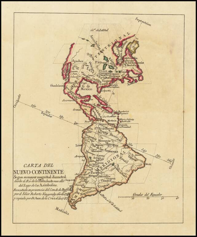
Rare Spanish edition of De Vaugondy's map of America. The map was apparently created to illustrate a Spanish edition of Georges-Louis Leclerc, Comte de Buffon's natural history. The map credits Juan de la Cruz Cano y Olmedilla, whose 9 sheet map of...
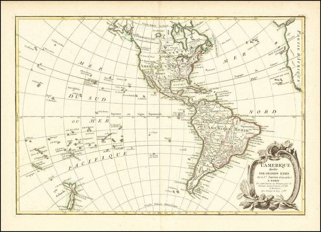
Fascinating Alaska Configuration 1783 edition of Janvier's map of America, issued in the same year that the United States was formally granted its independence from England. The mythical Sea of the West is no longer shown, replaced by a curious...
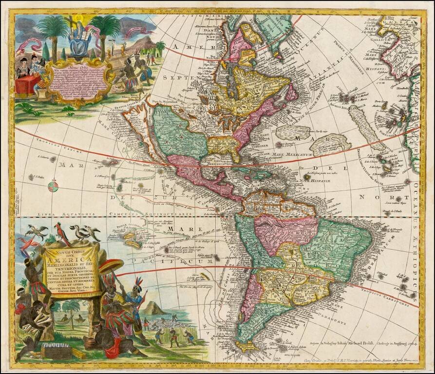
Striking, Richly Engraved Map of the Americas—One of the Last to Feature California as an Island Fine, detailed map of the Americas, with California as an island and two richly illustrated cartouches. This is one of the last maps to be printed with...
Rare map of America, showing California as an Island. California is shown as an Island, with the extended westward land mass to Asia and the Mississippi River extending to the Straits of Anian. Odd Great Lakes Projection and other interesting...
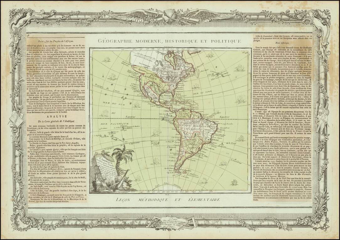
Interesting map of America, published in Paris by Brion de la Tour. The map includes a largely unknown Northwest Coast, River of the West, Straits of Juan De Fuca and other early details. Includes 16 ships and decorative cartouche. Ornate decorative...
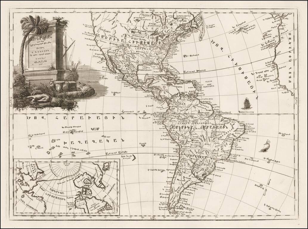
Fine example of the first map of America printed in Armenian. The translation of the title into English is "Amerika, engraved according to recent geographical observations." One of four continental maps compiled by Elia Endasian, printed in Armenian...