
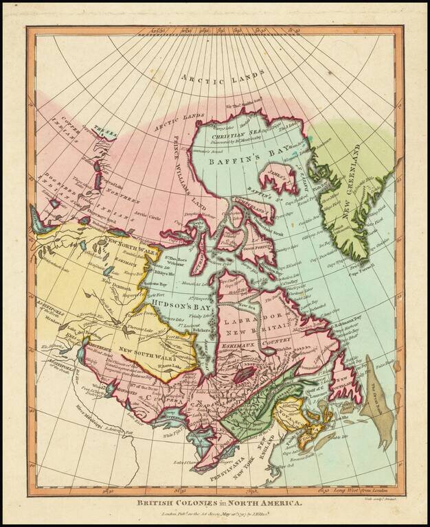
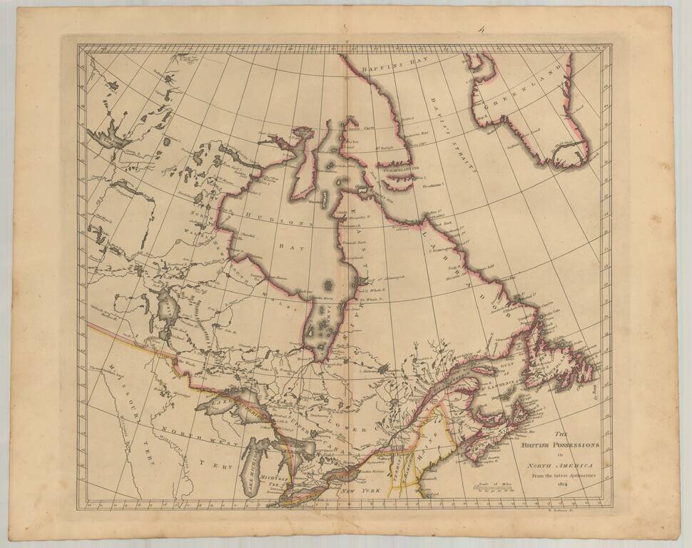
Includes a Reference to New Denmark. This map purports to show the extent of British colonial power in North America, which at present was limited to eastern Canada. The map extends from "New Greenland" to the upper Mississippi. Curious details and...
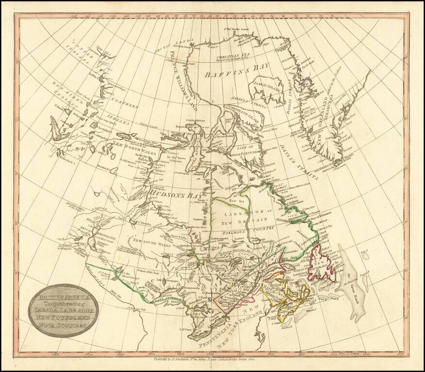
Rare Dublin edition of John Stockdale's map of British America. The map is centered on the Great Lakes and Hudsons Bay. The course of the Mississippi River is quite fascinating, and titled "Miiskoue-sipi or Red R." and a bit further south,...
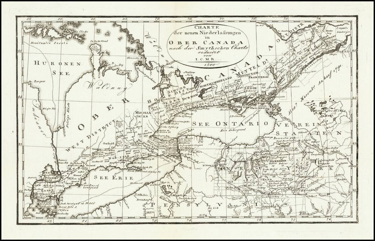
Rare Weimar edition of David William Smyth's map of Ontario. David William Smyth was the province's surveyor general of Canada, who produced A Map of the Province of Upper Canada, describing all the new settlements, townships &c. (London: William...
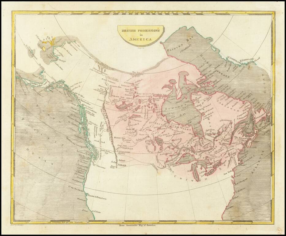
Scarce engraved map of Canada, published in Philadelphia in 1804. Shows a potential land bridge from Russia to Alaska. Speculates about the existence of the Northwest Passage.
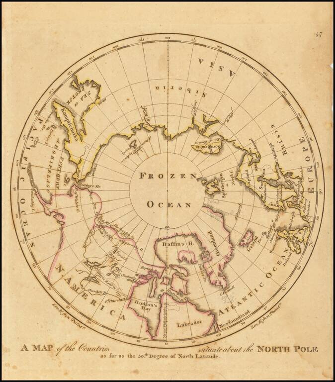
Early American map showing the extent of explorations in the North Pole, with emphasis on the efforts to find a Northwest passage and Hearne's and MacKenzies' routes.

Detailed plan of the Siege of Quebec, illustrating action during the early days of the Seven Years War (French & Indian War). This fascinating map embraces the environs of Quebec City and illustrates the British victory on the Plains of Abraham in...
Early American published map of Canada, New England, the Great Lakes and Old Northwest Territory, from a late edition of Carey's General Atlas. Extends North to Baffin's Bay and the Sea as Seen By Hearne in 1771, West to Slave Lake, Buffalo Lake, Ft....
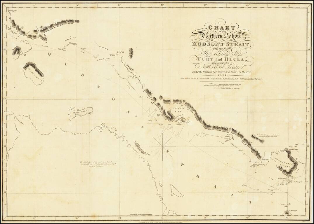
A nice example of Parry's map of Hudson's Strait, showing a portion of his expedtiion in search for the Northwest Passage. Shows Parry's tracts in marvelous detail, including a day by day account of his route and a number of annotations. After...
![Amer. Sep. No. 36 Partie Du Bas Canada [Gulf of St. Lawrence, Isle de Anticosti, District De Gaspe]](/map/small/14185.jpg)
Remarkably detailed map of the mouth of the St. Lawrence, District of Gaspe, Gulf of St. Lawrence Isle de Anticosti and west coast of Newfoundland. Includes coastal soundings. An amazing work and a must for regional collectors. Perhaps the most...
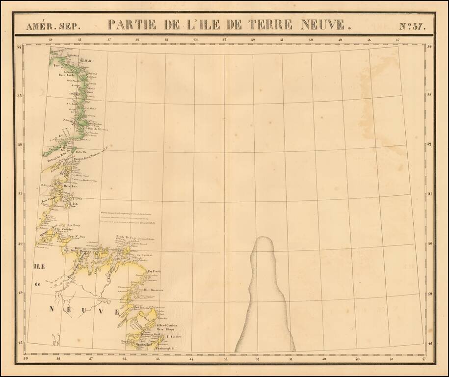
Large format map of Newfoundland, extending from Random Head and Flamborough Head to Wolf Island and Table Bay and centered on White Baie and Belle Ile. From Vandermaelen's remarkable 6 volume atlas, which if combined as globe gores forms an immense...
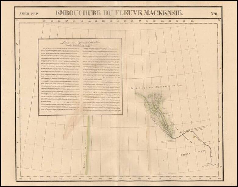
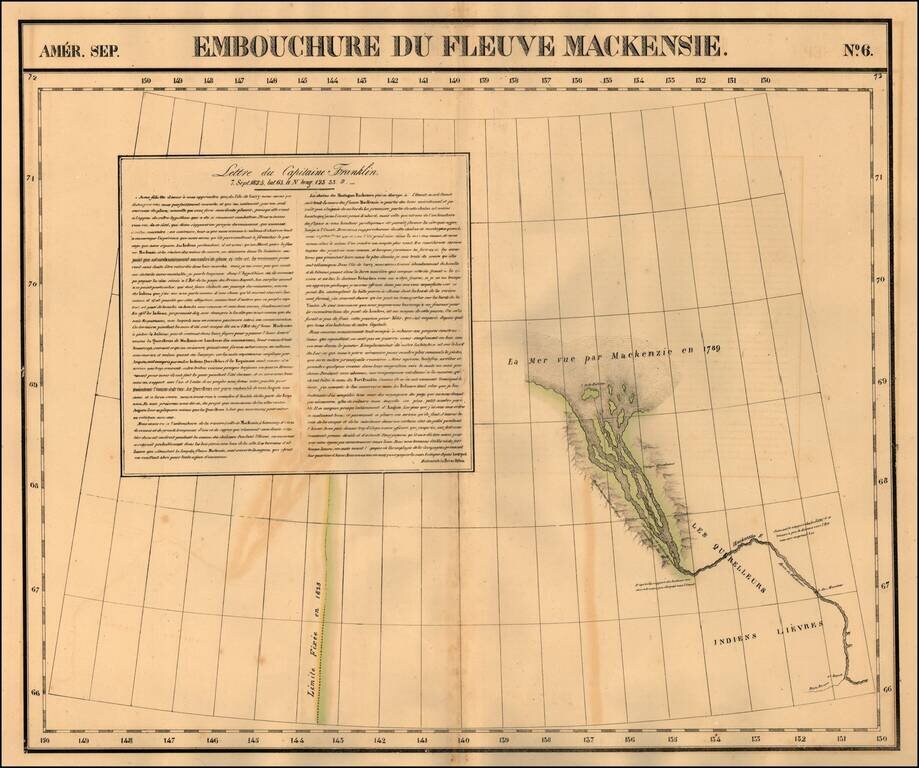
Highly detailed regional map, showing the mouth of the MacKenzie River and extending south to Petite Riviere and 1st Rapide. One of the earliest maps to focus on the region on such a large scale. The best large format map of the region during this...
![[MacKenzie River, Yukon Territory and Northwest Territory] Amer. Sep. No. 15. Grand Lac De L'Esclave](/map/small/19469.jpg)
Highly detailed map centered on the MacKenzie River and showing much of Yukon Territory and Northwest Territory. The map shows the region bounded the MacKenzie River, the Rocky Mountains and Grand Slave Lake. On the eastern portion of the map is a...
Regional map of part of the mouth of the MacKenzie River and the Arctic Sea. Shows towns, roads, rivers, mountains, and a host of other details. From Vandermaelen's remarkable 6 volume atlas, which if combined as globe gores forms an immense globe.
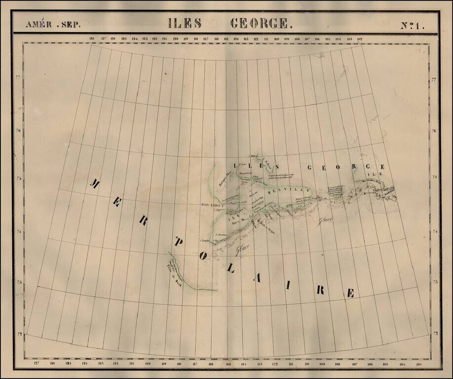
The Isles of George in the Arctic Sea. Shows towns, roads, rivers, mountains, and a host of other details. From Vandermaelen's remarkable 6 volume atlas, which if combined as globe gores forms an immense globe.
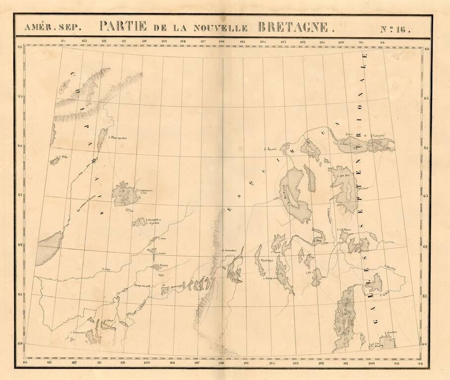
Large format map of the region the Esquimaux and Chippeway Lands of Canada. Highly detailed, with many rivers, lakes, place names, Indian Tribes, forts, etc. From Vandermaelen's remarkable 6 volume atlas, which if combined as globe gores forms an...
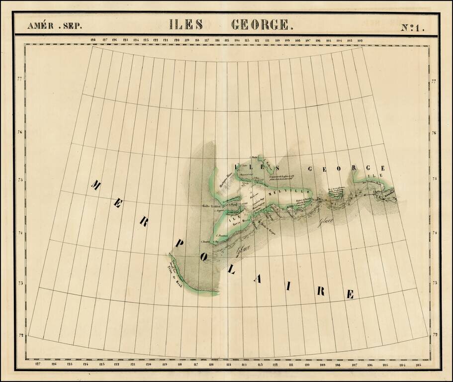
The Isles of George in the Arctic Sea. Shows towns, roads, rivers, mountains, and a host of other details. From Vandermaelen's remarkable 6 volume atlas, which if combined as globe gores forms an immense globe.