

Rare separately issued map of Alaska and British Columbia, showing the route to Gold Regions of Alaska, among the earliest printed maps to illustrate the route to the newly discovered Gold Regions in Alaska. Lowman & Hanford of Seattle produced...
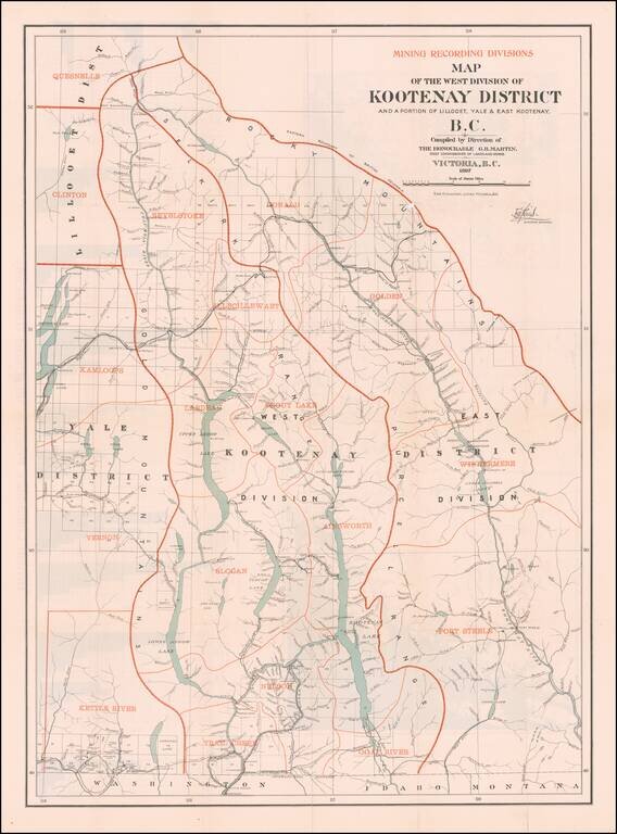
British Columbia's Progress Illustrated Graphically (and a Great Map of the West Kootenay District) Fine large Canadian government publication, illustrating the West Kootenay Mining District on the front side of the map and the Klondyke, Cassiar,...
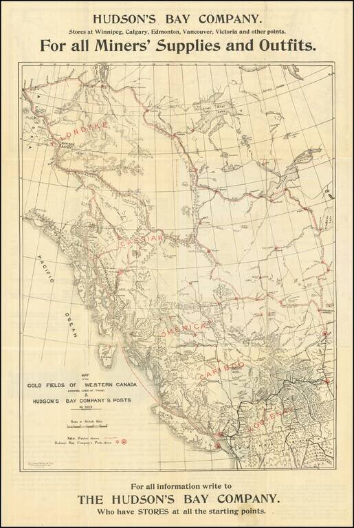
Hudson's Bay Company Guide & Map To The Klondike Gold Fields -- Rare Winnipeg Imprint Rare Hudson's Bay Trading Company map of the the Klondike and Yukon Gold Regions, illustrating the Canadian Routes to the Gold regions from Winnipeg and...

Victoria, B.C. The Key to the Klondyke and Yukon Gold Mines Rare promotional brochure and map, illustrating the routes the gold regions of Alaska and the Yukon, published by the British Columbia Board of Trade, extolling the virtues of traveling to...
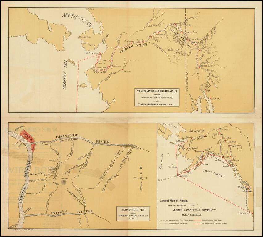
Rare promotional pamphlet showing the routes to the Klondike, published by the Alaska Commercial Company. Three maps includes: General Map of Alaska Showing Routes of Alaska Commercial Company's Ocean Steamers Klondike River and Surrounding Gold...
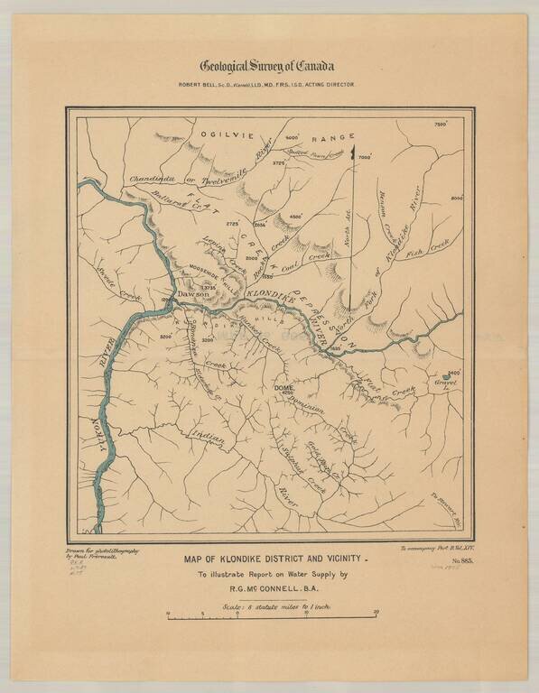
Detailed map of the Klondike Gold Region, centered on Dawson's and the Klondike River.
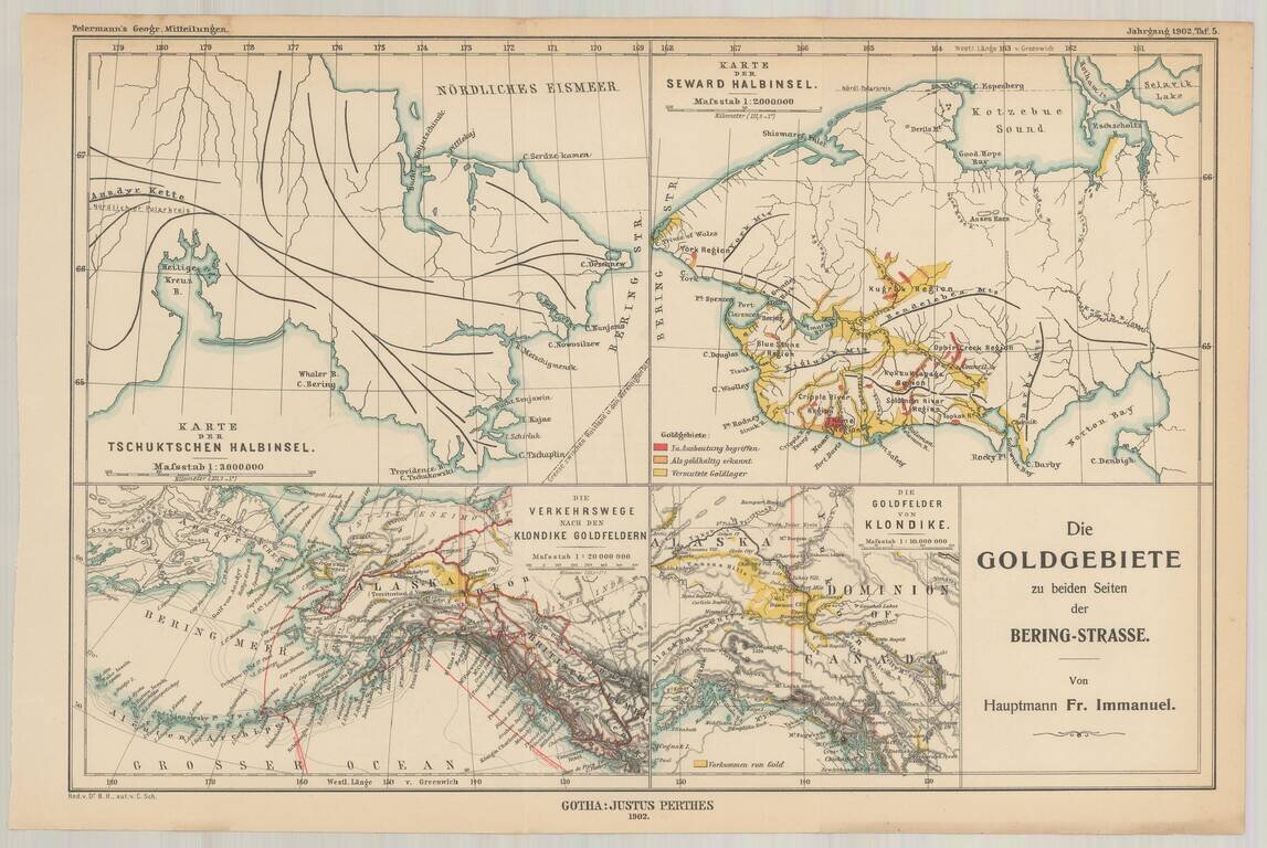
Fine set of four maps, highlighting the gold regions in Alaska and the Behring Straits, published by A.H. Petermann. The maps including the following: The Klondike Gold Region The Seward Peninsula Gold Region Routes to the Klondike Gold Fields...
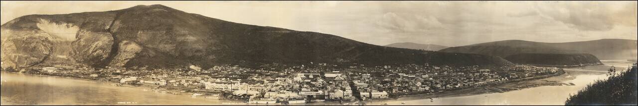
Panoramic photographic view of Dawson City in Yukon Territory, likely taken by Sheelor at the later end of the Klondike Gold Rush. Wonderful panorama of the town taken from a hill across the Yukon River. While at the time of this photo Dawson City...
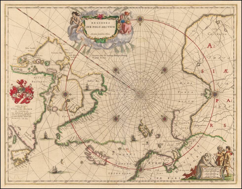
Nice example of the second edition of Blaeu's signature map of the North Polar Regions, with several wonderful cartouches and decorative coat of arms. Blaeu's decorative map of the North Pole, including Arctic North America, Scandinavia, and northern...
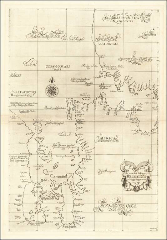
The First Sea Chart of Hudson Bay and Hudson Strait Fine example of the first edition of Robert Dudley's chart of Hudson Bay and Hudson Strait, the earliest sea chart of the region and the first printed map to focus on Hudson Bay. Dudley's chart is...
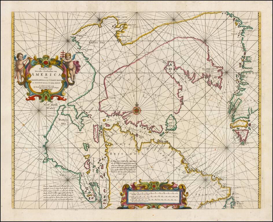
Fine example of Doncker's rare early map of the Northern part of America, including Hudson Bay, Davis Straits, Button Bay and the west coast of Greenland. Doncker's chart is one of the earliest obtainable charts to show this configuration and much of...
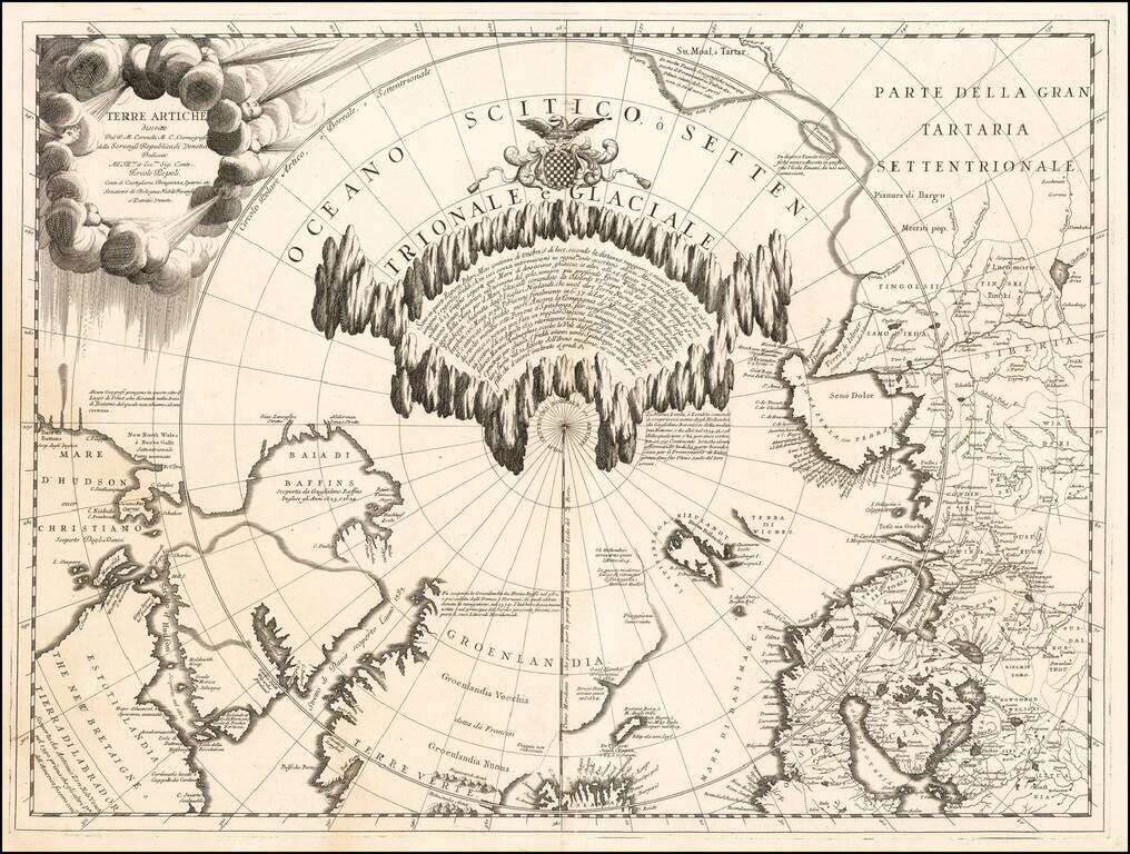
Fine example of Vincenzo Maria Coronelli's map of the North Polar Regions, published in Venice circa 1690. Coronelli's map provides a remarkable depiction of the Arctic Circle, North Pole, Greenland, and Baffin Bay, with parts of Canada, parts of...
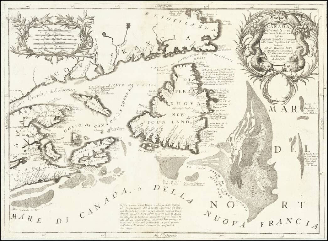
Detailed map of the Newfoundland, Labrador, Nova Scotia and the Gulf of St. Lawrence, by Vincenzo Maria Coronelli. The map comes from Coronelli's rare Atlante Veneto, one of the most decorative and ornate of all 17th Century Atlases. It exhibits the...
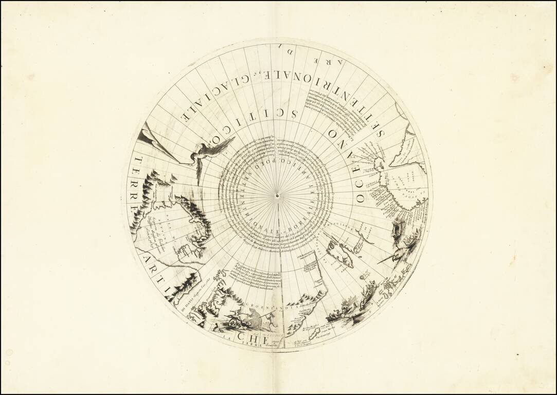
Rare north polar section of Coronelli's remarkable globe gores, first published in 1690. The present gore section is the upper calotte for Coronelli's large (110cm) globe showing the north pole and surrounding areas. The section includes extensive...
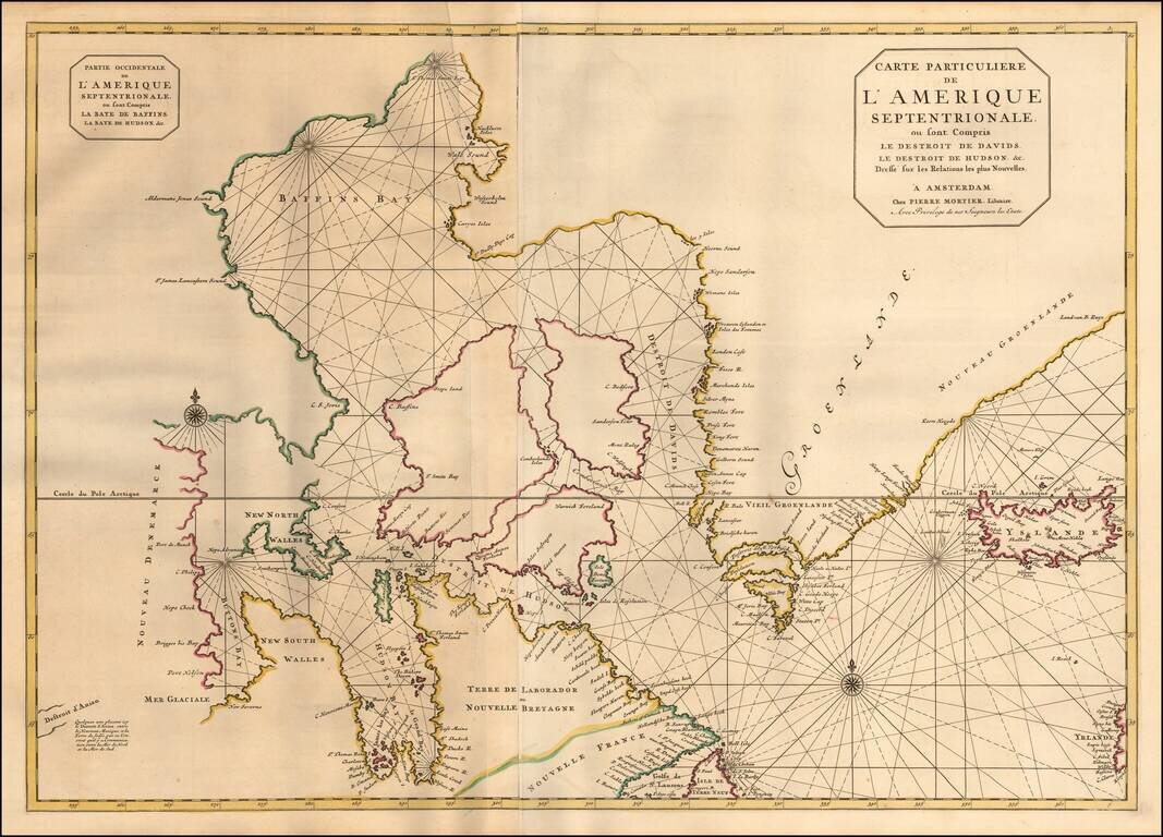
Pierre Mortier's large map of the Canadian Polar Regions, Greenland and Iceland, which appeared in his Suite de Neptune Francois. Among the more remarkable elements of the map is the depiction of "Destroit d'Anian," showing the Straits of Anian...
![[Unique Extra-Illustrated Example!] Carte Nouvelle Contenant La Partie d'Amerique La Plus Septentrionale, . . . Le Canada ou Nouvelle France, La Nouvelle Ecosse, La Nouvelle Angleterre, Les Nouveau Pais Bas, La Pensylvanie . . . Et Jle. de Terre Neuve . .](/map/small/47720.jpg)
Heavily embellished example of the eastern part of Visscher's 2-sheet map of the Northeastern part of North America, first published in 1696. Cartographically, the map extends from Nova Scotia and Acadia to Newfoundland, the St. Lawrence Gulf and St....