
![The Coast of Newfoundland From Plancentia to Cape Bonavista [and] A Draught of the River Plata in South America [and] Havana, Harbour [and] the Bay of Honda](/map/small/38599.jpg)
Rare Sea Charts of North and South American Ports from an Influential Atlas This composite sea chart shows Newfoundland, Havana Harbor and the Bay of Honda, both in Cuba, and the River Plata in South America. The chart shows the coastlines and...
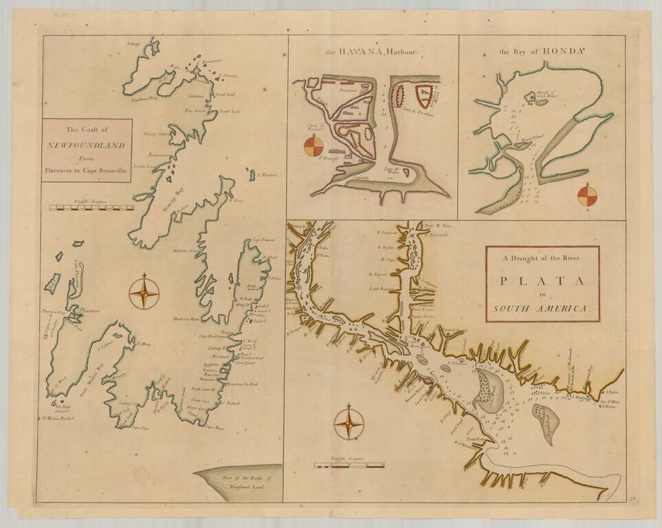
Rare Sea Charts of North and South American Ports from an Influential Atlas This composite sea chart shows Newfoundland, Havana Harbor and the Bay of Honda, both in Cuba, and the River Plata in South America. The chart shows the coastlines and...
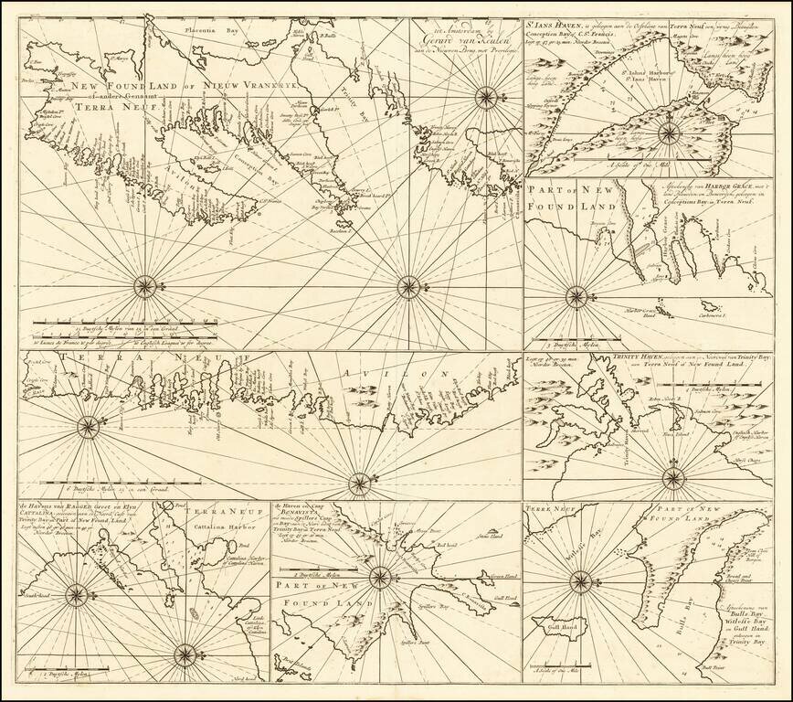
Rare sea chart of of the Coast of Newfoundland, published by Gerard Van Keulen. The chart incorporates eight insets showing various portions of Canada's Newfoundland coast. Include twelve compass roses with rhumb lines, with separate delineations of...
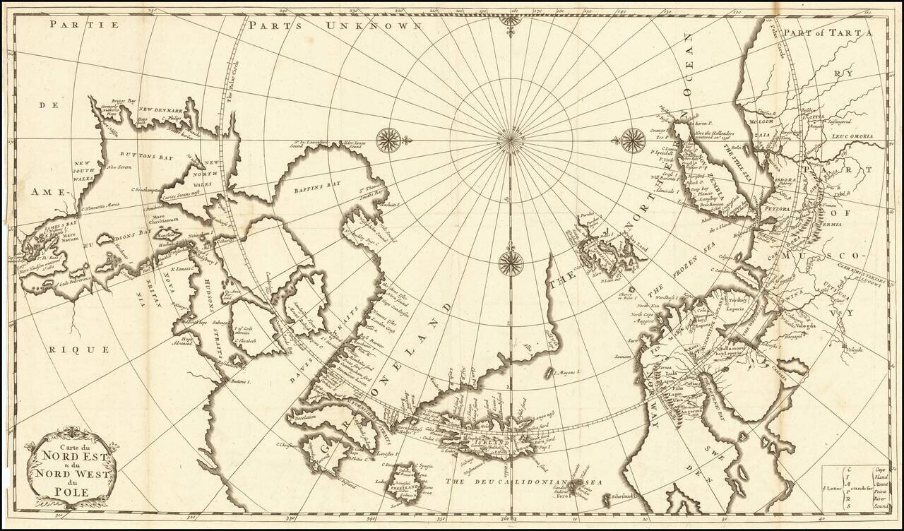
Fine Eighteenth-Century Map of the Arctic Elegant and finely-wrought map of “Northeast and Northwest of the Pole,” published by Amsterdam-based French scholar and mapmaker Jean Frédéric Bernard. The map encompasses the polar region from Tartary...
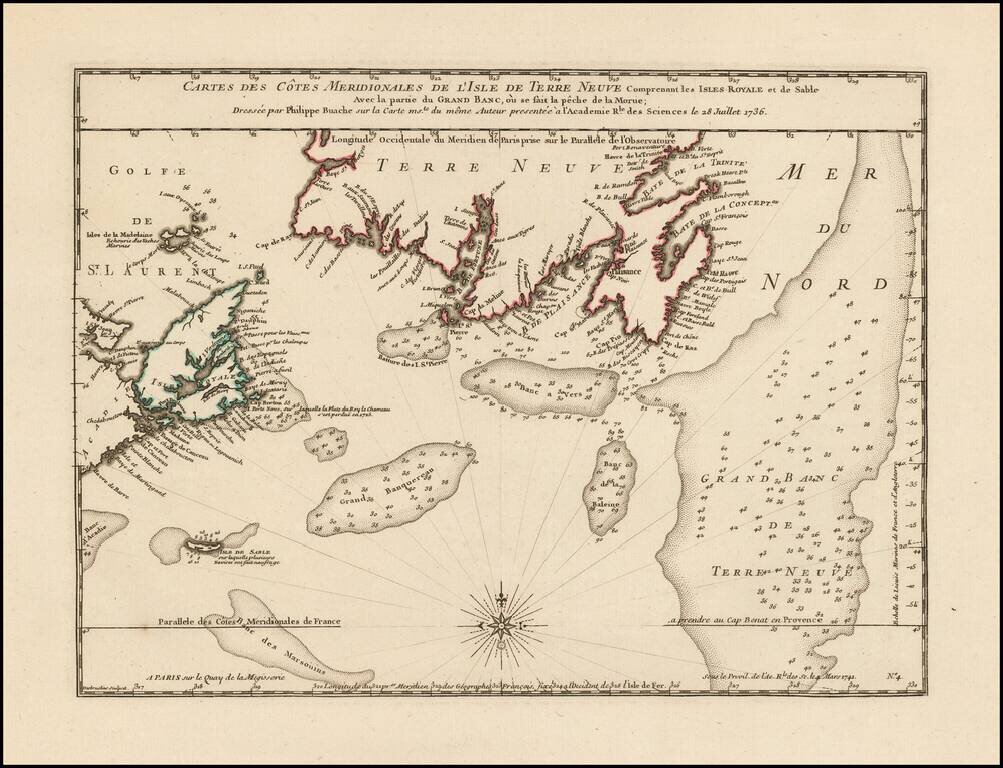
Philippe Buache Responds To Errors In Popple's Map of the British Colonies. Scarce map of the coast of Southern Newfoundland and part of Nova Scotia by Philippe Buache in 1736, as part of his critique of the accuracy of Henry Popple's map of 1733....
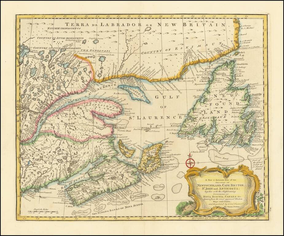
Striking and highly detailed map of Northeastern Canada, etc. published by Emanuel Bowen in London. The map covers the region bounded by Newfoundland, Nova Scotia, Acadia and Labrador. Decorative cartouche, compass rose and excellent detail...
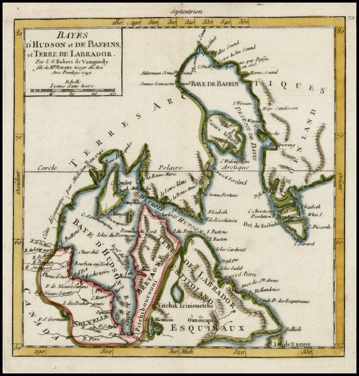
Detailed map of Hudson Bay, Baffin Bay Labrador and contiguous regions, from De Vaugondy's Atlas Portatif.
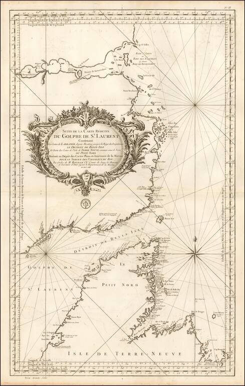
Important mid-18th Century chart of the Gulf of St. Laurence, Straits of Belle Isle and contiguous coastlines, published by Bellin, for the French Depot de la Marine. This interesting chart is one of the most significant maps of the region. The Strait...
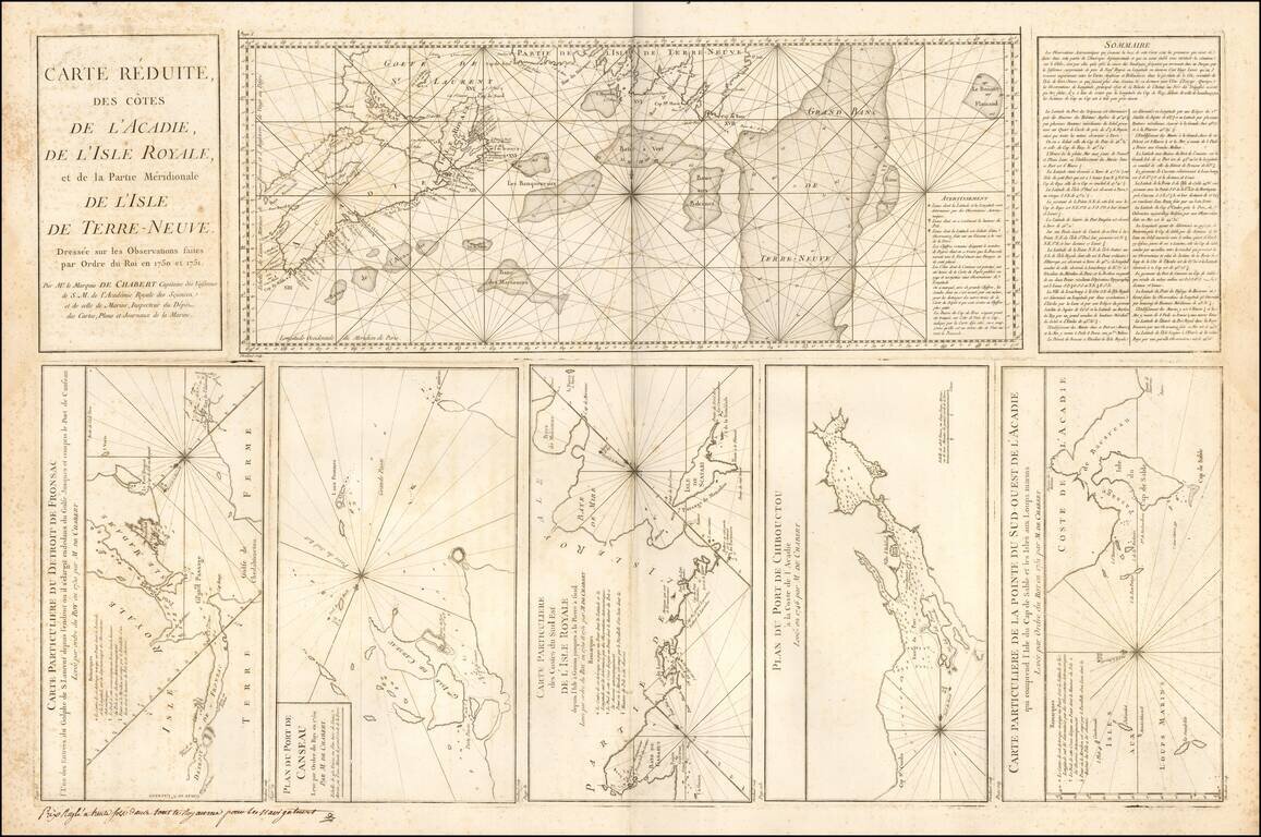
Large engraved mapsheet, comprising six inset maps related to the coast of Acadia and Ile Royale, published by Depot de la Marine in the mid-1750s. The maps are all credited to Mr. le Marquis de Chambert Capitaine des Vaisseaux.
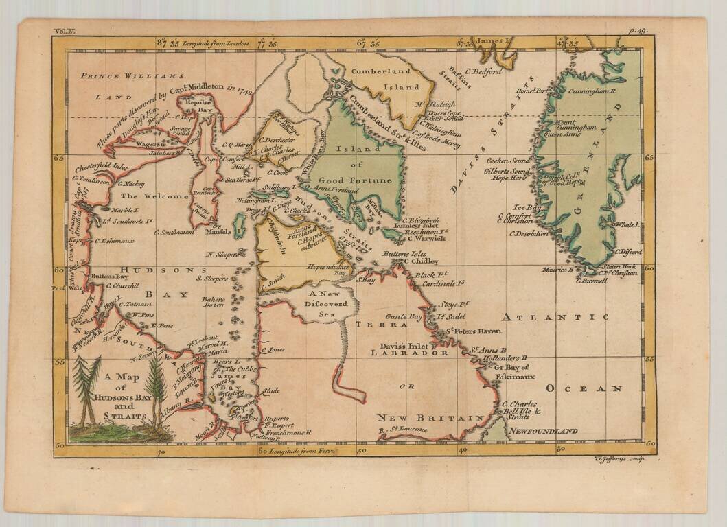
Interesting early map of Hudson Bay and vicinity, engraved by Jefferys. The map illustrates the English expeditions in search of the fabled Northwest Passage. Notes the discoveries in the vicinity of Repulse Bay and Wager River by Capt. Middleton in...
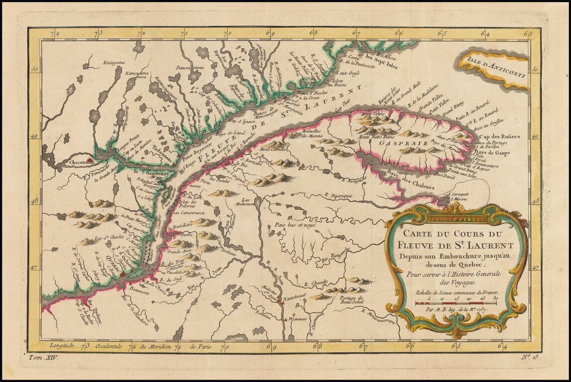
Detailed regional map of Canada, extending from Anticosti Island to just west of Quebec, centered on the St. Laurence River. Includes a decorative title cartouche.
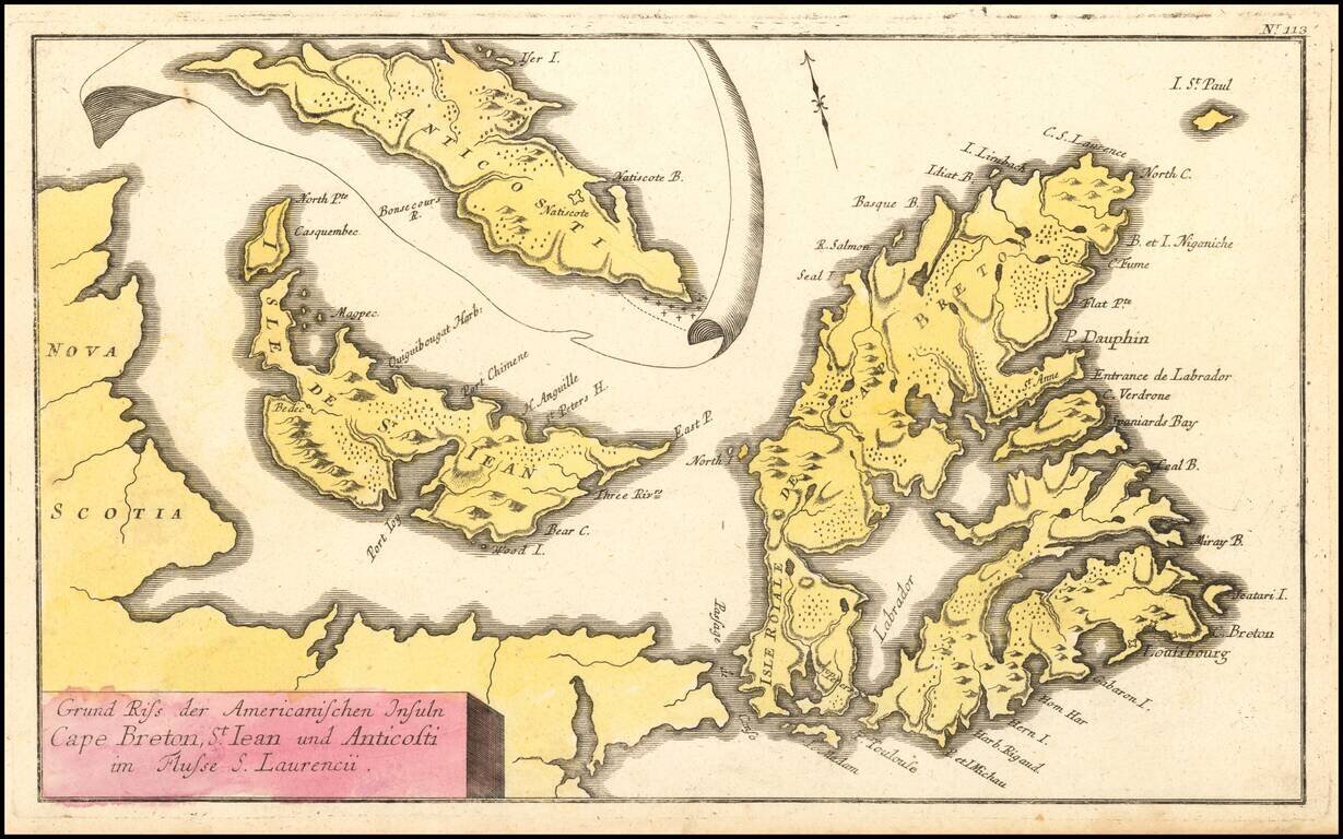
French & Indian War Map of NE Canada Detailed map of Northeastern Canada, including the eastern part of Nova Scotia, namely Cape Breton and Prince Edward Islands, published by Raspe in Nuremberg. The map includes an inset map of Anticosti Island...

Scarce Leipzig edition of Bellin's excellent map of Hudson's Bay, Labrador, Hudson's Straits and neighboring regions originally issued in Bellin's Histoire General des Voyages. Includes numerous bays, islands, rivers, mountains and notes regarding...
![Partie du Cours du Fleuve de Saint Laurent depuis Quebec jusqu'au Cap aux Oyes [on sheet with] Carte du Cours du Fleuve Saint Laurent depuis Quebec jusqu'a la Mer en Deux Feuilles ... 1761](/map/small/55185.jpg)
French Sea Chart of the Saint Lawrence, published during the French and Indian War. Jacques Nicolas Bellin's 1761 double-page engraved map of the Saint Lawrence east of Isle d'Orleans. The top map is a more focused version of the map on the bottom,...
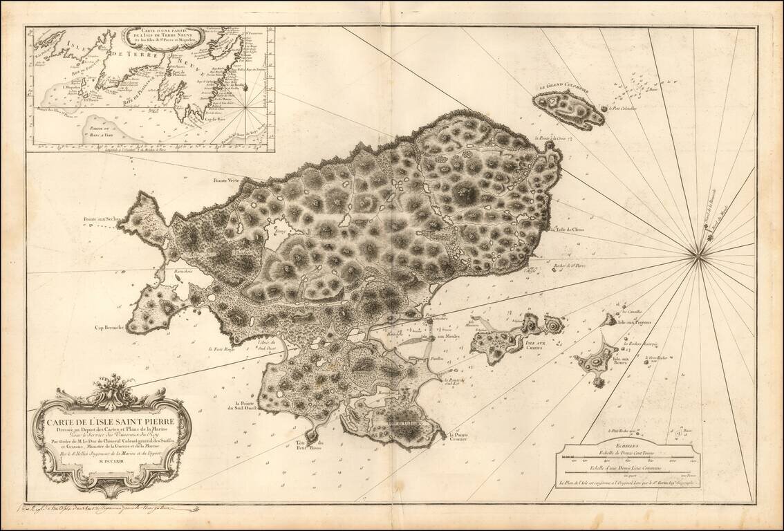
Detailed sea chart of Saint Pierre, one of the small islands in the Grand Banks retained by France under the Treaty of 1783. The chart was produced by the Depot de la Marine toward the end of the Seven Years War (French & Indian War) . Following...
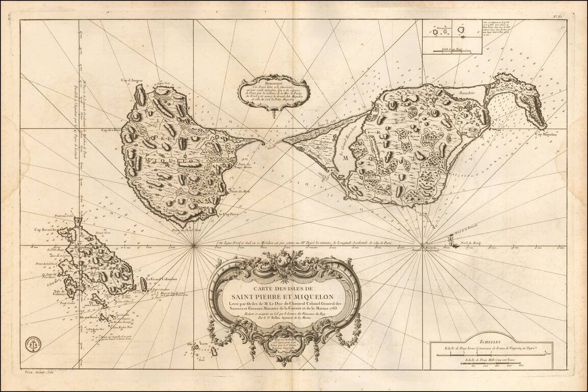
Detailed sea chart of the islands retained by France under the Treaty of 1783. The chart was produced by the Depot de la Marine toward the end of the Seven Years War (French & Indian War). Following the conclusion of the Seven Years' War, the...