
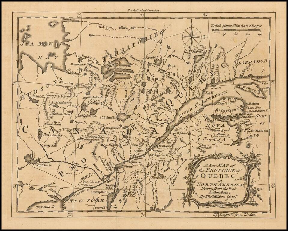
Scarce early map of the the Province of Quebec by Thomas Kitchin, which appeared in the London Magazine. The map provides a detailed early map of Quebec, bounded to the northwest by the Hudson's Bay Territories and to the South by New England. The map...
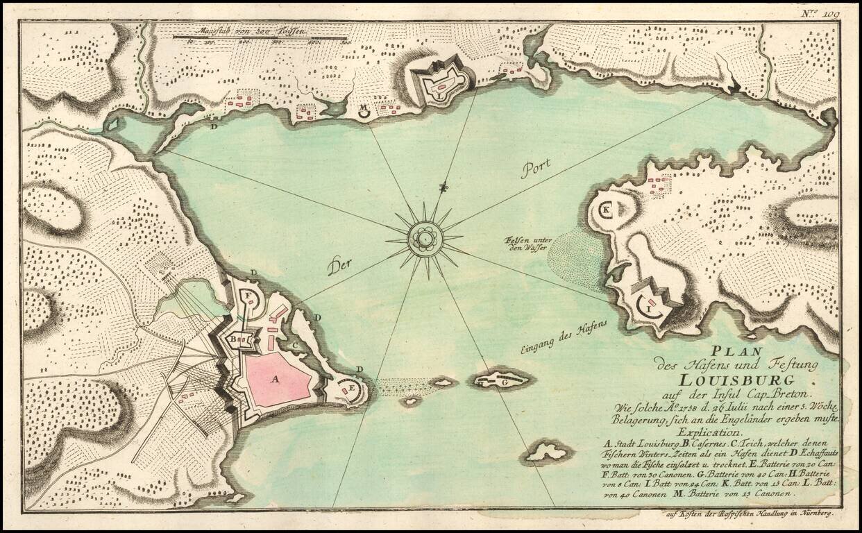
Scarce French & Indian War Plan of the area around Louisbourg, from Raspe's Schauplatz des Gegenwaertigen Kriegs . . . Shows fortifications, batteries, Cannon, and other details. A rare French and Indian War Battle plan.
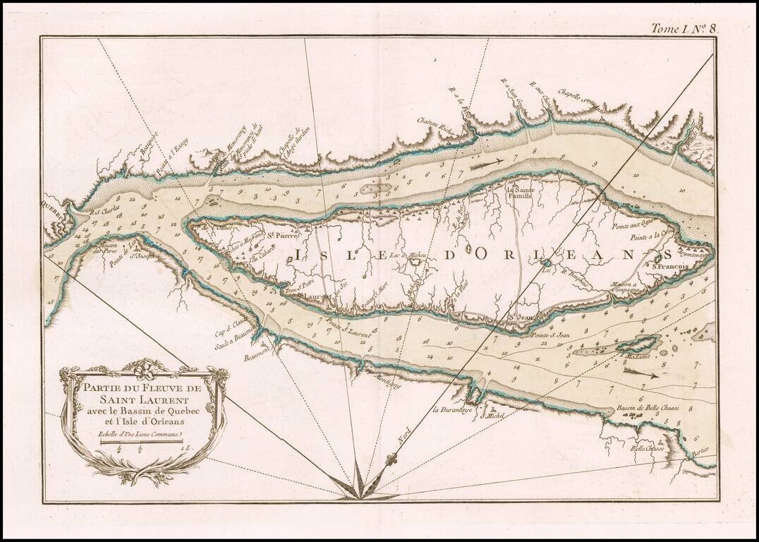
An excellent map of a portion of the St. Lawrence River centered on the Island of Orleans, from Bellin's Petit Atlas Maritime.
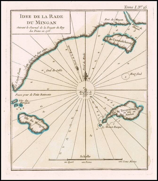
The French Fur Trading Fort at Mingan An excellent map of Harbor at Mingan and coastal islands, from Bellin's Petit Atlas Maritime. The map shows a section of the coast of Quebec, at the mouth of the Gulf of St. Lawrence, just north of the Island of...
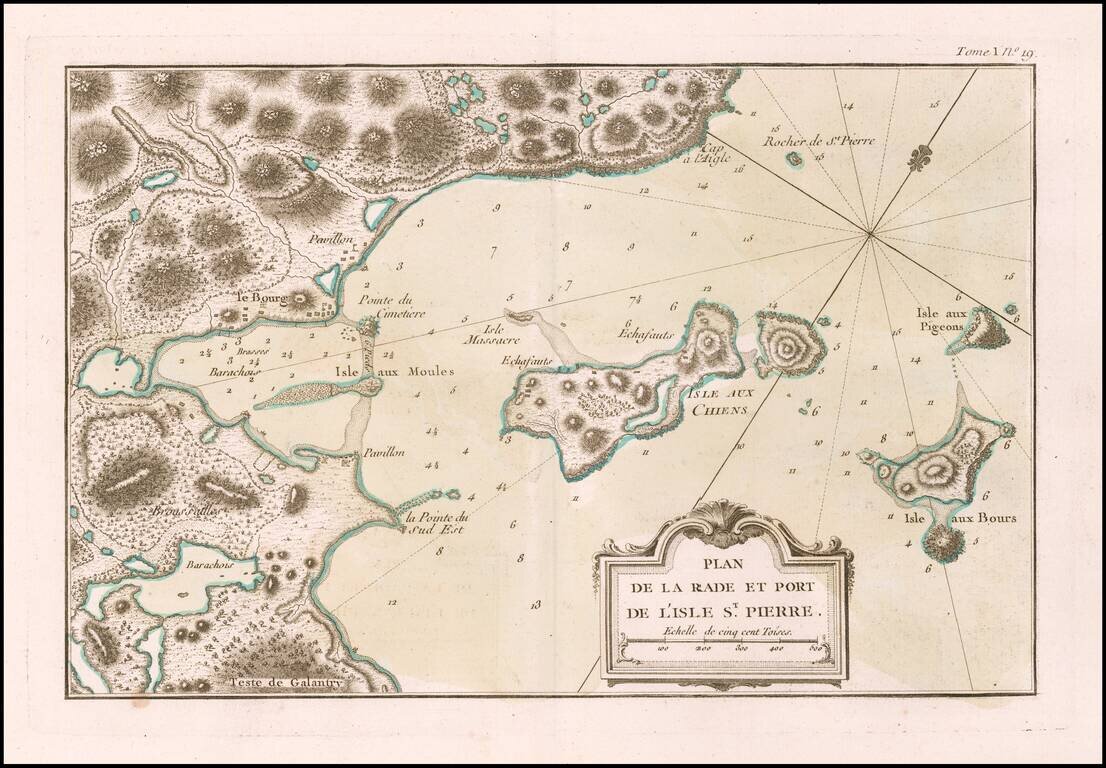
The Strategically Important Island of St. Pierre An excellent map of the western part of the island of St. Pierre, from Bellin's Petit Atlas Maritime. Following France's losses during the Seven Years War, France surrendered most of its Colonial...
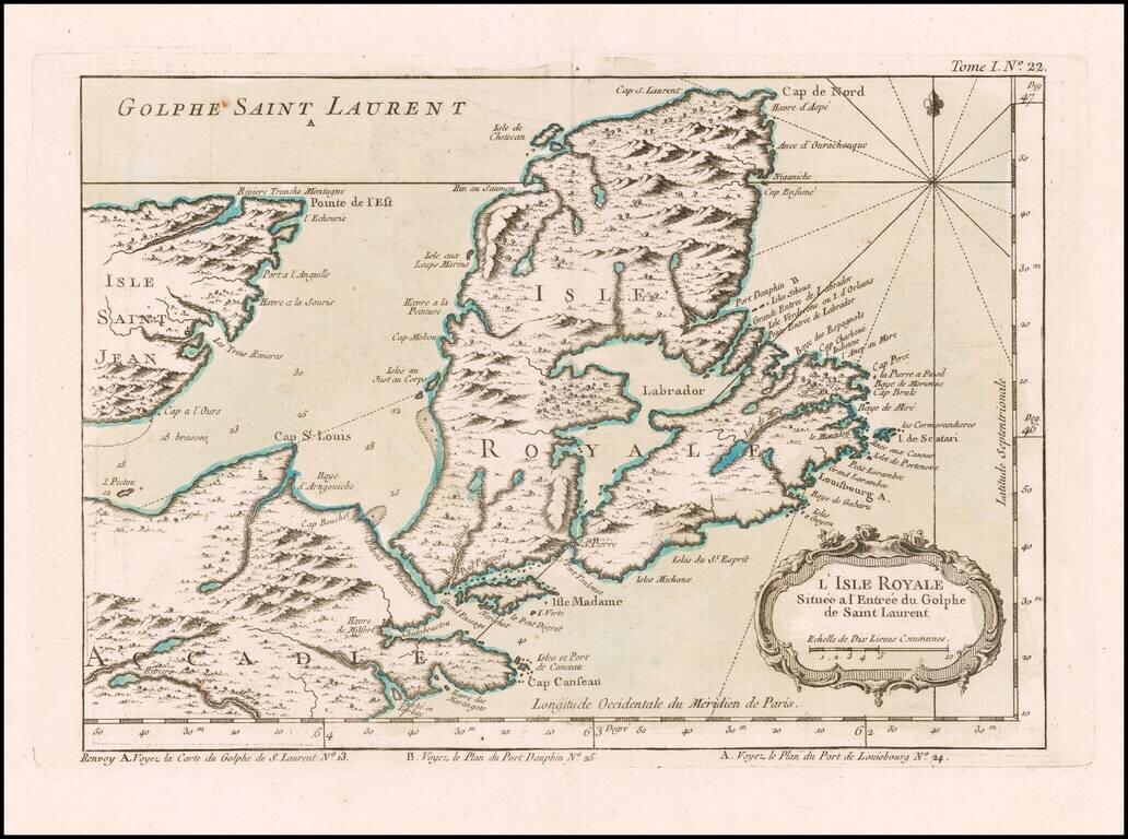
Attractive map of the area around Isle Royale at the entrance of the Gulf of St. Lawarence. The map appeared in Bellin's Petit Atlas Maritime.
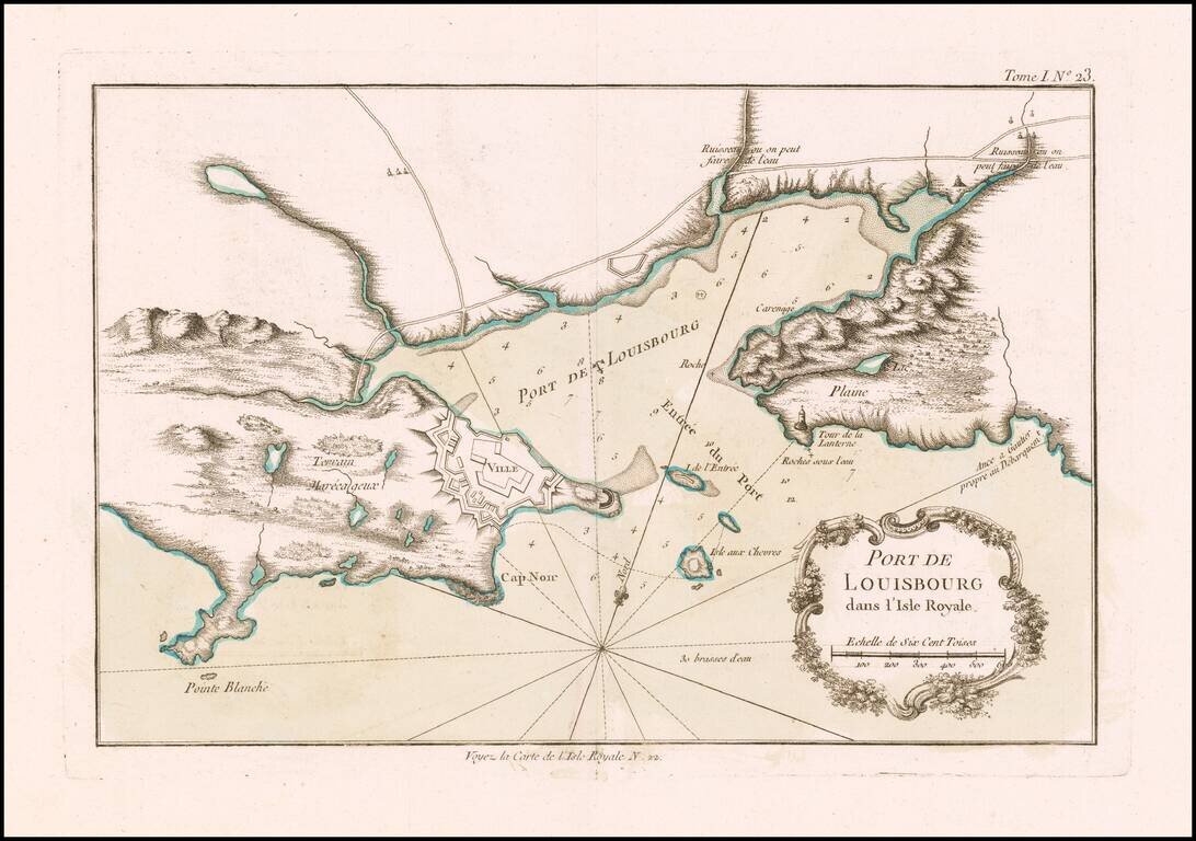
Attractive map of the harbor of Louisbourg, showing the fortified port and environs. The map appeared in Bellin's Petit Atlas Maritime. Louisbourg was originally settled in 1713, and initially called Havre à l'Anglois. Subsequently, the fishing...
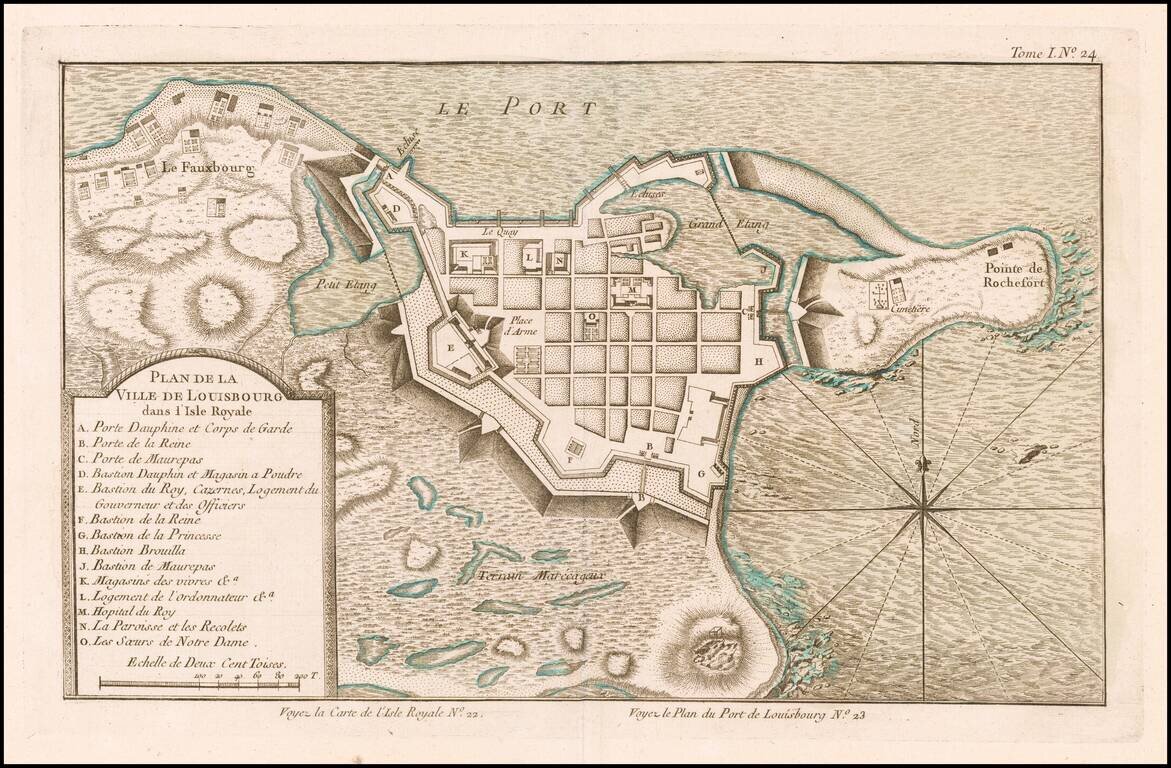
Scarce plan of Louisbourg, published at the conclusion of the French & Indian War, from Bellin's Petit Atlas Maritime. The map shows major fortifications and includes a key locating 14 important points of interest. Louisbourg was originally...
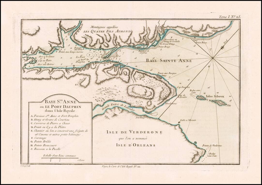
Detailed plan of the Bay of St. Anne and Port Dauphin on Isle Royale (Cape Breton Island). The map appeared in Bellin's Petit Atlas Maritime. The French established a fort and fishing base across St Anns Bay (Fort Sainte-Ann, now Englishtown) in...
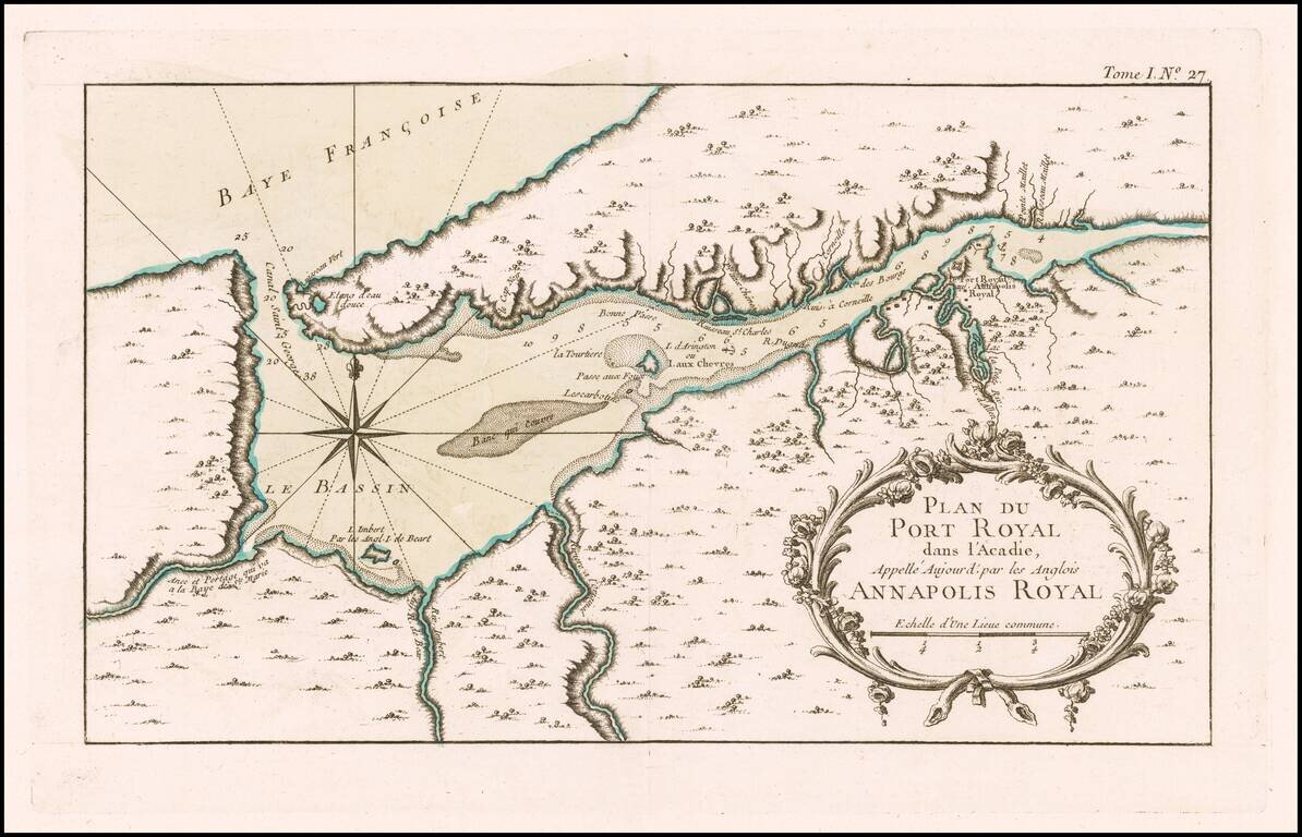
Interesting map of the harbor of Port Royal and the town of Annapolis Royal, pubished in Bellin's Petit Atlas Maritime.
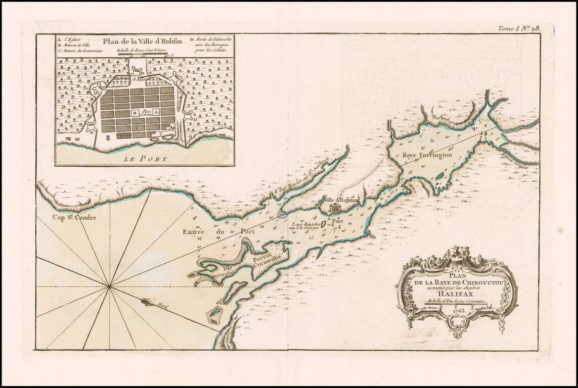
Halifax, Nova Scotia An excellent map of Chibouctou (Beford) Bay and environs, published by Nicolas Bellin in his Petit Atlas Maritime shortly after the conclusion of the Seven Years War. Includes a large plan of the town of Halifax.
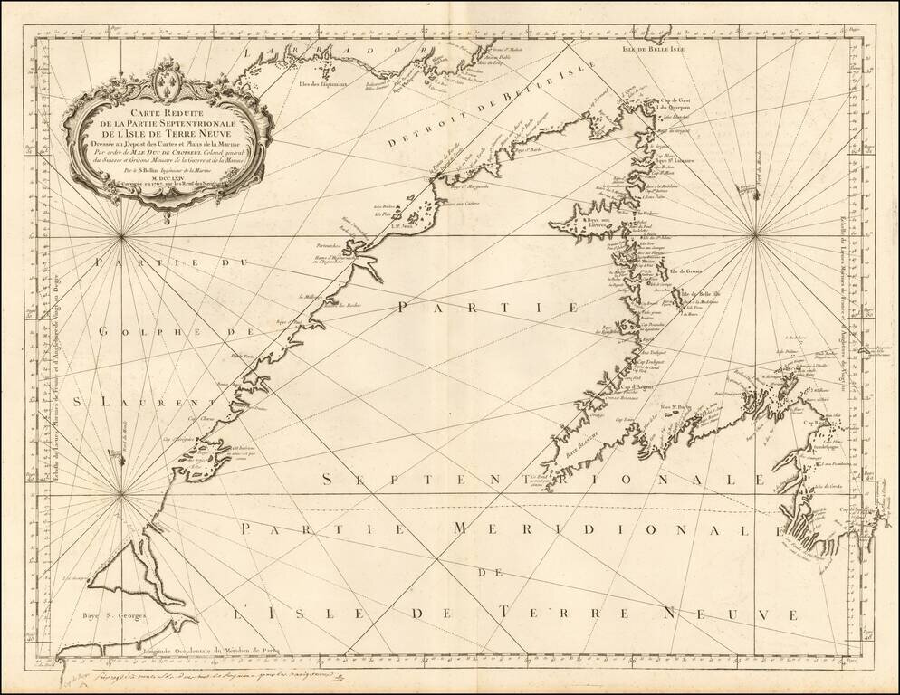
Detailed sea chart of northern part of Newfoundland and the mouth of the St. Lawrence River. The chart was produced by the Depot de la Marine toward the end of the Seven Years War (French & Indian War).
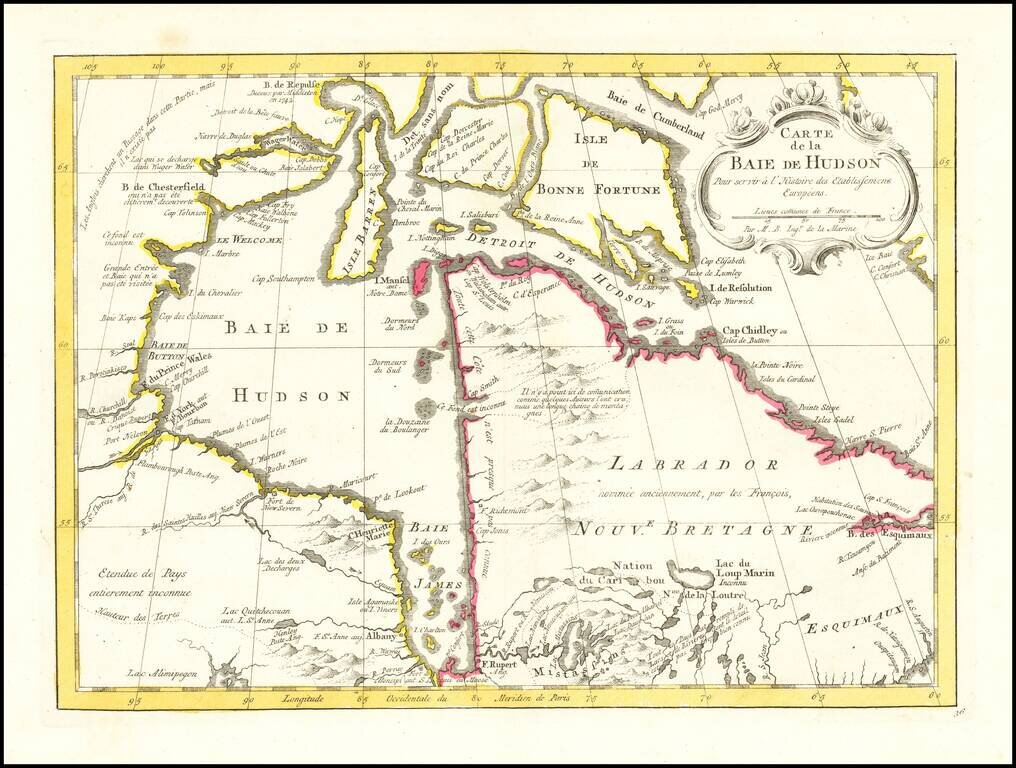
An excellent map of Hudson's Bay, Labrador, Hudson's Straits and neighboring regions from Bellin's Histoire General des Voyages. Includes numerous bays, islands, rivers, mountains and notes regarding explorations.
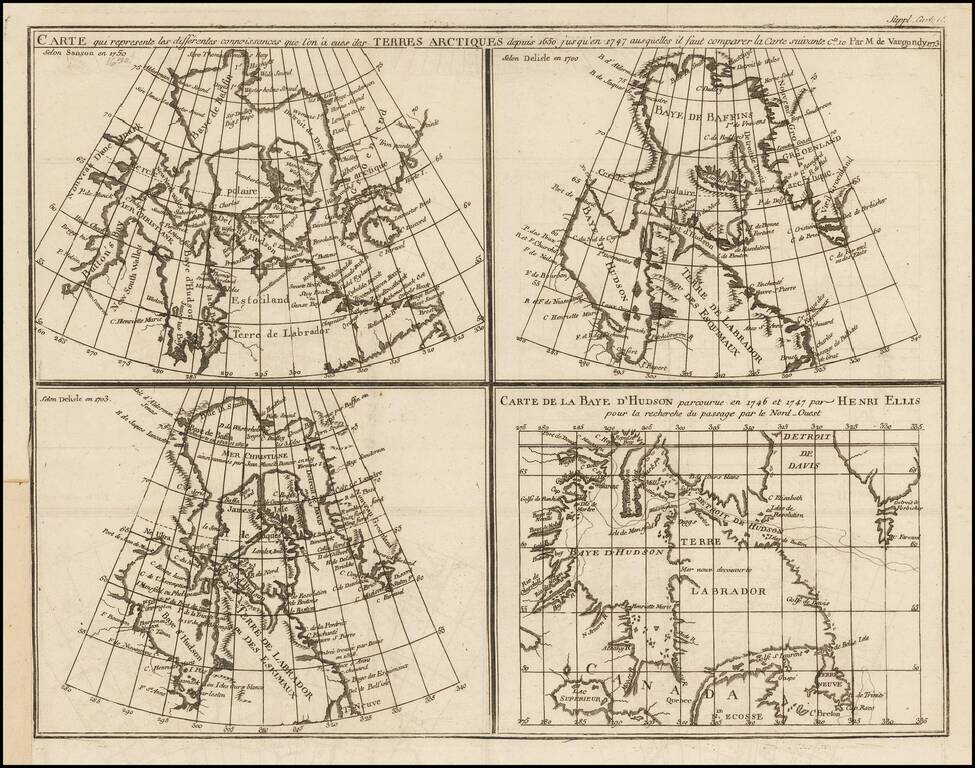
Marvelous set of four maps of the Hudson, Button and Baffin Bay regions, Davis Straits, and the Coast Labrador, as developed and explored between 1650 and 1750. This map was one of ten maps in Diderot's important 10 volume encyclopedia, one of the...
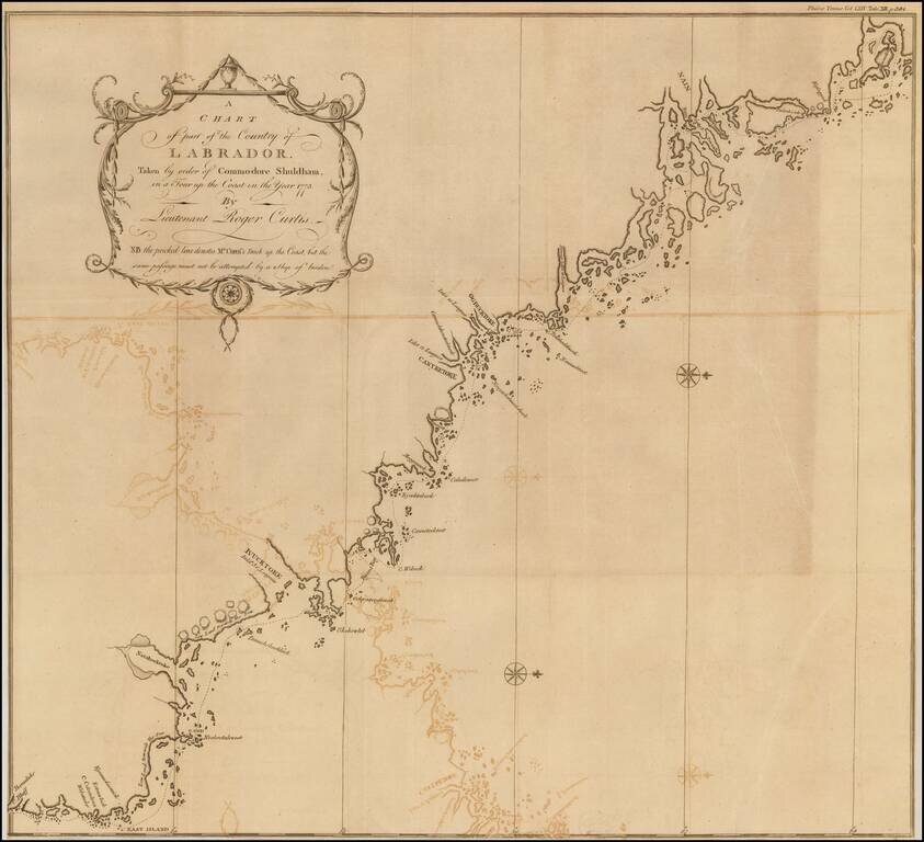
Fine map of the Coast of Labrador, showing the region explored by Roger Curtis, under instructions from Commodore Shuldham in 1773. Admiral Sir Roger Curtis, 1st Baronet, GCB (1746 - 1816) was an officer of the British Royal Navy, who saw action in...
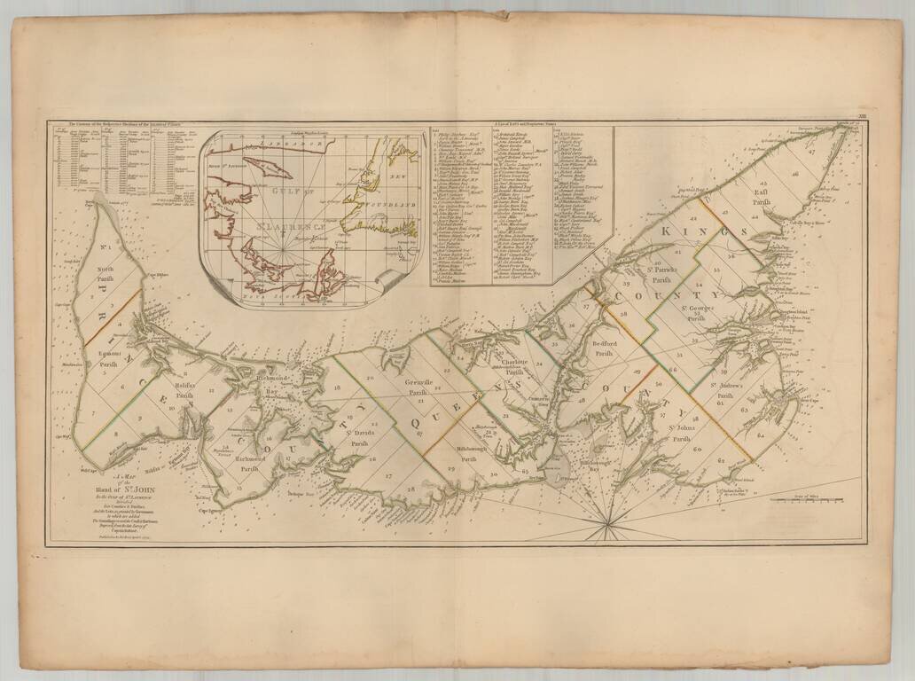
Important early map of St. Johns Island, published by Thomas Jefferys in the American Atlas. The map provides a finely detailed treatment of the island and environs, including a list of 67 lots and the proprietors of each lot, including Samuel Holland...