
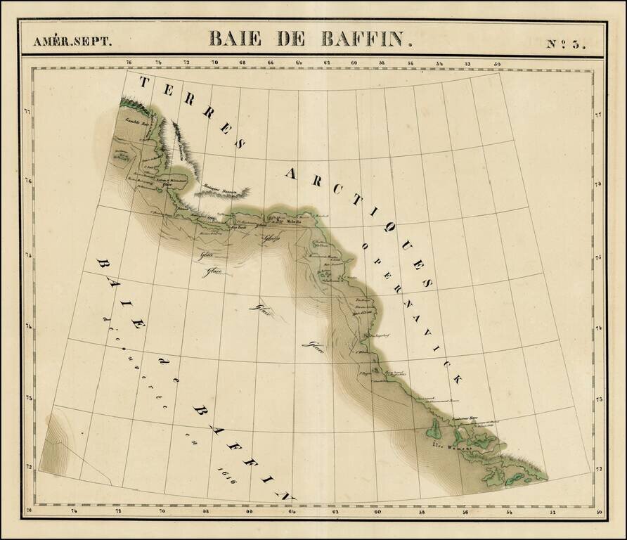
Large format map of the region bounded by Gamble Bay and Entrée de Baleine to Sandersons Hope and Iles Womens. Includes notes of David's voyage in 1587 and Baffin's voyage in 1616, Centered on Melville Baie. Shows the extensive ice flows in the...
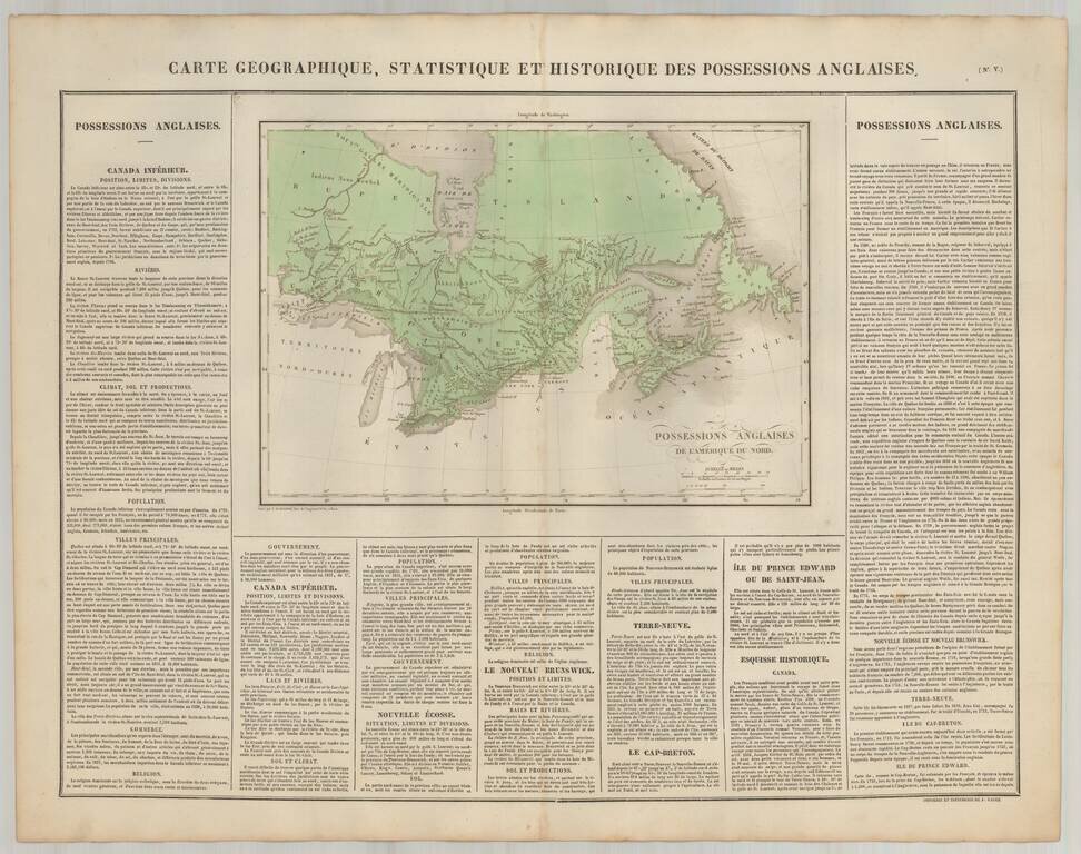
Scarce map of Canada, from JA. Buchon's fine American Atlas, published in Paris. Includes detailed descriptive text surrounding the map.
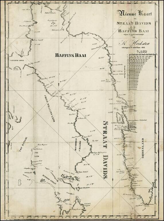
Rare map of the Baffin Bay and the David Straits, from Klaas Hoekstra's Dagverhaal van het verongelukken van het galjootschip Harlingen in Straat-Davids etc., in 1828. The last or nearly-last Dutch whaling voyage to the Arctic was an ill-fated venture...
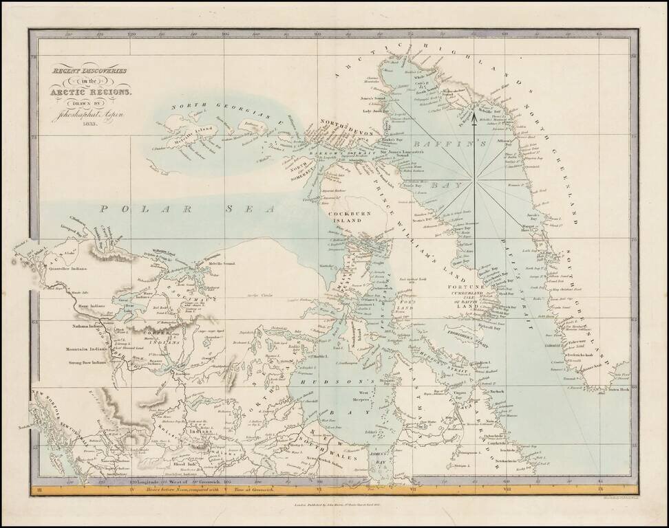
Very rare map of the Arctic Regions of North America, drawn by Jehoshaphat Aspin and published by John Harris in London. The map provides a marvelous snapshot of the known and partially explored regions of the Polar Seas, as of 1833. The map provides...
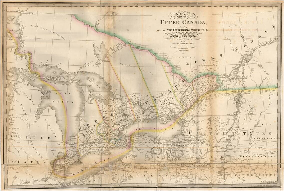
Highly detailed map of the Province of Upper Canada, originally published by David William Smyth and periodically revised over time. Fine map of Upper Canada, showing detailed information on the counties, districts, townships, transportation systems,...
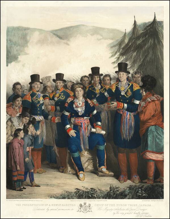
One of the Best Canadian Lithographs. Separately issued hand-colored lithograph of the newly-elected Chief of the Huron Tribe, by H.D. Thielcke. Lithographed by James Henry Lynch, Day & Haghe, Lithographers to the Queen. This superbly composed...

Nice example of Lizars map of Canada, Alaska and the Polar Regions. Excellent early map of Canada, Alaska and the Northwest part of America and contiguous regions covered by Lewis & Clark. The map provides a fine treatment of the search for the...
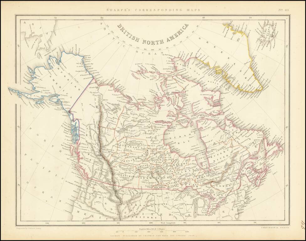
Scarce map of the British North America and Russian America (Alaska) published in London in 1848. The far western portion of Canada is labeled simply "Columbia and extends from the US to Russian America, dominated by a speculative "Cook River." A...
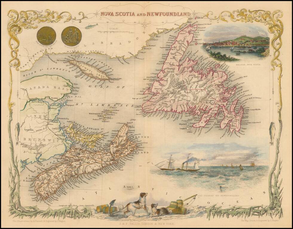
Striking full color example of this marvelous map of Nova Scotia, Newfoundland and the Gulf of St. Lawrence. Decorative Vignettes of Halifax, Cod Fishery Off Newfoundland, and several others. Engraved for R. Montgomery Martin's Illustrated Atlas....
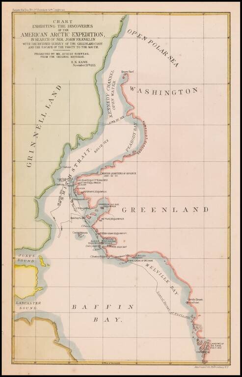
Map of the area of the Upper Part of Baffin Bay and the coasts of Greenland and Grinnell Land, illustrating the tracts of the Second Grinnell Expedition in 1854-1855. The Second Grinnell expedition of 1853–1855 was an American effort, financed by...
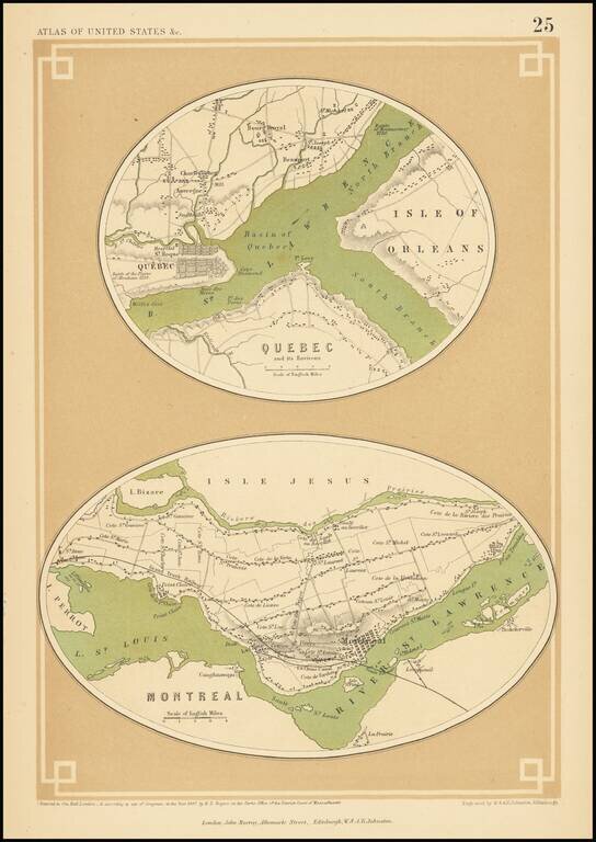
A rare map of Quebec and Montreal, from Rogers & Johnston's Atlas of the United States. The map shows the layout of the two cities including streets, neighborhoods, and other major features. Both cities are mapped on a large scale, showing towns...
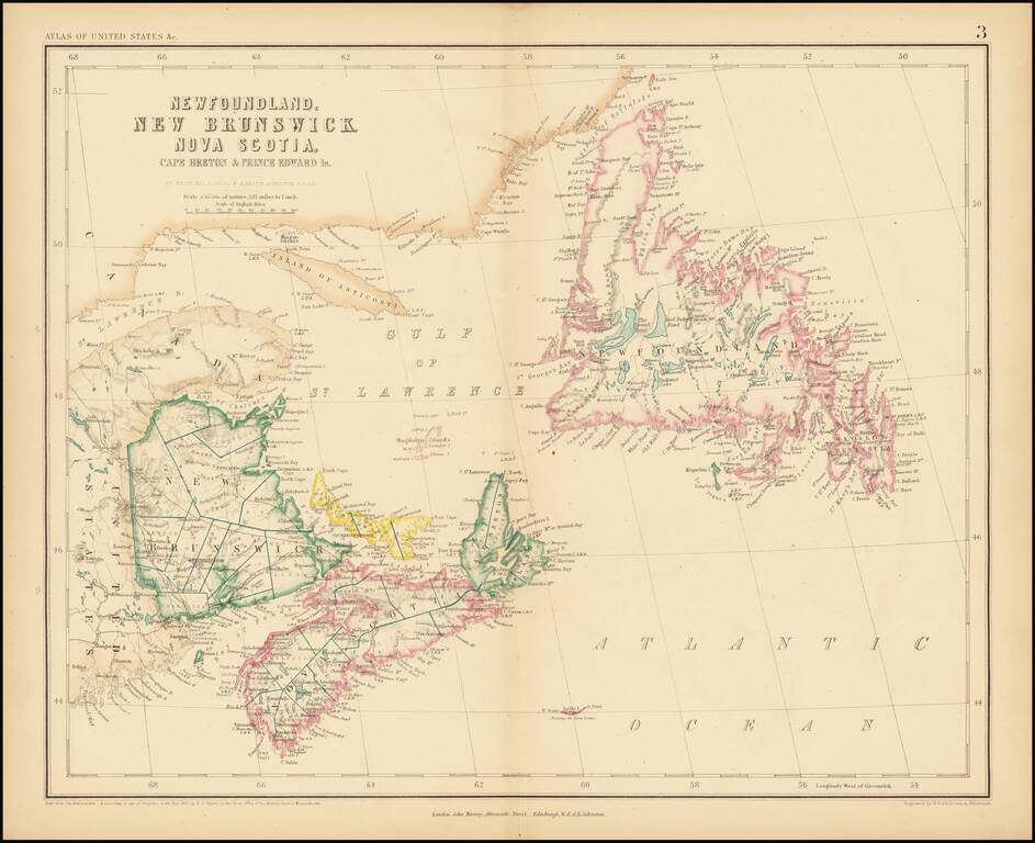
A rare antique map of eastern Canada from Rogers & Johnston's Atlas of the United States, one of the most attractive American atlases of the 19th century. This atlas was an unusual collaboration between an American, Englishman, and Scot. The map is...
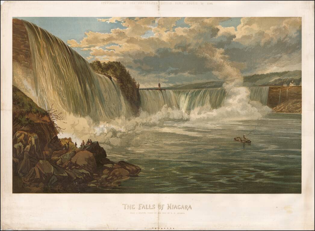
Rare color chromolithograph of Niagara Falls, with a small steamship in the center and several buildings visible at the top of the falls. The image was issued as a supplement to the Illustrated London News on August 25, 1860.
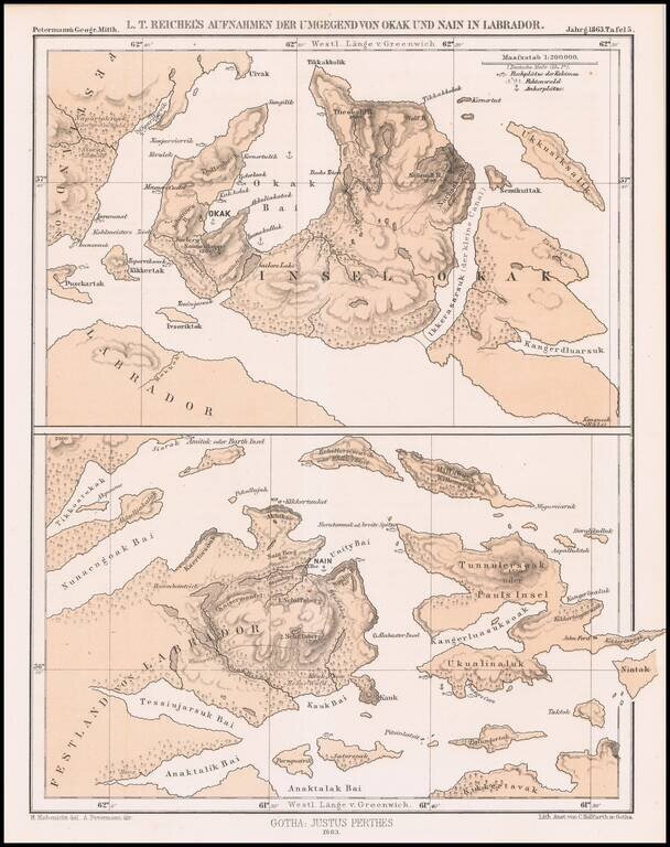
Detailed map of a portion of Labrador, published by Augustus Peterman. Includes Petermann's report on the region.
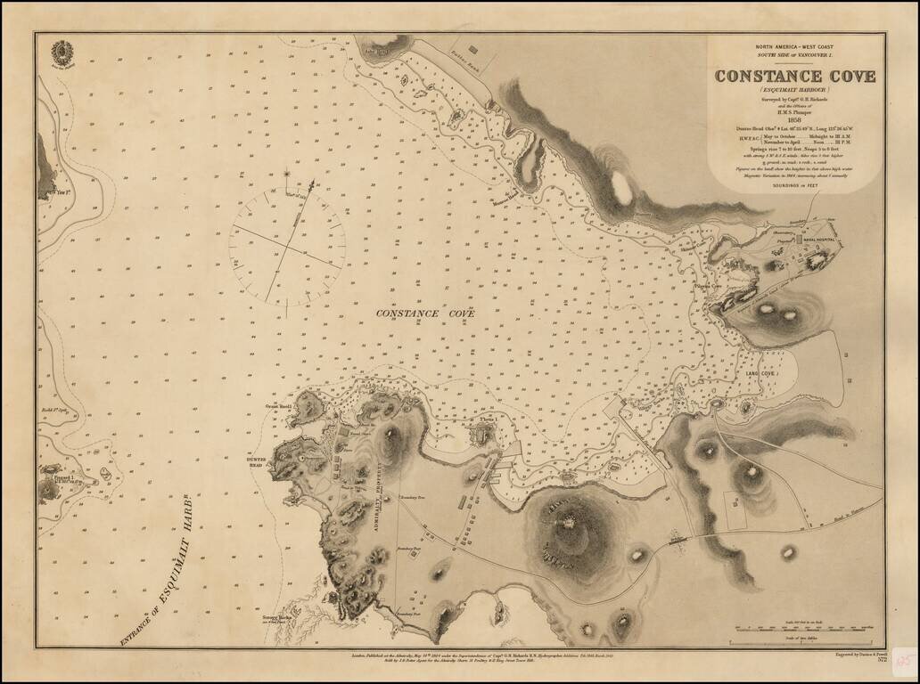
Surveyed For The New Headquarters of the British Navy's Pacific Fleet Rare British Admiralty Chart of Constance Cove, Esquimalt Harbour, home to the British Royal Navy's Pacific Fleet beginning in 1865 and thereafter the Canadian Royal Navy. This is...
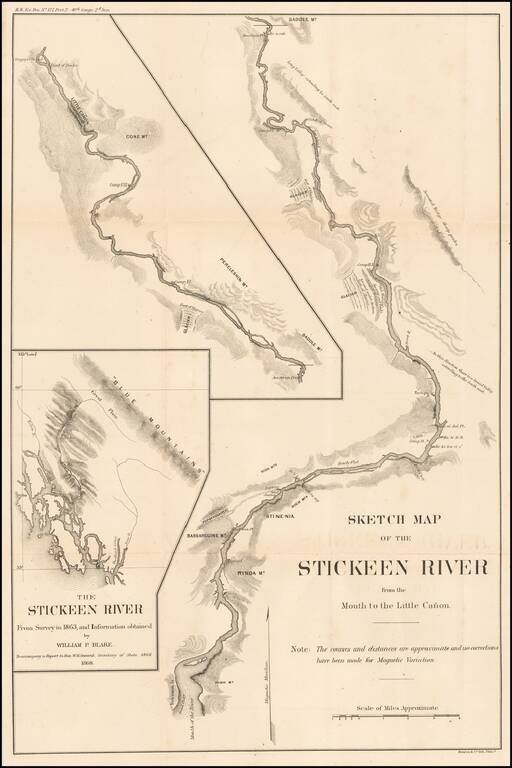
Finely detailed map of the Stikine River, based upon an expedition led by Mineralogist William Phipps Blake in 1863. The map was drawn to accompany the report of W.H. Seward, shortly after the acquisition of Alaska by the United States in 1867. The...