
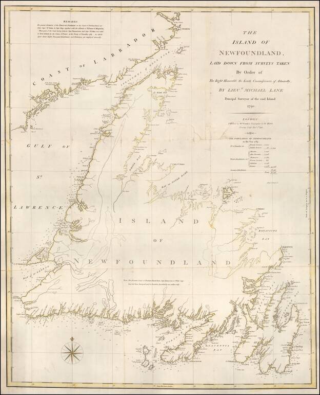
Rare separately issued chart of Newfoundland, published in London by William Faden in 1791. Faden's chart covers the entire island of Newfoundland along with a portion of the coast of Labrador bordering the Gulf of St. Lawrence. There is fine detail...
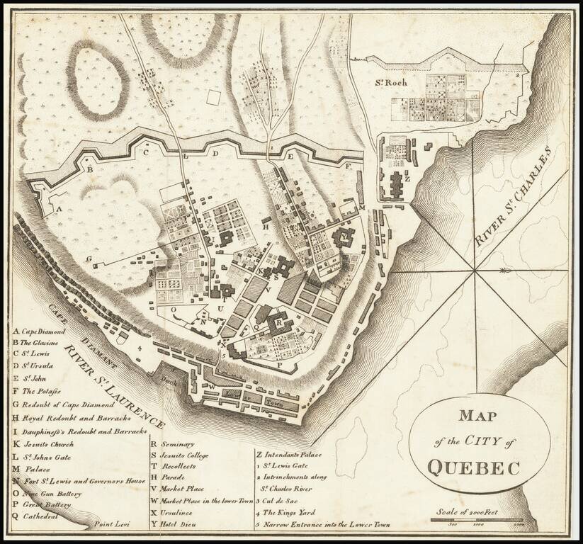
Rare Revolutionary War battle plan of Quebec City, from Charles Smith's Monthly Military Repository, the first map of Quebec printed in the United States. This rare engraving from Charles Smith's Monthly Military Repository is the first detailed plan...
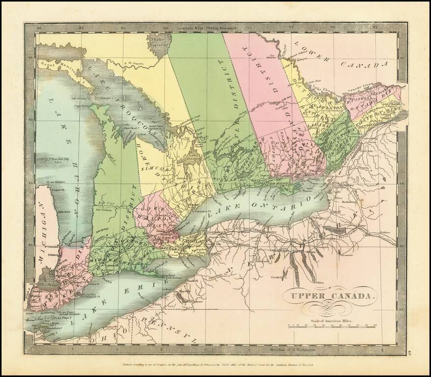
Interesting map of Upper Canada by David Burr, from his New Universal Atlas. Names Toronto on Lake Ontario, and, in the far west, Detroit. The internal districts are named and colored individually.
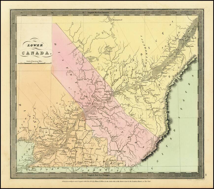
Interesting map of Lower Canada by David Burr, from his New Universal Atlas. The map is centered on the St. Lawrence River. The internal districts are named and colored individually.
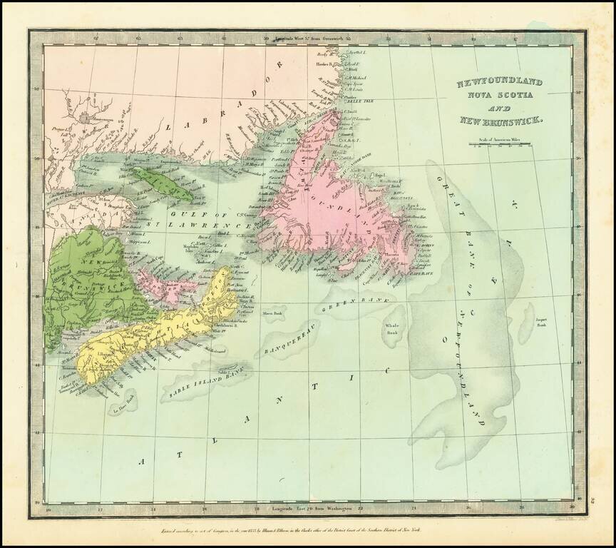
Detailed map of Northeastern Canada, published by David Burr.
![[Newfoundland] Carta Esferica en dos hojas Del Banco y La Isla De Terranova con parte de la Costa de Labrador, Consruida en la Direccion de Hidrografia seun las ultimas publicadas por el Deposito hidrografico de Londres y presantada a S.S.M.M. por Don Ju](/map/small/42237sh.jpg)
Northern chart of this scarce Spanish Chart of Newfoundland and Labrador, published in Madrid.
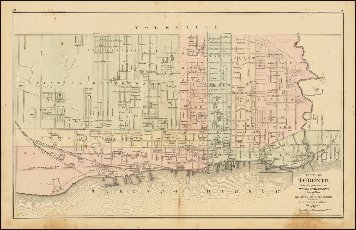
Detailed map of Toronto, colored by Wards, from Tackabury's Atlas of the Dominion. Locates a number wharfs, buildings, railroad lines and other details. Toronto was originally named York, changing its name in 1834. The map shows Toronto during a...
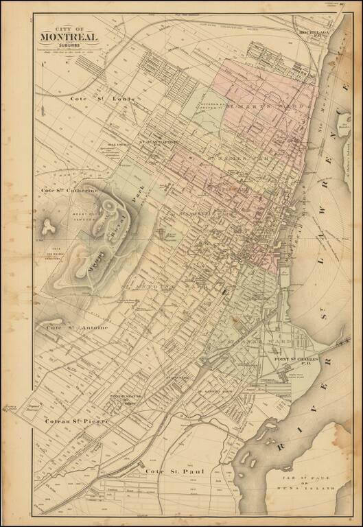
Scarce lithographed map of Montreal, probably from Tackabury's Atlas of the Dominion of Canada (1876). Hand-colored by wards. Many important public buildings are outlined and labeled. The topography of Mount Royal is rendered with hachuring.
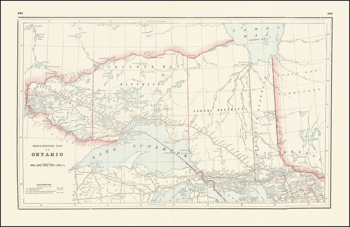
Detailed railroad map, showing counties, railroad lines, towns, rivers, township surveys, lakes, mountains, creeks, waterfalls, and a host of other information. Focuses on the northern Great Lakes, specifically Lake Superior, and shows Ontario north...
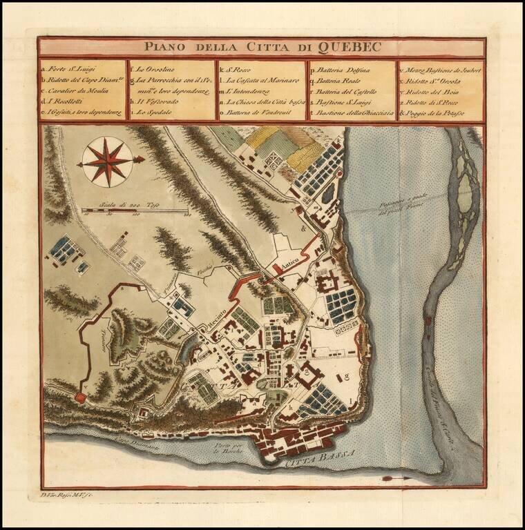
Finely colored plan of the town and fortifications of Quebec. The map illustrates the fortifications, as they existed during the French & Indian War.
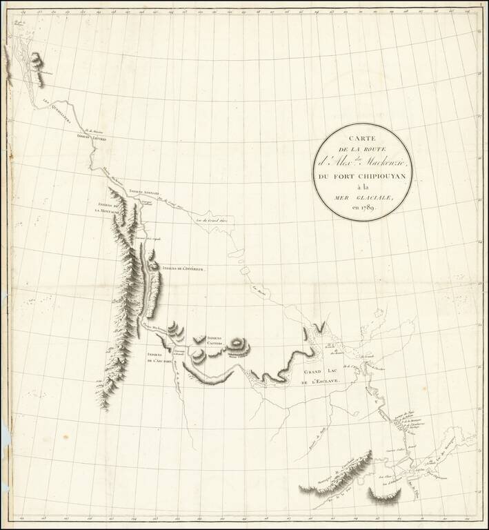
Exploring the River Which Would Bear His Name Nice example of the French edition of Alexander Mackenzie's route map between Lake Athabasca to the Arctic Sea in 1789. Alexander Mackenzie was the first European to cross the North American continent...
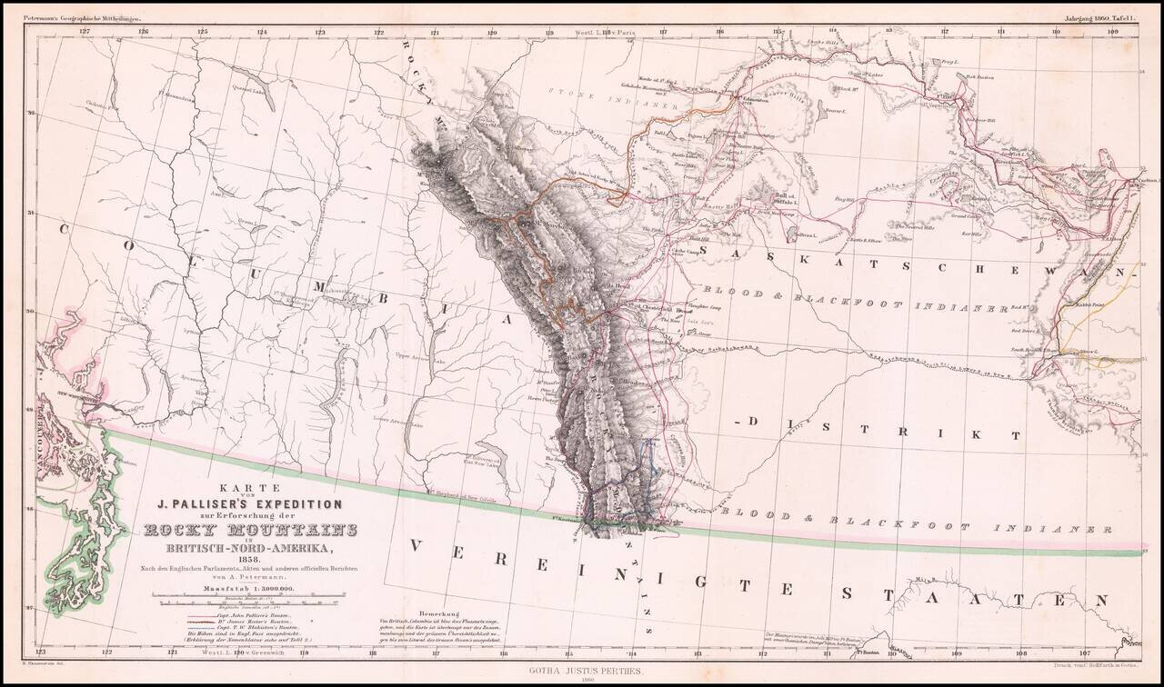
Detailed map of Western Canada illustrating the western part of Captain John Palliser's explorations in Western Canada, based upon Palliser's virtually unobtainable map published about three years earlier. The map shows the disputed boundary claim...
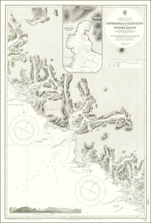
Finely detailed sea chart of a portion of the Western Coast of Vancouver Island, published by the British Admiralty. The chart is centered on Nootka Sound and extends north to Atluck Lake and the Fair Harbor area, and south to Vargas Island and...
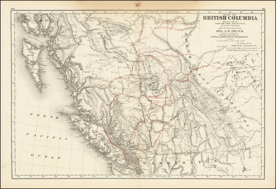
A historically important map of British Columbia after the province entered the Confederation which shows the proposed routes for the Canadian Pacific Railway. Following the establishment of the Canadian Confederation in 1867, Trutch worked to...
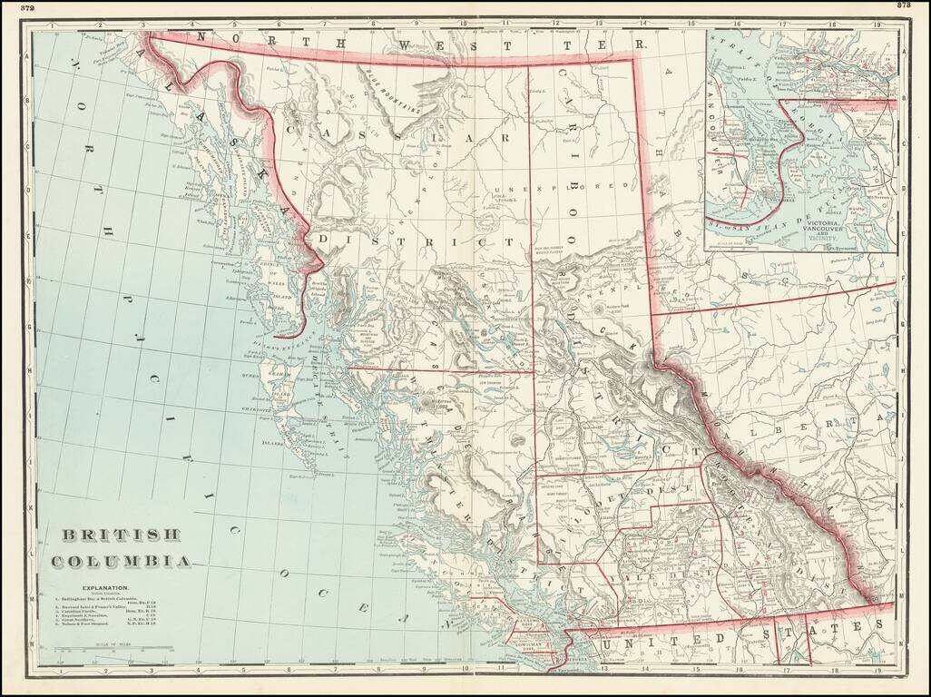
Fine large format map of British Columbia, published in Chicago by George Cram. Includes topographical features, towns, rivers, mountains and early railroads (completed and proposed) The map divides British Columbia into Districts, including...
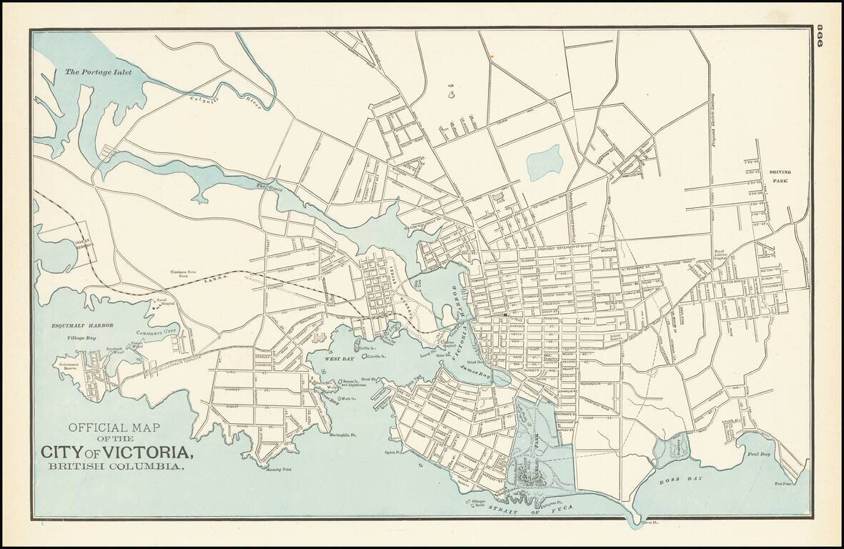
Detailed map of Victoria and environs, published by George Cram in Chicago. The map is centered on Victoria harbor, with a large Indian Reserve on the waterfront. The line of the E & N Railroad extends westward from downtown and a large park in...