
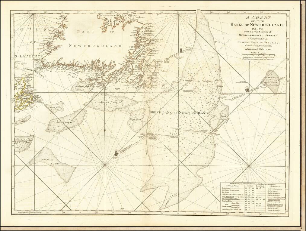
Detailed map of Newfoundland the Grand Banks, published in Jeffery's American Atlas. The map includes three ship illustrations representing the voyages of Chabert, Cook and Fleurieu, inset of astronomical observations on which the chart is based, as...
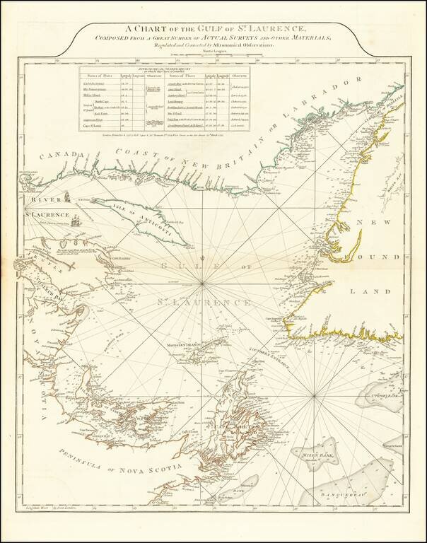
Fine example of Sayer and Bennett's chart of the Gulf of St. Laurence, based on the surveys by James Cook and Michael Lane. At the conclusion of the French and Indian War, the British needed accurate charts of the territories that had been awarded to...
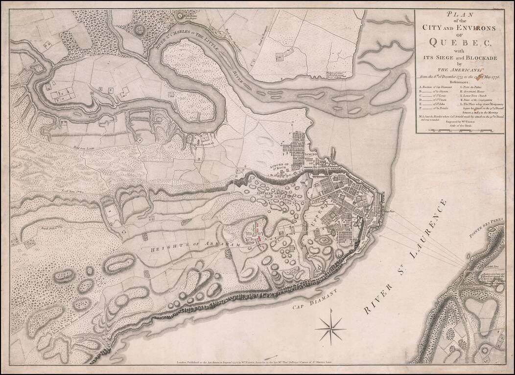
Fine, Detailed, Separately-Issued Plan of the Siege of Quebec (1775-6) Rare, separately-published plan of the Siege of Quebec, published by William Faden in London. The plan shows a pivotal early moment in the American Revolution and highlights the...
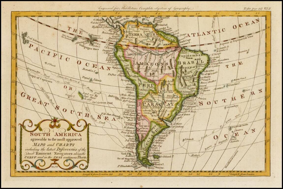
Detailed map of South America, published in London by Middleton. The map shows the exploration tracks of a number of major voyages of exploration, including: James Cook Sir Edmund Halley Philip Carteret Samuel Wallis John Byron Louis Antoine de...
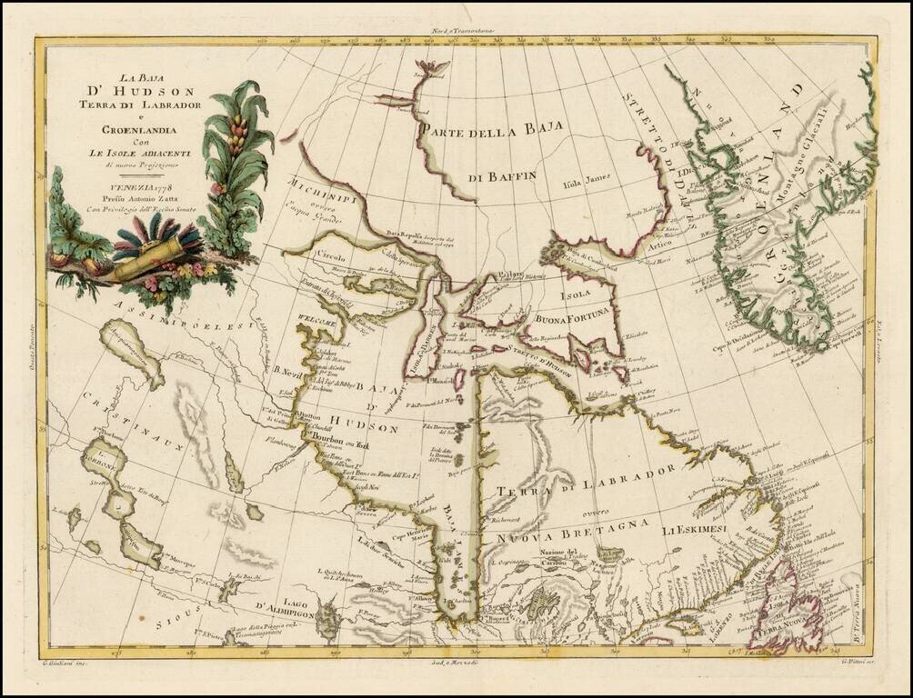
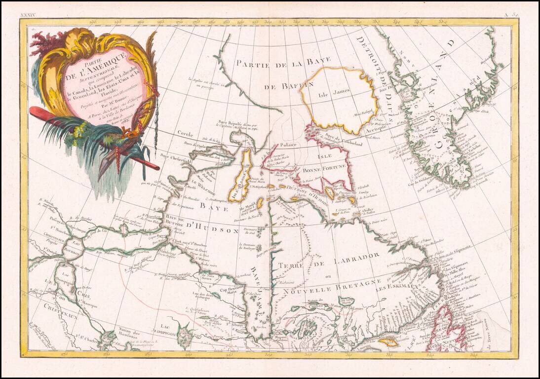
Striking map of Hudson Bay, Baffin Bay, part of Greenland, Labrador and Northern Canada. Marvelous detail on the islands and coastlines, known and unknown. Issued as part of Zatta's Atlante Novissimo, one of the last great decorative atlases.
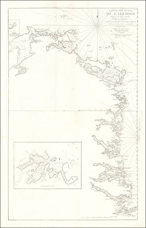
Rare French edition Jefferey's 2-sheet map of part of Labrador, which appeared in Le Rouge's Pilot Americain Septentrionale. Includes extensive soundings, sailing directions, rhumb lines and many other fine details. The chart was included in Le...
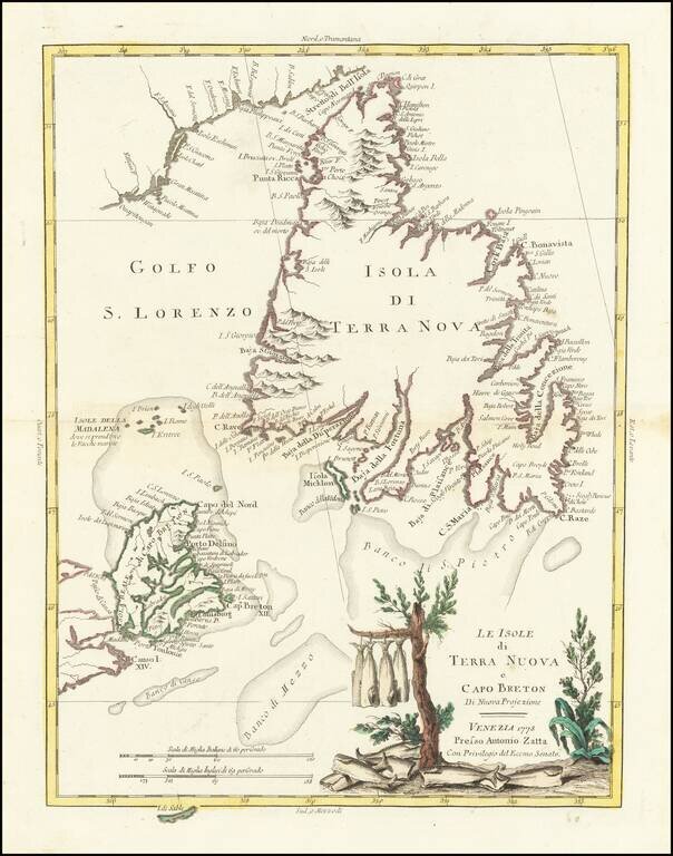
Gorgeous separate map of Newfoundland and Cape Breton Island, along with neighboring Islands, including St. Pierre Michelon. Antonio Zatta was a leading European cartographer and publisher, and his Atlante Novissimo was one of the most beautifully...
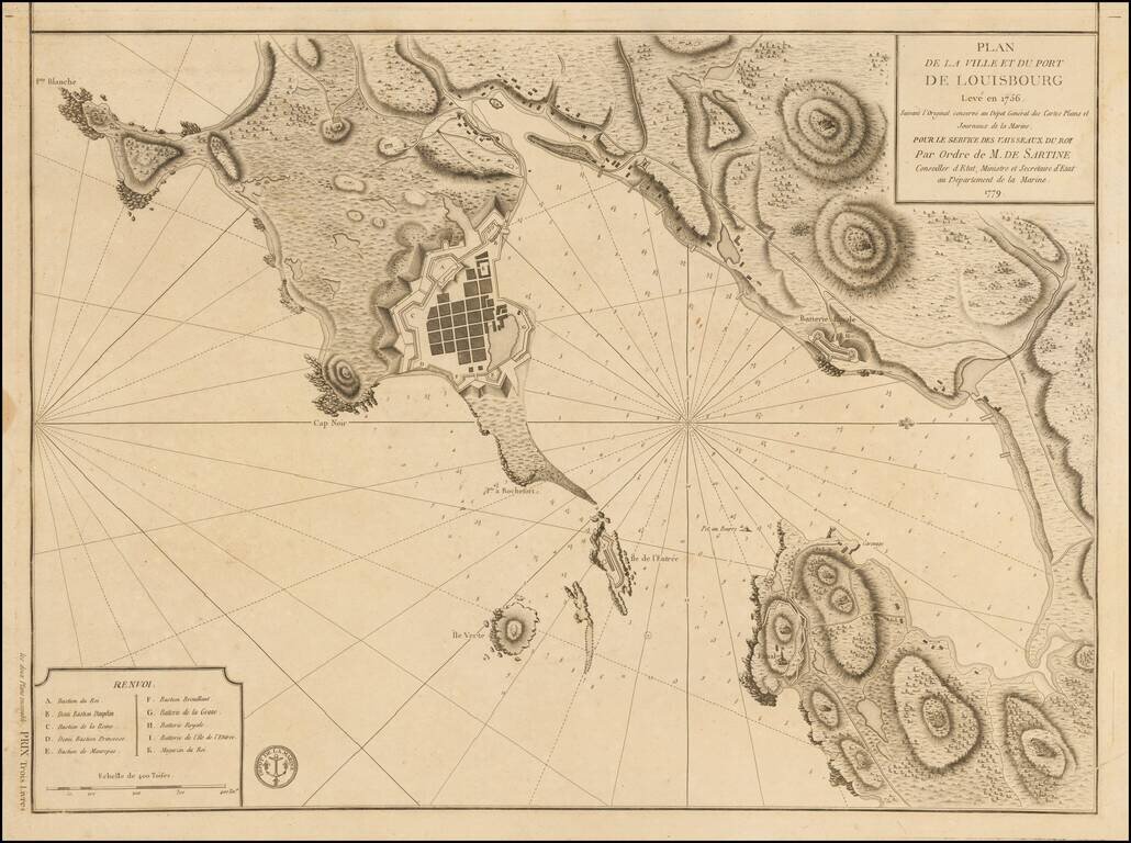
Plan of Louisbourg in 1779 Detailed plan of the town and port of Louisbourg, oriented with west at the top, made by order of the French Depot de la Marine, during the American Revolution. The plan was originally made 2 years prior to the Siege of...
![[East Coast of Prince Edward Island - Rollo Bay to Wood Islands]](/map/small/62849.jpg)
Rare chart of the East Coast of Prince Edward Island, centered on Cardigan Bay and Panmure Island. St. John's Island (Isle of St. John) was renamed Prince Edward Island in 1798, after Edward, Duke of Kent. This fine chart appeared in the Atlantic...
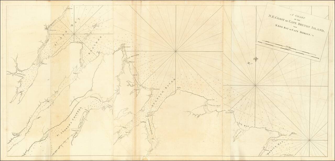
Rare chart of the North East Coast of Cape Breton, from Morien Bay to St Anne's Bay. This fine chart appeared in the Atlantic Neptune by Captain Joseph Frederick Wallet des Barres. The Atlantic Neptune was remarkable, multi-volume set of sea charts...
Detailed map of Canada and Hudson's Bay. Includes decorative cartouche and excellent detail throughout. Extends from Lake Winnipeg to the Eastern Seaboard.
![Plan De Louisbourg... [French & Indian War Battle Plan--Louisbourg]](/map/small/57192.jpg)
Rare French & Indian War Battle Plan, showing the fortifications and battles fought at Louisbourg. The key at the bottom of the battle plan explains the various places on the plan. The plans were issued in Les plans de la guerre de sept ans...
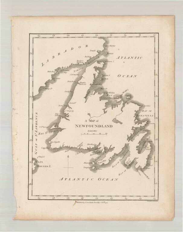
Scarce early map of Newfoundland, which first appeared in Samuel Morse's Universal Geography in 1794.
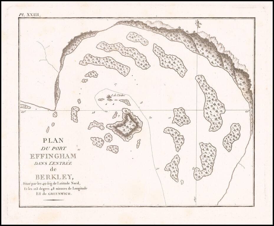
Detailed map of Port Effingham, likely on the present-day Effingham Island, previously known as Village Island in British Columbia, part of the Broken group of islands.
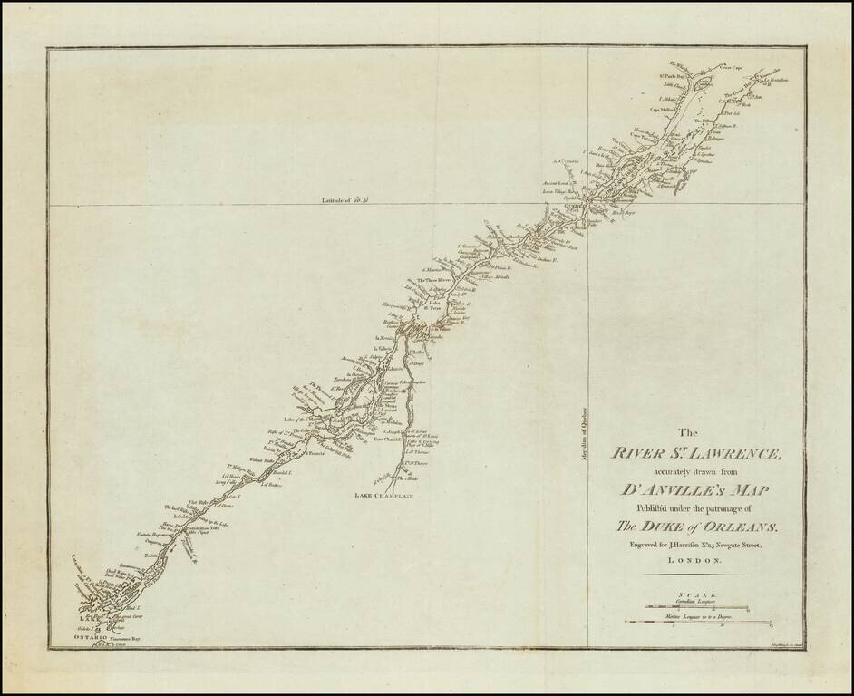
A rare English map of the St. Lawrence River, extending from Lake Ontario and Thousand Islands to just north of Quebec and Orleans Island. The chart shows channels, islands, shoals, waterfalls, rocks, and rapids in the river. Also shows towns, forts...
![[Vancouver Island] Carte Particuliere de la Cote du Nord-Ouest de l'Amerique reconnue par les Fregates Francaises la Boussole et l' Astrolabe en 1786 2e. Feuille.](/map/small/62141.jpg)
Vancouver Island Before Vancouver! Early sea chart of a portion of the west coast of Vancouver Island, centered on Nootka from the epic voyage of the Jean-François de Galaup, Comte de La Pérouse. This fine map embraces the western coast of...