
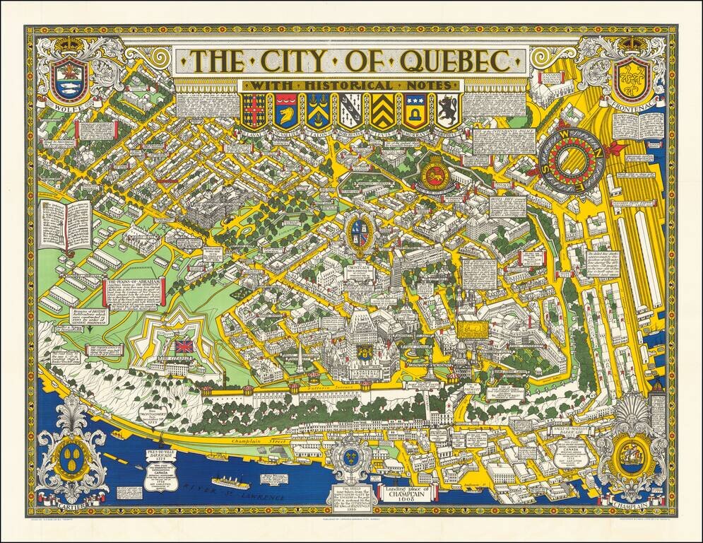
Decorative historical map of Quebec, richly adorned by coats of arms and historical facts.
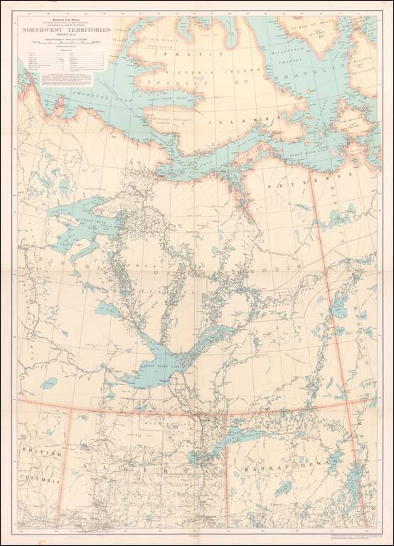
Detailed map of a portion of the Northwest Territories, published by the Department of the Interior in 1932. The map illustrates: Main, Wagon and Winter Roads Falls and Rapids Ranger Cabins Royal Candian Mounted PoliceStations Sea Plane...
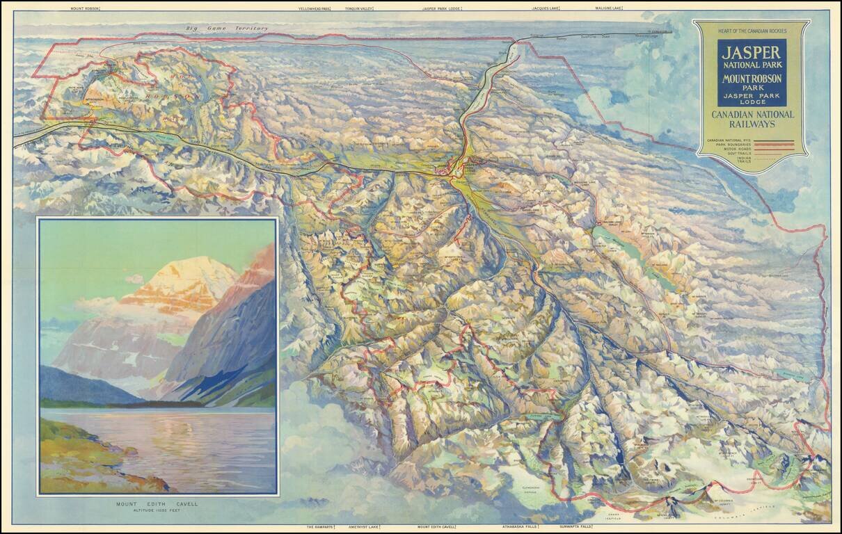
Finely illustrated vintage view-map of the Jasper National Park and environs, published by the Canadian National Railway. Color coding identifies Canadian National Railway lines, Park Boundaries, Motor Roads, Government Trails, and Indian Trails....
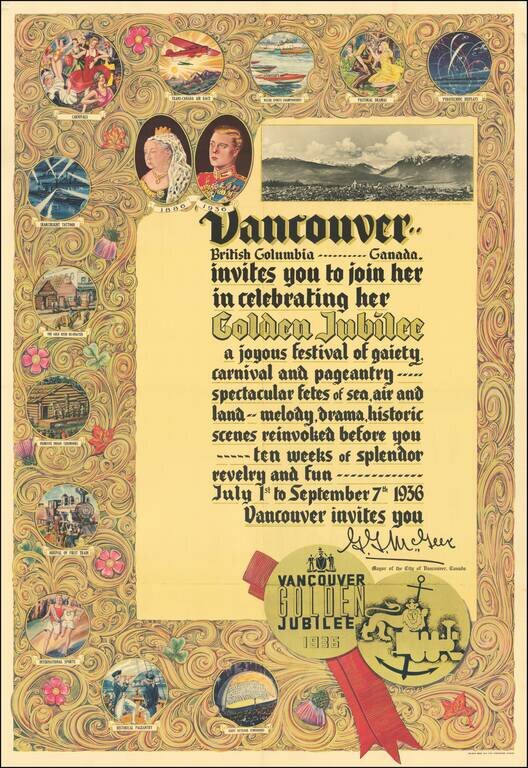
Beautiful color-printed poster commemorating the centennial of the founding of Vancouver, British Columbia, printed by Bulman Bros. in 1936. The full text of the poster reads: Vancouver.. British Columbia..... Canada. invites you to join her in...
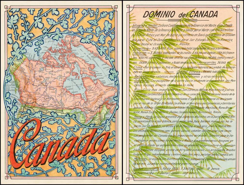
Award winning pair of manuscript cards, prepared by Antonio Raggio for the 11th Congreso de la Union Postal Universal (World Postal Congress) Exposition Filatelica Internacional, held in Buenos Aires, Argentina in 1939. The map shows a finely...
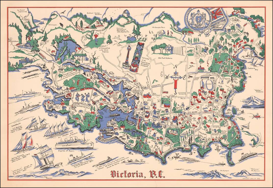
Rare pictorial map of Victoria, British Columbia, drawn by Amy Adamson. The map shows major buildings, railways, towns, major roads, landmarks, rivers, forests, recreational sites and activities. The compass is created from Cross, oriented north to...
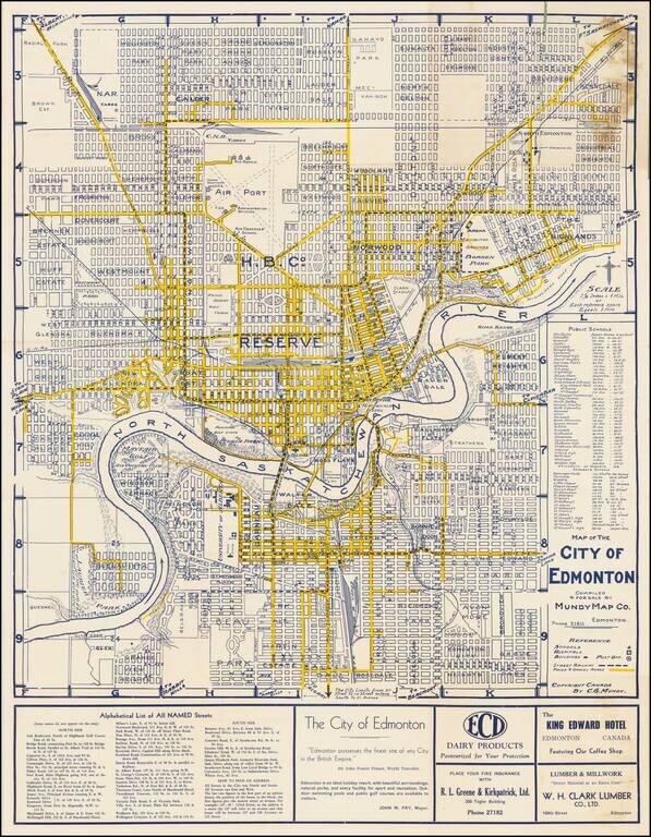
"Edmonton Possesses The Finest Site of any City in the British Empire" -- Sir John Foster Frazer Fine early plan of Edmonton, published in Edmonton by the Mundy Map Company. The center of town is dominated by a large area noted as "Hudson Bay...
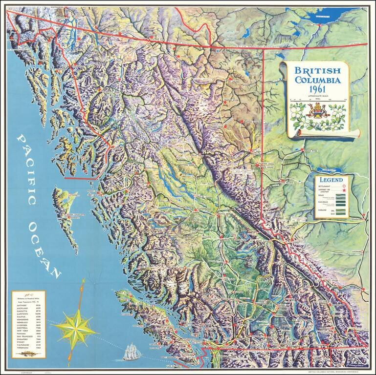
Finely executed pictorial map of British Columbia, published for the British Columbia Natural Resources Conference. The map provides a remarkable topographical presentation of British Columbia's complex terrain. The legend locates: Settlements...
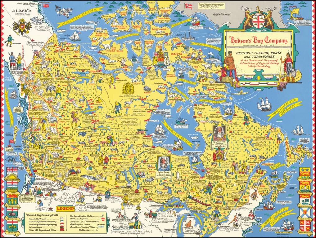
"Third Revision" of this marvelous pictorial map celebrating the history of the Hudson's Bay Company, published in Toronto. Fine large format map drawn by Toronto Artist Stanley Turner, one of the best known WWII map illustrators. The map is filled...
![[Battle of Placentia]](/map/small/70282.jpg)
Lahontan's Account of the Battle of Placentia Nice example of Baron Lahontan's illustration of the Battle of Placentia (September 1692), which was fought between the English and the French at Fort St. Louis (Castle Hill) in Placentia, Newfoundland...
![[Encampment of De La Barre on Lac Frontenac]](/map/small/70174.jpg)
Important Early French Fur Trading Post. Interesting engraving depicting the Encampment of Joseph-Antoine le Fèbvre de La Barre. La Barre (1622-1688) was the Governor of New France from 1682 to 1685. Having replaced the frustrated Comte de...
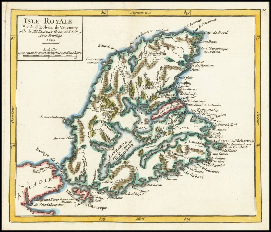
Detailed map of Isle Royale (Cape Breton Island) and contiguous regions, from De Vaugondy's Atlas Portatif.
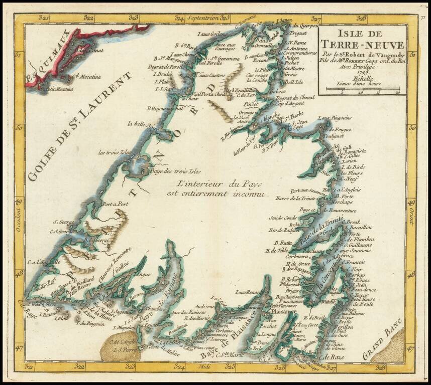
Detailed map of the island of Newfoundland, from De Vaugondy's Atlas Portatif.
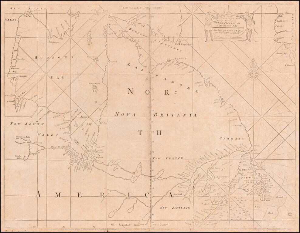
A Fine Mount & Page edition of John Thornton's important sea chart of Hudson's Bay and Eastern Canada. This fascinating sea chart embraces all of eastern Canada, from the southern part of Baffin Island down to include the Canadian Maritimes,...
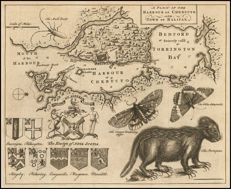
Popular engraved map of Halifax featuring a remarkable depiction of a porcupine in the lower right of the image. This map, which was published in the Gentleman's Magazine in 1750, has long been sought after by collectors for its curious natural...
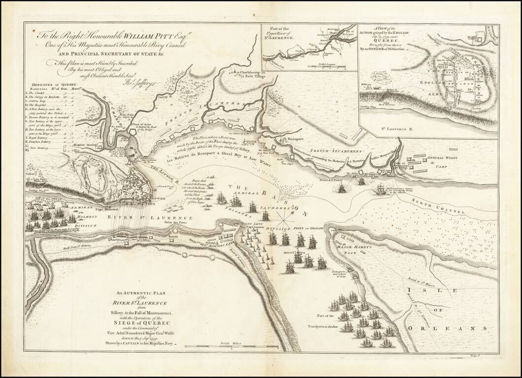
Battle Plan of the Siege of Quebec Striking example of the first State of Jefferys' map of the siege of Quebec of 1759, widely considered to be the most important single printed military map in Canadian history. Drawn by an officer of the Royal Navy,...