
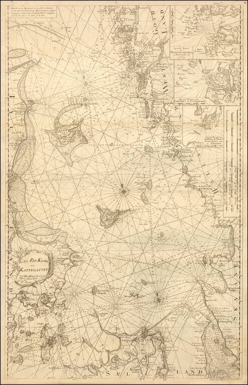
Rare separately published sea chart of the Kattegat Sea, published by Lous. The chart includes large inset charts of Malo, Gothenburg and Marstrand Havn in Sweden. Christian Carl Lous (1724 - 1804) was a Danish mathematician, navigation director and...
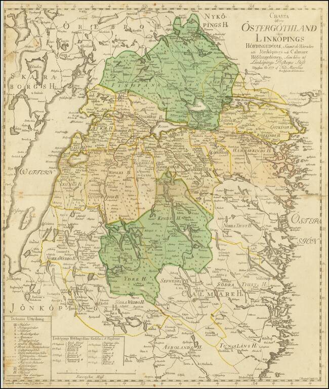
Uncommon map of the Swedish province Östergötlands by the Swedish cartographer Nils Marelius (1707-1791). The map was published as a separate map in Stockholm, 1779, by Kongliga Lantmäteri Contoiret (Royal Institute of Surveyors) and engraved by...
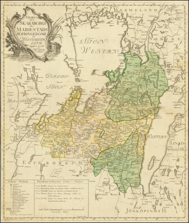
Detailed engraved map of Skaraborg, published in Sweden by Nils Marelius in 1780. The map depicts the area between the lakes Vanern and Vattern. The regional subdivisions, towns, and roads of the area are shown. The map was engraved by C. Bergquist,...
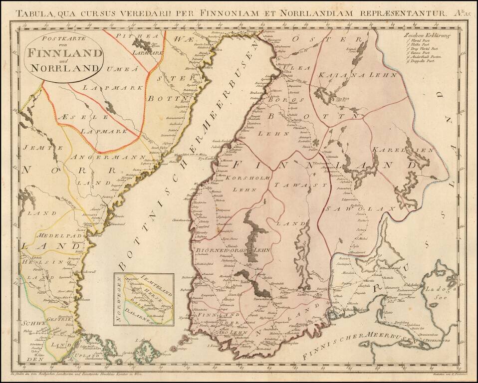
Rare postal map of Finland and part of Norway, which appeared in Von Reilly and Kuhn's Atlas Universae rei veredariae bilinguis ... Allgemeiner Postatlas von der ganzen Welt . . . , published in Vienna in 1799. Von Reilly & Kuhn's atlas is the...
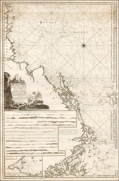
Fine regional Sea Chart of the Coast of Sweden from Soderhamn to Stockholm, published by Swedish Admiral Johann Nordenankar in his Sveriges Sjo-Atlas, the first modern sea atlas of the Baltic. The chart includes a number of profile recognition views...
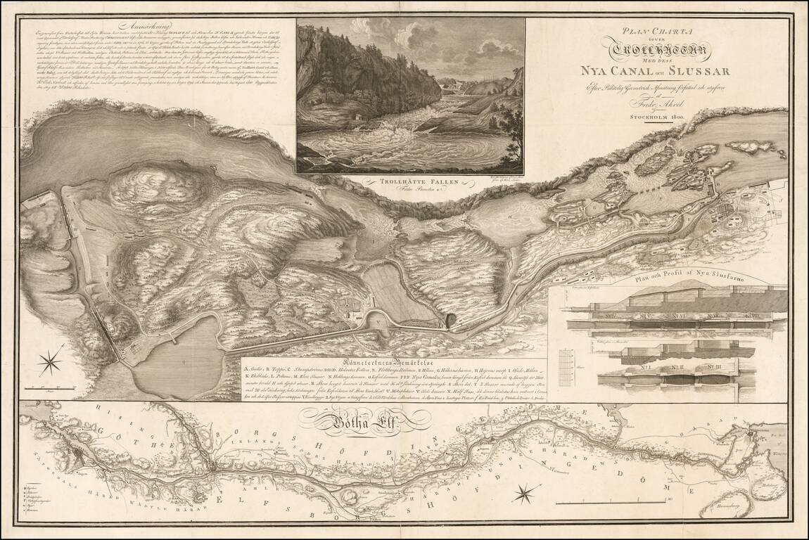
Striking Plan Detailing the Trollhattan Locks & Canal, Published At The Time of the Opening of the Newest Lock System in August 1800 Highly detailed plan of the Trollhattan Canal and Locks by Fridrick Akrel in Stockholm. The upper view...
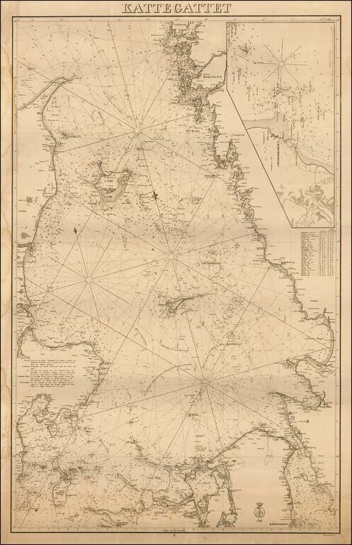
Extremely rare first edition of this separately issued Danish sea chart of Kattegat Sea, published by the Kongelige Danske Sokort Archiv (Royal Danish Nautical Chart Archive). Includes a large inset of the area around the Danish town of...
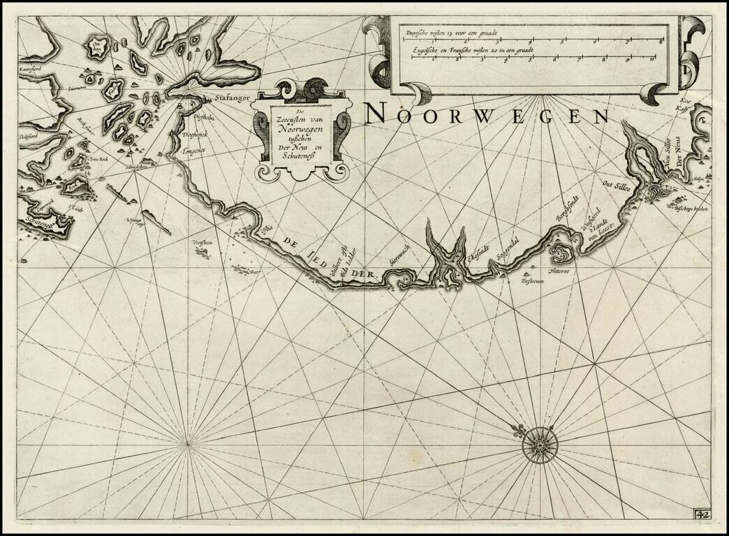
First edition of Blaeu's chart of part of southwestern Norway, from Blaeu's Zeespiegel, Inhoudende Een Karte Onderwijsinghe in de Konst de Zeevaert, en Eene beschrijvinghe der Seekusten van de Oostersche, Noordsche, en Westersche Schipvaert. The map...
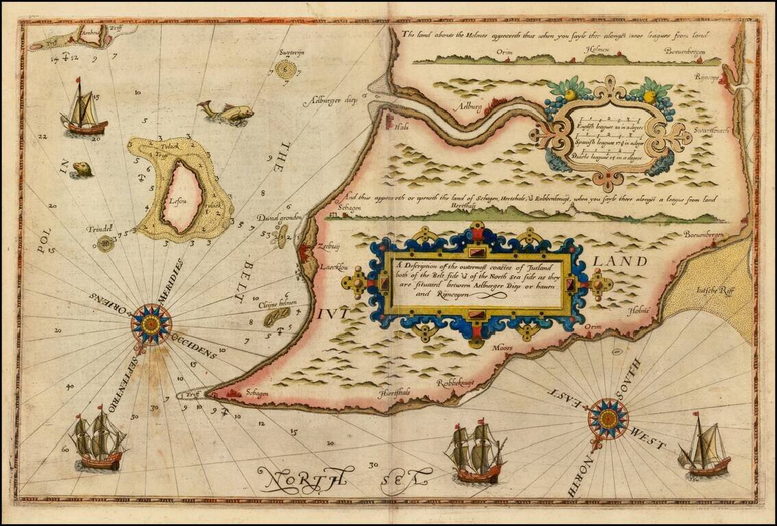
Rare unauthorized English Edition Waghenaer's map of the Jutland Coastline. Oriented with southeast at the top, the map extends from Aalborg and Hals to Skagen at the northern tip of Jutland. The English map is a copy of the first state of...
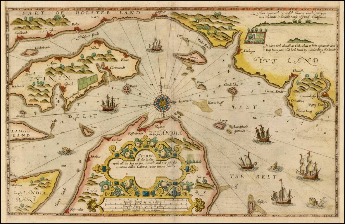
Rare unauthorized English Edition Waghenaer's map of the Danish coastline. The chart is oriented with west at the top and includes the modern cities of Randers, Kalundborg, Korsor, Aarhus, Horsens, Vejle, Kolin, Haderslev, Sonderborg, Nordborg,...
Fine example of this rare sea chart of part of Denmark, published by Blaeu in his Zeespiegel, first published in 1623. The Zeespiegel was the second of Blaeu's sea atlas, following after his Het Licht der Zee-Vaert, which was first issued in 1607. The...
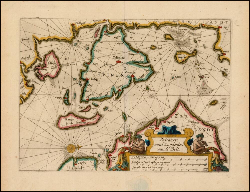
Fine example of this rare sea chart of part of Denmark, published by Blaeu in his Zeespiegel, first published in 1623. The Zeespiegel was the second of Blaeu's sea atlas, following after his Het Licht der Zee-Vaert, which was first issued in 1607. The...
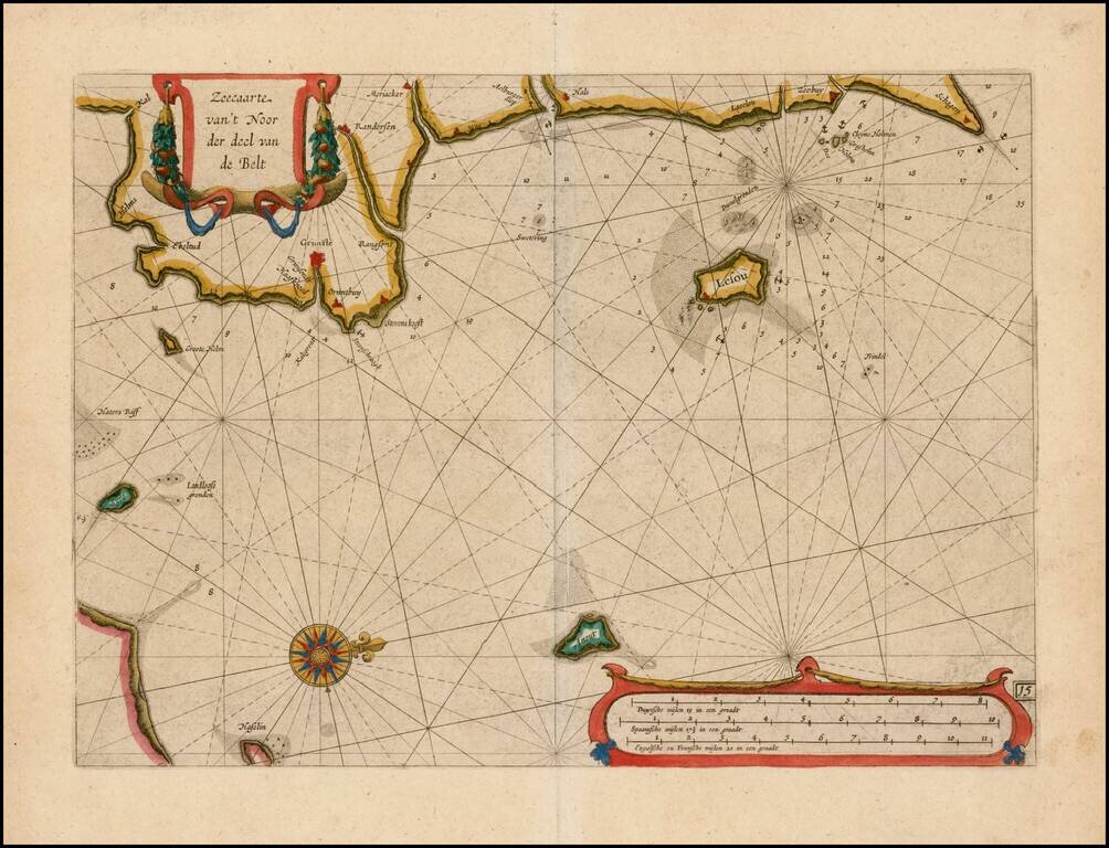
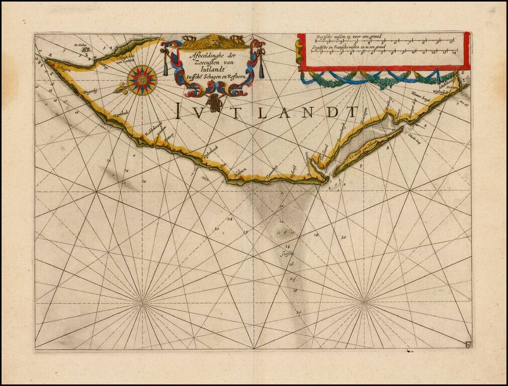
Fine example of this rare sea chart of the east coast of Jutland, published by Blaeu in his Zeespiegel, first published in 1623. The Zeespiegel was the second of Blaeu's sea atlas, following after his Het Licht der Zee-Vaert, which was first issued in...
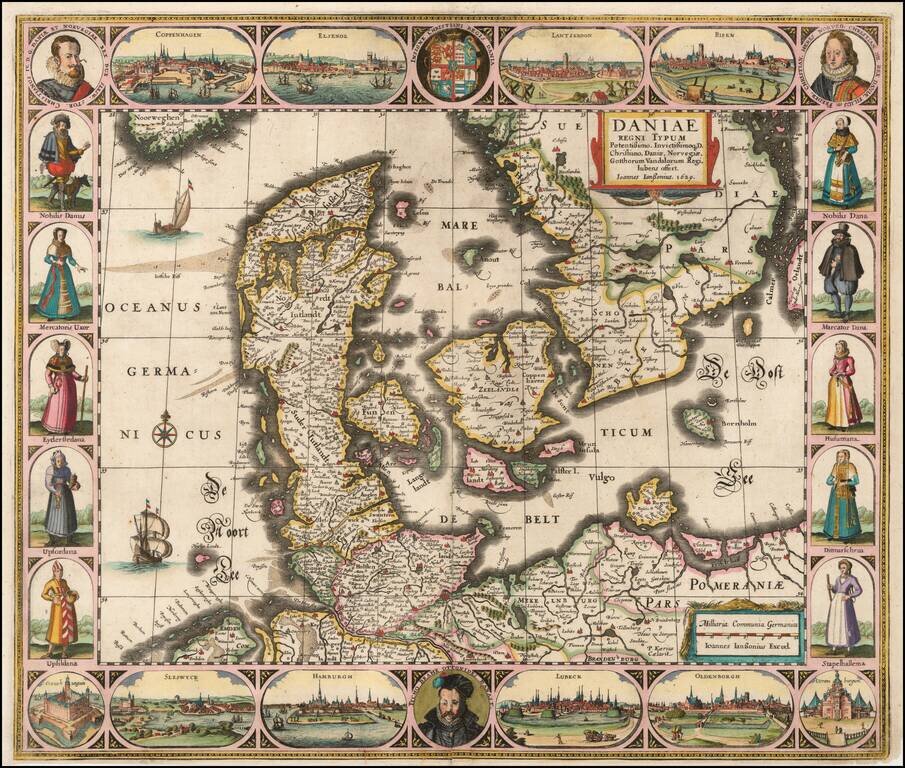
Striking example of the Jansson carte-a-figures map of Denmark, published in Amsterdam. The map includes a portrait of Tycho Brahe bottom center and city views of: Coppenhagen Elsenor Lanskroon Ripen Veraniburgum Oldenborgh Lubeck Hamburg...
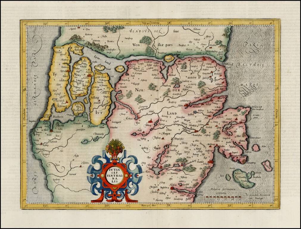
Fine full color example of Mercator's map of the northern part of Jutland, from the first edition of his Atlas Sive Cosmographia.
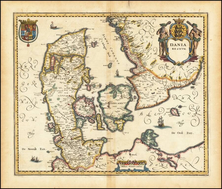
Decorative map of Denmark, from Merian's Neuwe Archontologica Cosmica . . ., published in 1638. Includes 2 decorative coats of arms and title cartouche.