Map size in jpg-format: 3.05745MiB
Click to open in high resolution (open in new tab).
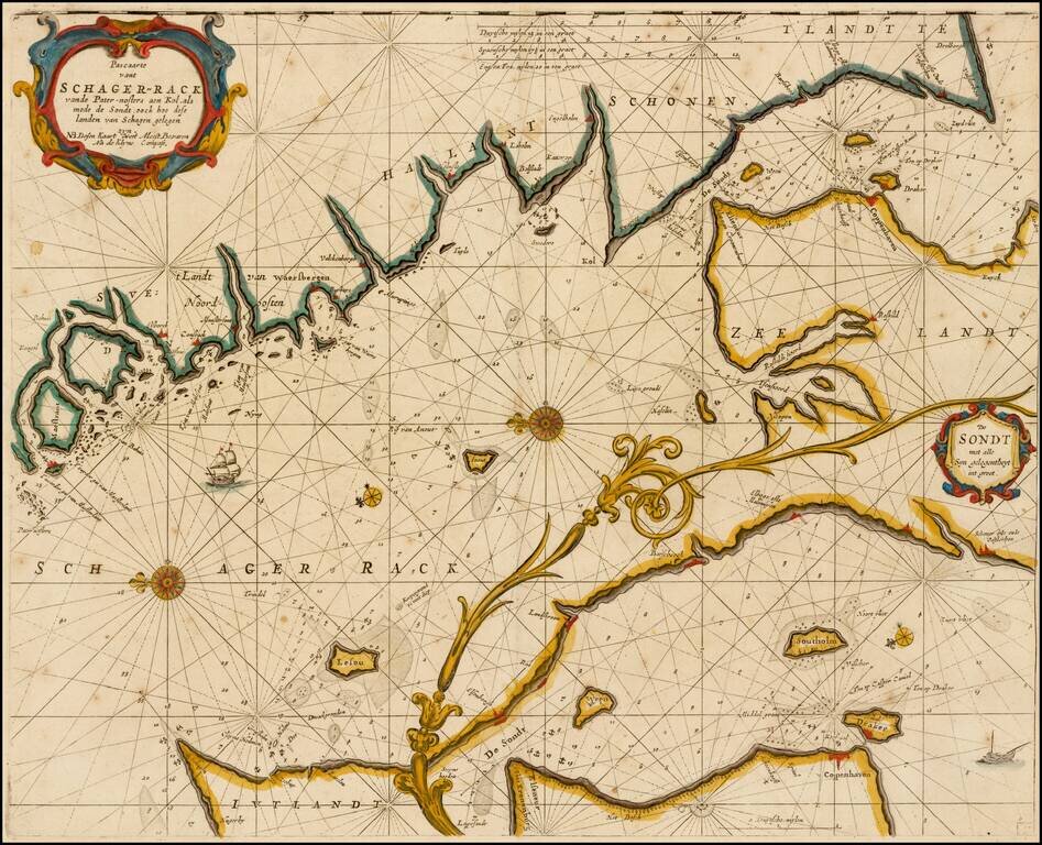
Rare variant of this striking sea chart of the strait between Sweden and Denmark, published by Goos.
This east-oriented sea chart shows the waterway between Sweden and Denmark leading to the Baltic Sea. Skagerrak, Kattegat and Oere-Sund with Copenhagen on the island of Seeland. The Swedish coast line runs from Schonen, Helsingborg, Hallant north to Goteborg. Opposite is Skagen on the tip of Danish Jutland.
Separated by a decorative acanthus, but etched on the same copper plate, is a large inset of Oere-Sund with Copenhagen and on the Swedish side from about Malmoe, via Landscroon to Helsingborg.
The present example includes an extra note at the end of the title, which is not on any other example of the map which we were able to locate.
Pieter Goos (ca. 1616-1675) was a Dutch map and chart maker, whose father Abraham Goos (approx. 1590-1643) had already published numerous globes, land and sea maps together with Jodocus Hondius and Johannes Janssonius in Antwerp.
Pieter Goos gained recognition due to the publication of sea charts. He bought the copperplates of the famous guide book for sailors, De Lichtende Columne ofte Zeespiegel (Amsterdam 1644, 1649, 1650), from Anthonie Jacobsz. Goos published his own editions of this work in various languages, while adding his own maps. In 1666, he published his De Zee-Atlas ofte Water-Weereld, which is considered one of the best sea atlases of its time. Goos' sea charts came to dominate the Dutch market until the 1680s, when the Van Keulen family began to come to prominence.
If you are a student, write to us in telegram: @antiquemaps and indicate what material you need and for what work you need a map in high detail. We are ready to provide material on special terms. For students only!


