logo

1799. A New and Correct Chart of The North Sea Drawn From The Latest Surveys, &c. By John Hamilton Moore.

  • A New and Correct Chart of The North Sea Drawn From The Latest Surveys, &c.  By John Hamilton Moore.

A New and Correct Chart of The North Sea Drawn From The Latest Surveys, &c. By John Hamilton Moore. information:

Year of creation: 
Resolution size (pixels): 
 10202x7551 px
Disk Size: 
 15.4749MiB
Number of pages: 
 1
Place: 
 London
Author: 

Print information. Print size (Width x height in inches):
Printing at 72 dpi 
  141.69 х 104.88
Printing at 150 dpi 
 68.01 х 50.34
Printing at 300 dpi 
 34.01 х 25.17

An example of detailing the file of this map of in a printable high-resolution:

Click to open in high resolution (open in new tab).
Attention! this is just the central piece (central area 960x960 px) of the map file!
This is an example, so that you can see and study the level of detail of a given map. The entire Map will be fully available after payment!

A New and Correct Chart of The North Sea Drawn From The Latest Surveys, &c.  By John Hamilton Moore.

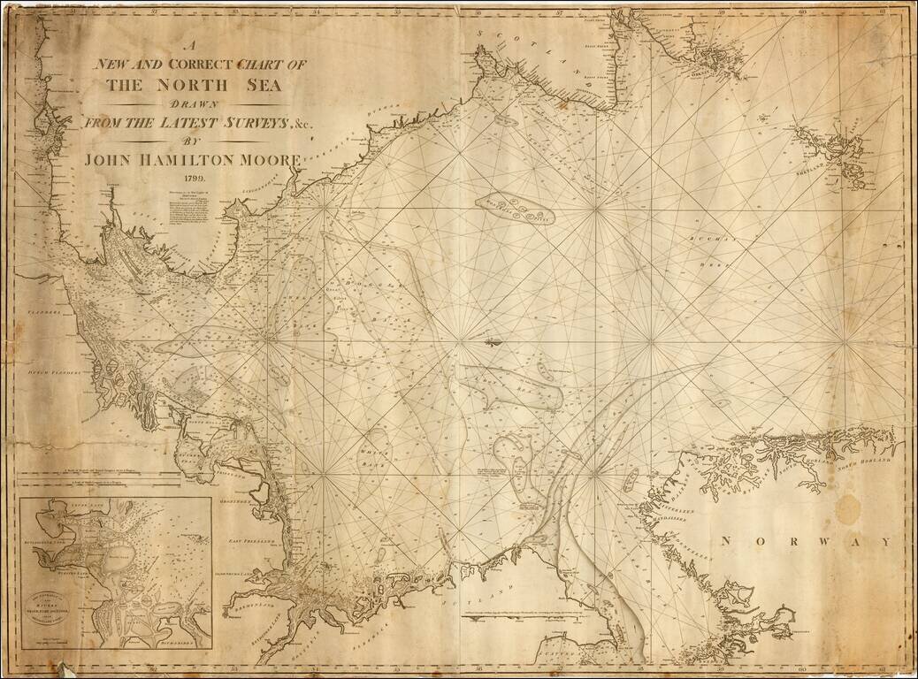
Exceedingly rare early commercial Sea Chart of the North Sea by John Hamilton Moore, published in London.

Moore was one of the earliest blue back chart publishers working in London.

The present chart is apparently the second edition, after an edition of 1795, although we have been able to locate only a single recorded example of the 1795 edition (National Library of Spain) and no examples of the 1799 edition.


Special conditions for students!

If you are a student, write to us in telegram: @antiquemaps and indicate what material you need and for what work you need a map in high detail. We are ready to provide material on special terms. For students only!

Item information:

Year of creation:
Size:
10202x7551 px
Disk:
15.4749MiB
Number of pages:
1
Place:
London
Author:
John Hamilton Moore.
$14.99

Related item