Map size in jpg-format: 34.2003MiB
Click to open in high resolution (open in new tab).
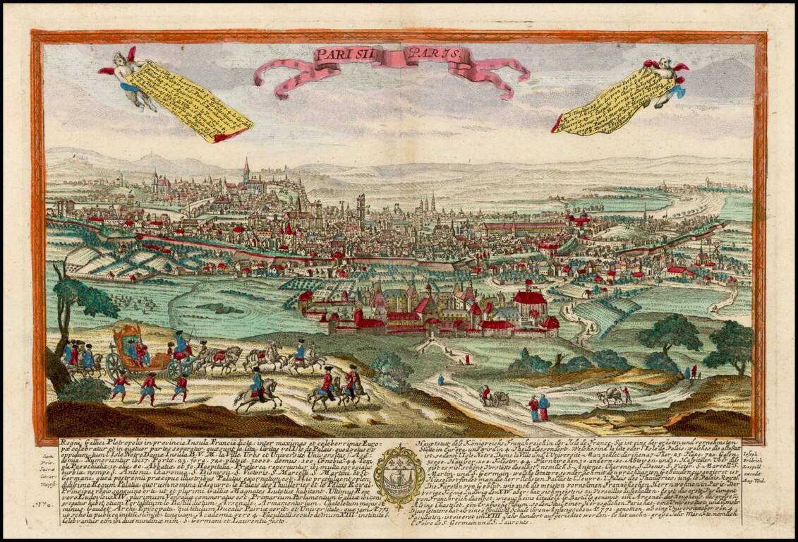
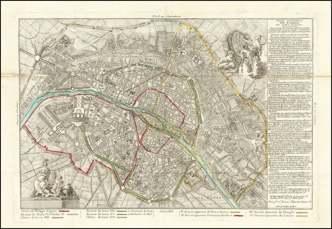
Rare map of Paris, illustrating the expansion of Paris's outer walls over the centuries and its 4 quarters.
Paris is divided into four districts:
The map was published separately and also accompanied Prévost de Saint-Lucien's work Le Provincial à Paris, ou Etat de Paris, published several times between 1787 and 1805.
The plan is based on a plan by Moithey published in 1772, and includes the arms of France and the city of Paris and shows the six successive city walls, watercolors at the time.
If you are a student, write to us in telegram: @antiquemaps and indicate what material you need and for what work you need a map in high detail. We are ready to provide material on special terms. For students only!
![[Charles Lindbergh] Spirit of St. Louis](/map/small/69234.jpg)
![[Charles Lindbergh / New York to Paris View] Spirit of St. Louis](/map/small/69235.jpg)