Map size in jpg-format: 111.035MiB
Click to open in high resolution (open in new tab).
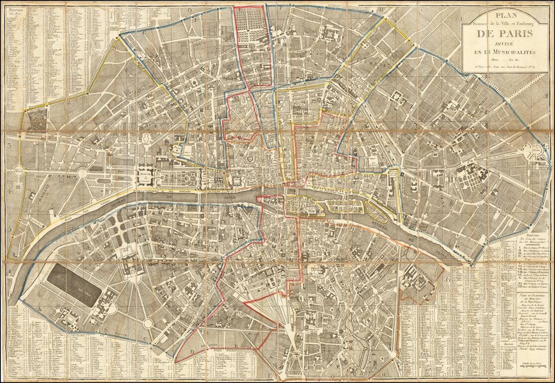
Napoleon's Paris
Fine large plan of Paris, published by Jean.
The map was published 2 years after the reorganization of the city by Napoleon into the 12 municipalities.
During the French Revolution, Paris briefly had a democratically elected mayor and government, the first Paris Commune. This system never really functioned and was suppressed by the French Directory, which eliminated the position of Mayor and divided Paris into twelve separate municipalities, whose leaders were selected by the national government.
A new law in February 1800 modified the system, with Paris becoming a single commune, divided into twelve arrondissements, each with its own mayor chosen by Napoleon and the national government. The real rulers of the city were the Prefect of the Seine, who had his office at the Hôtel de Ville, and the Prefect of Police, whose headquarters was on rue Jerusalem and the quai des Orfèvres on the Île de la Cité. This system, with a brief interruption during the Paris Commune in 1871, remained in effect until 1977.
If you are a student, write to us in telegram: @antiquemaps and indicate what material you need and for what work you need a map in high detail. We are ready to provide material on special terms. For students only!
![[Charles Lindbergh] Spirit of St. Louis](/map/small/69234.jpg)
![[Charles Lindbergh / New York to Paris View] Spirit of St. Louis](/map/small/69235.jpg)