logo

1760. Plan de la Ville et des Faubourgs De Paris Divise en ses Vingt Quartiers . . .

  • Plan de la Ville et des Faubourgs De Paris Divise en ses Vingt Quartiers . . .

Plan de la Ville et des Faubourgs De Paris Divise en ses Vingt Quartiers . . . information:

Year of creation: 
Resolution size (pixels): 
 3031x2014 px
Disk Size: 
 2.71875MiB
Number of pages: 
 1
Place: 
 Paris

Print information. Print size (Width x height in inches):
Printing at 72 dpi 
  42.1 х 27.97
Printing at 150 dpi 
 20.21 х 13.43
Printing at 300 dpi 
 10.1 х 6.71

An example of detailing the file of this map of in a printable high-resolution:

Click to open in high resolution (open in new tab).
Attention! this is just the central piece (central area 960x960 px) of the map file!
This is an example, so that you can see and study the level of detail of a given map. The entire Map will be fully available after payment!

Plan de la Ville et des Faubourgs De Paris Divise en ses Vingt Quartiers . . .

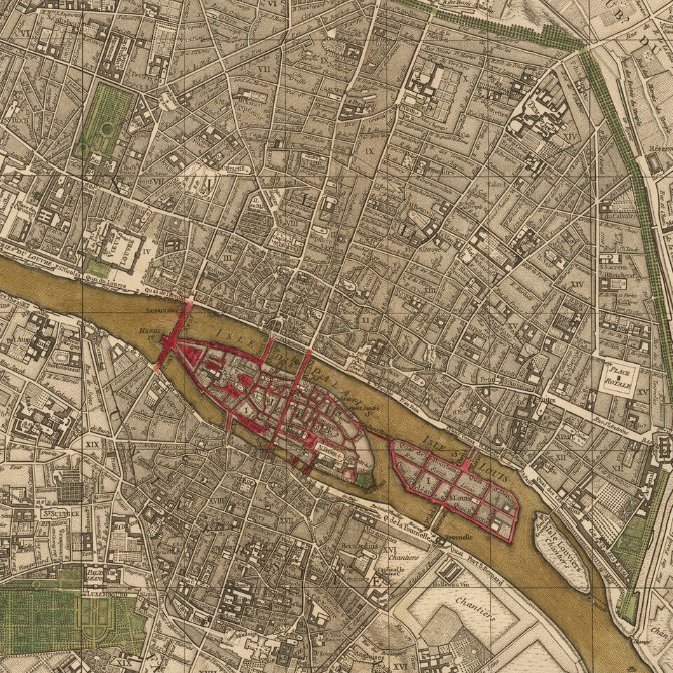
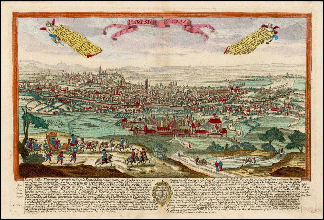
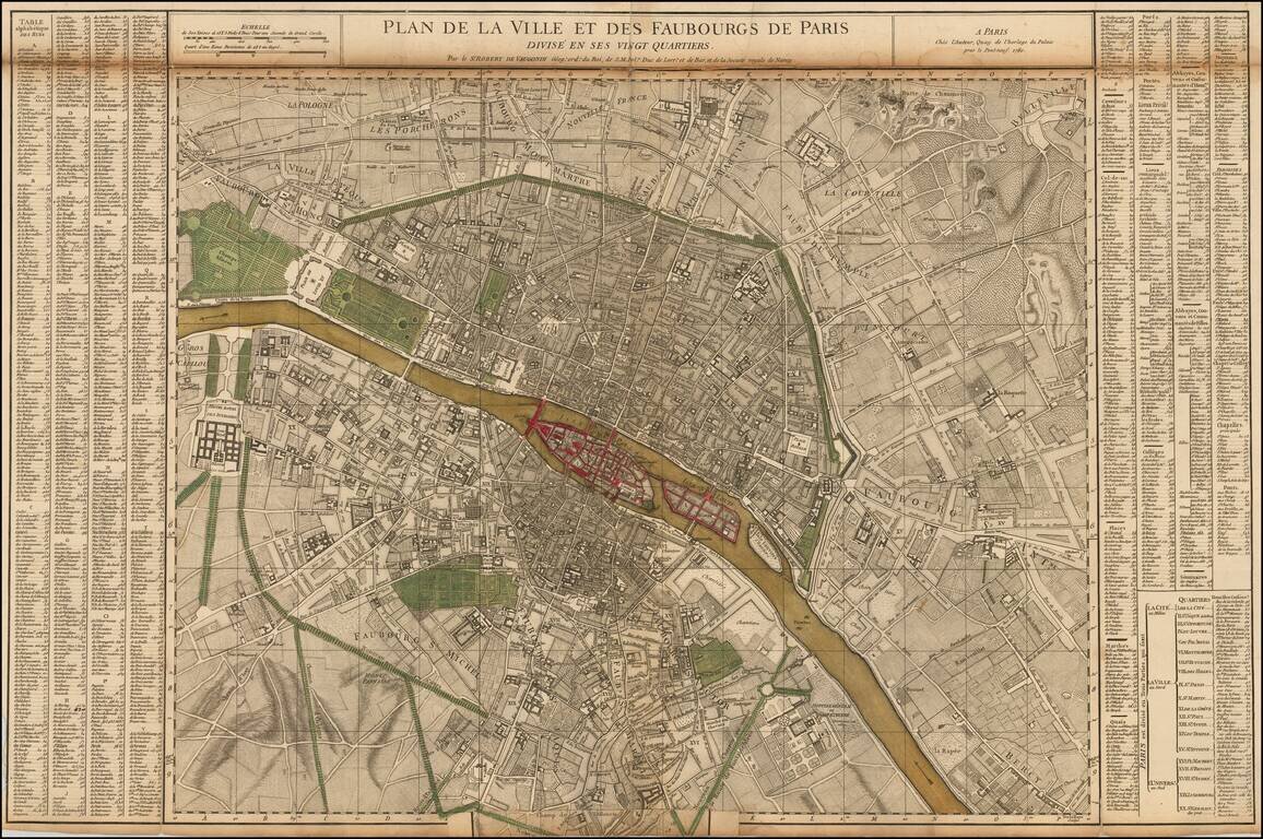
Nice example of the first state of De Vaugondy's 2 sheet map of Paris.

Includes symbols showing the limits of the City at the time of Philippe Auguste, Charles V and Charles VI, and Louis XIII (based upon the map of Gomboust).

Inset at the sides locates hundreds of locations on the map.

Pedley, M.S. 119; Boutier, J. 260.

Special conditions for students!

If you are a student, write to us in telegram: @antiquemaps and indicate what material you need and for what work you need a map in high detail. We are ready to provide material on special terms. For students only!

Item information:

Year of creation:
Size:
3031x2014 px
Disk:
2.71875MiB
Number of pages:
1
Place:
Paris
Author:
Gilles Robert de Vaugondy.
$14.99

Related item