Map size in jpg-format: 4.56769MiB
Click to open in high resolution (open in new tab).
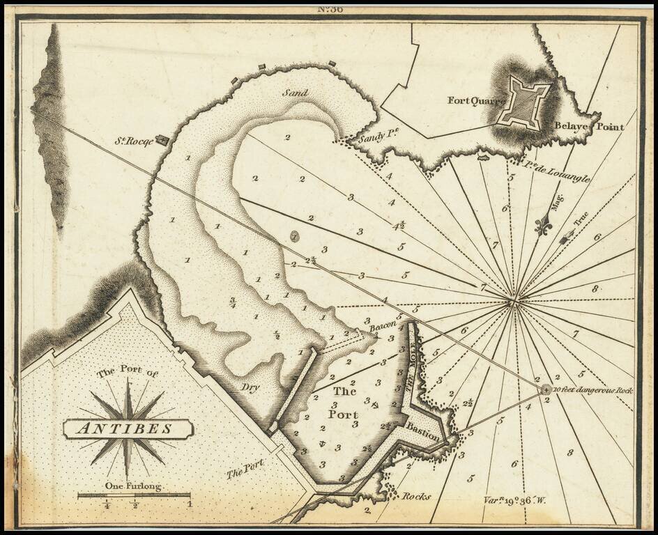
Very scarce miniature engraved chart of the port of Antibes, in the south of France.
This is possibly the first English printed chart of the famous port of Antibes, now sometimes known as Port Vauban, one of the great private yacht in the south of France.
The chart is very focused on the port proper, with details of the surrounding fortifications (which would have been particularly relevant to British sailors during the Napoleonic Wars, when the map was published.)
Specific maps of Antibes are extremely rare.
Heather's The New Mediterranean Pilot
This small chart comes from the first English attempt at a collection of ports of the Mediterranean, although the genre was well established in France, Italy, and Spain already. The first was published by Joseph Roux in Marseilles in 1764, with versions published in several Italian port cities.
The French and Italian versions were of relatively crude execution, but Heather’s version is notable for the finely engraved charts, many signed in monogram by the London engraver John Stephenson.
If you are a student, write to us in telegram: @antiquemaps and indicate what material you need and for what work you need a map in high detail. We are ready to provide material on special terms. For students only!
![Carte d'Etude [Study Map]](/map/small/66795.jpg)
![Orange [Vauban Style Fortress]](/map/small/62043.jpg)
