Map size in jpg-format: 270.283MiB
Click to open in high resolution (open in new tab).
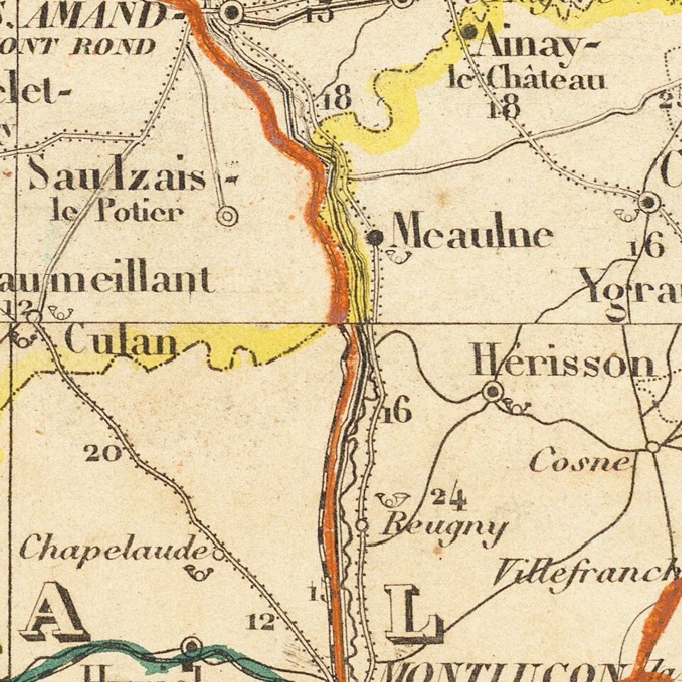
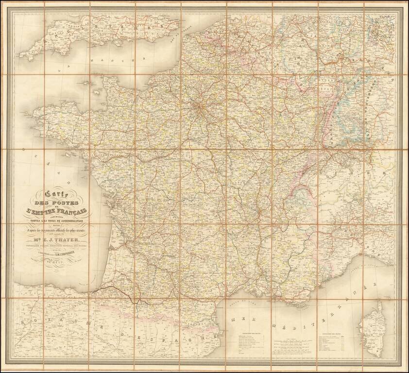
Detailed railroad and postal map of France from the 1860s.
The map differentiates between operating railroads and those that are in construction or had been granted concessions.
The map illustrates the State, Department, and Arrondissement. Special Customs Zones are marked in green.
If you are a student, write to us in telegram: @antiquemaps and indicate what material you need and for what work you need a map in high detail. We are ready to provide material on special terms. For students only!
![Carte d'Etude [Study Map]](/map/small/66795.jpg)
![Orange [Vauban Style Fortress]](/map/small/62043.jpg)
