logo

1843. Carte Pittoresque Des Environs de Paris de ses Fortifications et forts detaches . . . 1864

  • Carte Pittoresque Des Environs de Paris de ses Fortifications et forts detaches . . . 1864

Carte Pittoresque Des Environs de Paris de ses Fortifications et forts detaches . . . 1864 information:

Year of creation: 
Resolution size (pixels): 
 3395x2014 px
Disk Size: 
 2.28289MiB
Number of pages: 
 1
Place: 
 Paris
Author: 

Print information. Print size (Width x height in inches):
Printing at 72 dpi 
  47.15 х 27.97
Printing at 150 dpi 
 22.63 х 13.43
Printing at 300 dpi 
 11.32 х 6.71

An example of detailing the file of this map of in a printable high-resolution:

Click to open in high resolution (open in new tab).
Attention! this is just the central piece (central area 960x960 px) of the map file!
This is an example, so that you can see and study the level of detail of a given map. The entire Map will be fully available after payment!

Carte Pittoresque Des Environs de Paris de ses Fortifications et forts detaches . . . 1864

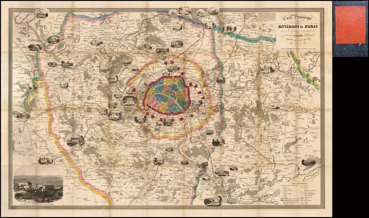
Fine decorative map of Paris and environs, embellished with a number of vignettes showing important landmarks around the City and beyond.

Includes a key at the bottom, identifying hundreds of streets and second table locating important places within the City.

A large decorative map of mid-19th Century Paris and environs.


Special conditions for students!

If you are a student, write to us in telegram: @antiquemaps and indicate what material you need and for what work you need a map in high detail. We are ready to provide material on special terms. For students only!

Item information:

Year of creation:
Size:
3395x2014 px
Disk:
2.28289MiB
Number of pages:
1
Place:
Paris
Author:
Alexandre Vuillemin.
$14.99

Related item