Map size in jpg-format: 3.93658MiB
Click to open in high resolution (open in new tab).
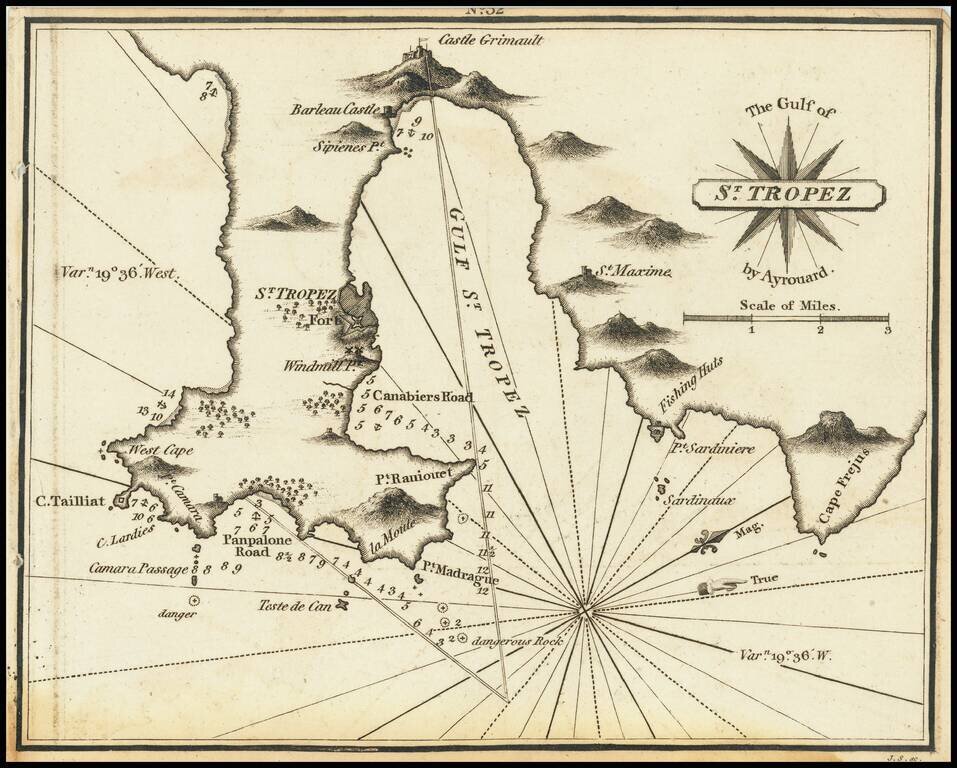
Rare miniature chart of St. Tropez, France, published by William Heather in London.
The chart is oriented with west at the top. It includes good detail of the region of St. Tropez, illustrating how much has changed over the more than 200 years since the map was made. On the slopes of St. Maxime, across the Golfe de Saint-Tropez from St. Tropez, Heather's map shows "Fishing Huts" where now there are hundreds of beautiful coastal villas.
The chart appeared in Heather's The New Mediterranean Pilot . . . , published in London in 1802.
Rarity
The charts from Heather's New Mediterranean Pilot . . . are extremely rare on the market. This is the first example of the chart we have ever seen.
This is also one of the few antiquarian maps specifically of St. Tropez that one is likely to ever see.
Heather's The New Mediterranean Pilot
This small chart comes from the first English attempt at a collection of ports of the Mediterranean, although the genre was well established in France, Italy, and Spain already. The first was published by Joseph Roux in Marseilles in 1764, with versions published in several Italian port cities.
The French and Italian versions were of relatively crude execution, but Heather’s version is notable for the finely engraved charts, many signed in monogram by the London engraver John Stephenson.
If you are a student, write to us in telegram: @antiquemaps and indicate what material you need and for what work you need a map in high detail. We are ready to provide material on special terms. For students only!
![Carte d'Etude [Study Map]](/map/small/66795.jpg)
![Orange [Vauban Style Fortress]](/map/small/62043.jpg)
