Map size in jpg-format: 621.283MiB
Click to open in high resolution (open in new tab).
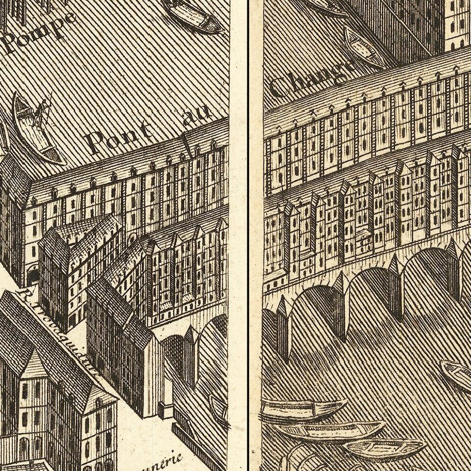
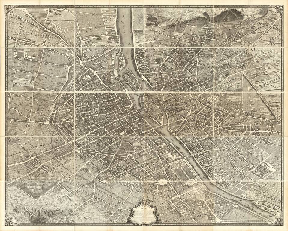
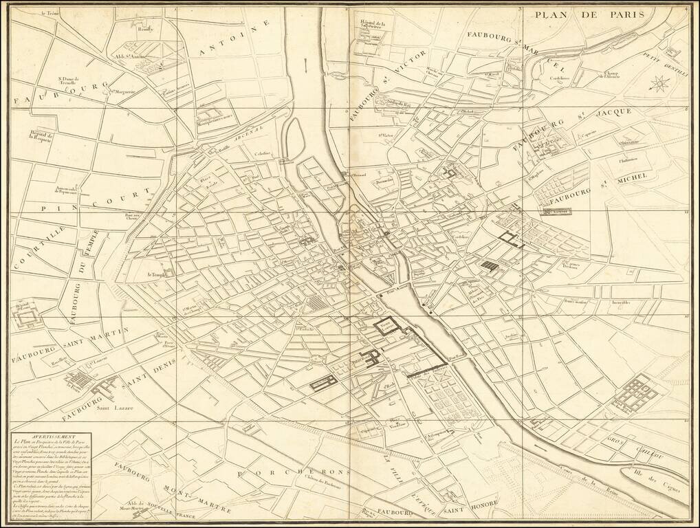
Turgot's Monumental View of Paris, Stretching to Over 10 Feet When Joined. This expansive engraved view of Paris covers the first eleven arrondissements of modern Paris. With a combined width of over ten feet, the joined plan makes for an arresting centerpiece. Turgot's is perhaps the best record of Paris in the 18th century, before its transformation by Georges-Eugène Haussmann and Emperor Napoleon III. It is widely regarded as one of the most important city views of all time.
The Mayor of Paris, Michel-Étienne Turgot, commissioned Louis Bretez, a member of the Académie de Saint-Luc to create an impressive image of the city. He was given license to survey wherever he needed and could enter private property if the task required. The end result was to be a statement piece, one which was presented to dignitaries, foreign and domestic alike, to reinforce their esteem of Paris.
Historians suspect that Bretez was awarded the commission in part because of the work he had already done on architectural perspective, some of which was published in his 1706 book La perspective pratique de l'architecture . Claude Lucas was Bretez's engraver.
If you are a student, write to us in telegram: @antiquemaps and indicate what material you need and for what work you need a map in high detail. We are ready to provide material on special terms. For students only!
![Carte d'Etude [Study Map]](/map/small/66795.jpg)
![Orange [Vauban Style Fortress]](/map/small/62043.jpg)
