logo

1720. Plan De La Ville de Douay et du Fort D'Escape . . .

  • Plan De La Ville de Douay et du Fort D'Escape . . .

Plan De La Ville de Douay et du Fort D'Escape . . . information:

Year of creation: 
Resolution size (pixels): 
 13556x12398 px
Disk Size: 
 53.8185MiB
Number of pages: 
 1
Place: 
 Amsterdam
Author: 

Print information. Print size (Width x height in inches):
Printing at 72 dpi 
  188.28 х 172.19
Printing at 150 dpi 
 90.37 х 82.65
Printing at 300 dpi 
 45.19 х 41.33

An example of detailing the file of this map of in a printable high-resolution:

Click to open in high resolution (open in new tab).
Attention! this is just the central piece (central area 960x960 px) of the map file!
This is an example, so that you can see and study the level of detail of a given map. The entire Map will be fully available after payment!

Plan De La Ville de Douay et du Fort D'Escape . . .

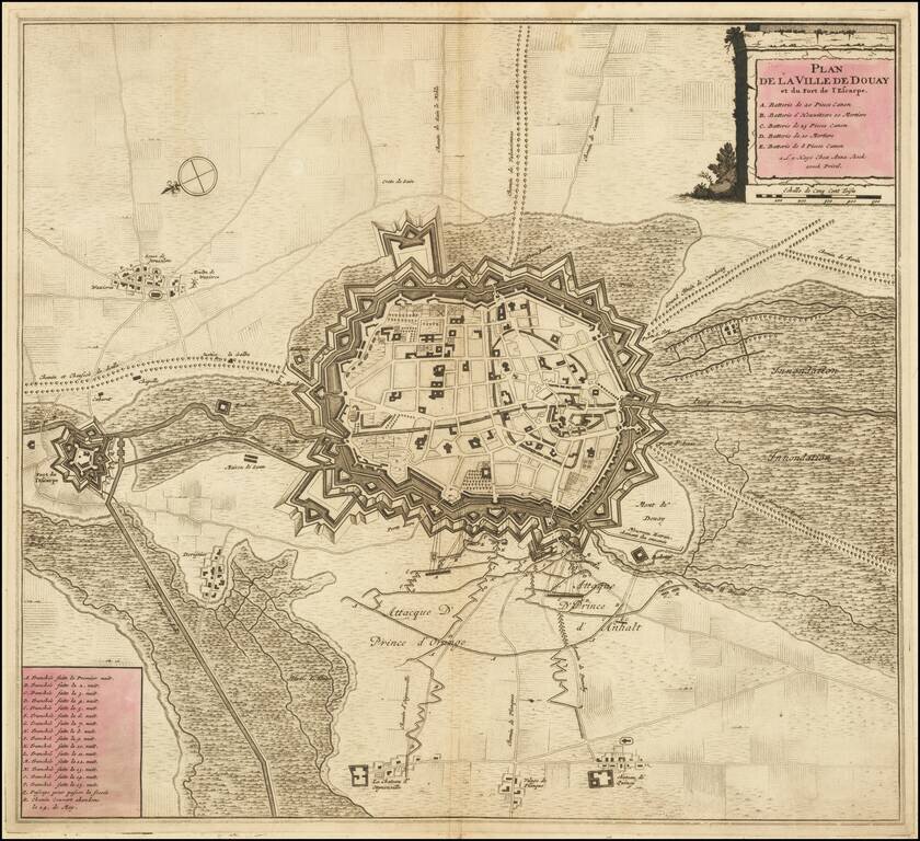
Striking example of Anna Beek's plan of Douay and the neighboring Fort D'Escape.

The map focuses on the town fortifications and also includes details of the town plan, and neighboring fields and details.


Special conditions for students!

If you are a student, write to us in telegram: @antiquemaps and indicate what material you need and for what work you need a map in high detail. We are ready to provide material on special terms. For students only!

Item information:

Year of creation:
Size:
13556x12398 px
Disk:
53.8185MiB
Number of pages:
1
Place:
Amsterdam
Author:
Anna Beek.
$14.99

Related item