
![[Signed Political Satire Artwork] Vietnam ... Vietnam ... Vietnam ...](/map/small/68726.jpg)
Signed Artwork By Famed Political Cartoonist Bob Gorrell Original cartoon artwork on paper by world renowned political cartoonist Bob Gorrell. Original cartoon was drawn for the Richmond News Leader in 1983, showing Uncle Sam being shown various...

One of the Earliest Modern Maps of Russia Striking map of Russia, based upon Anthony Jenkinson's rare map of Russia drawn in 1562. The map covers the region from the Gulf of Finland, Lithuania and the Black Sea to the Sur River, Tashkent, the...

Striking map of the German Empire, including the Low Countries, Switzerland, Austria, and part of the Balkans prepared by Johan Baptiste Vrients for the very late editions of Ortelius' Theatrum Orbis Terrarum, the first modern atlas of the world. The...


Decorative map of the Black Sea Region, with a large decorative cartouche surmounted by the Russian Imperial Coat of Arms. The map extends north to Moscow and Smolensk from Constantinople in the south.

This is a scarce map encompassing Poland and parts of the grater Baltic Region, Russian, and Ukraine. The map extends from the Gulf of Riga to the Black Sea at the mouth of the Dniepr. The map includes an attractive cartouche. This is only the second...

Scarce 18th-century American map of Scandinavia, from Mathew Carey's General Atlas. Engraved by Samuel Hill in Boston.
![Europe No. 16. Partie De La Russie D'Europe [Tambow, Woroniege, Saratow and Territoire De La Milice De Don, etc.]](/map/small/19823.jpg)
Regional map of part of Russia and the Ukraine. Shows towns, roads, rivers, mountains, and a host of other details. From Vandermaelen's remarkable 6 volume atlas, which if combined as globe gores forms an immense globe.


![[Hand Drawn Prussian Military Encampment at Opole, Poland] Special Grund-Riss Des Kaeyserl Feldl Lagers bey Oppeln in Ober Schlesien](/map/small/59726.jpg)
Rare Manuscript Plan of a Prussian Military Encampment Mid-eighteenth-century plan of a Prussian military camp located near Opole, made at a time when the Prussian army was one of the strongest in the world. This document is a rare survival and...
![Сны Султана (Картина 2) [Dreams of the Sultan. Scene 2]](/map/small/60238.jpg)
Russia Imagines the Ottoman Response to Crimean War Reversals. A fascinating ephemeral lithograph, this was apparently one of three "scenes" prepared during the Crimean War, and said to represent the Ottoman ruler's response to defeats during the...
![Повстанцы 1863 Года [(Polish) Insurgents of 1863]](/map/small/52719.jpg)
Three Vilnius-Published Prints of the January Uprising -- Polish National Uprising in 1863. A highly unusual, early Lubki (popular graphic) series, locally-published in Vilnius, Lithuania and depicting a contemporary nationalist revolt by the...
![[Soviet Russian Ecology Propaganda Poster] Основы Водного Законодательства Союза ССР](/map/small/68343.jpg)
Original vintage Soviet Russian propaganda poster. The title translates as follows: The blue expanse is dear to us everywhere and it is not without reason that we are talking about it. - It's time to protect the wealth of our rivers and lakes in...
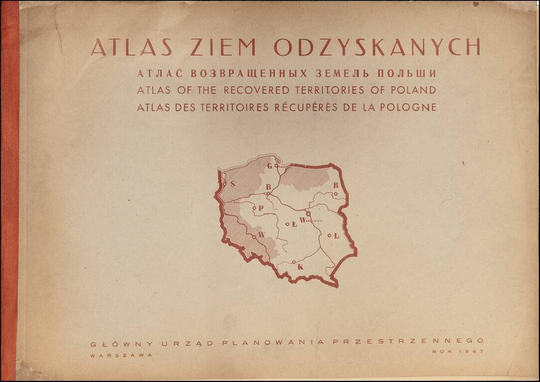
Rare Atlas of the Regions Recovered by Poland After World War II A rare and graphically sophisticated atlas that provides a multi-dimensional picture of the regions of Poland--then called the Recovered Territories--which were ceded back to Poland at...

Willem Barentsz's Map of the Polar Regions, drawn from his observations during his third voyage of 1596-97 and engraved by Baptiste Van Deutecum. The Barentsz map of the polar regions is a major landmark in Arctic cartography, depicting the details...