
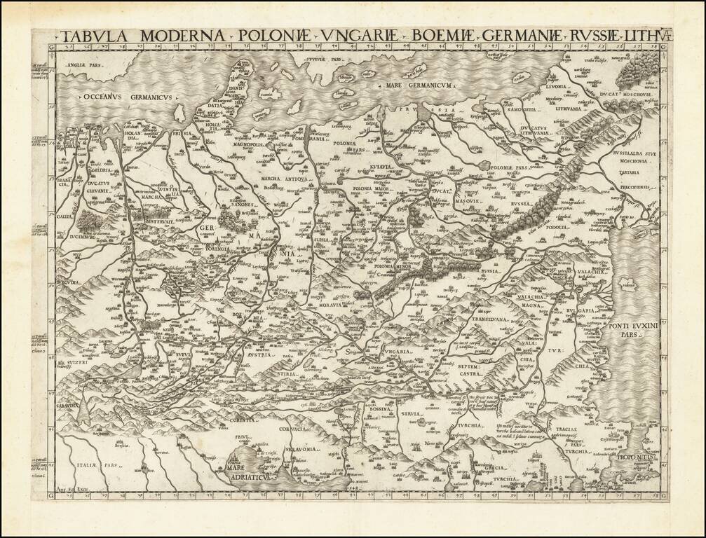
First State of one of the Earliest Modern Maps of Central and Eastern Europe A fine example of this rare and important map of Central and Eastern Europe, published by Antonio Salamanca in Rome. The map is derived from the iconic manuscript map of...
![Pomeraniae, Wandalicae Regionis Typ [with] Livoniae Nova Descriptio [with] Ducatus Oswieczensis, et Zatoriensis, Descriptio](/map/small/43172.jpg)
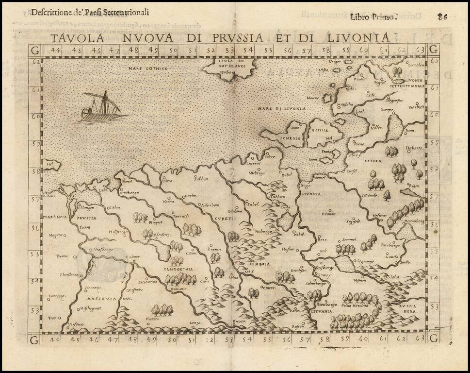
Finely colored example of Ortelius' maps of Pomerania, Latvia and part of Southern Poland above the Carpathian Mountains, from Ortelius Theatrum Orbis Terrarum.
![Thietmarsiae, Holsaticae Regionis Partis Typus Auctore Petro Boeckel [with] Prussia Descriptio ante aliquot annos ab Henrico Zellio ab coque D. Ioanni Clur. civi Gedanesi Ded:](/map/small/45904.jpg)
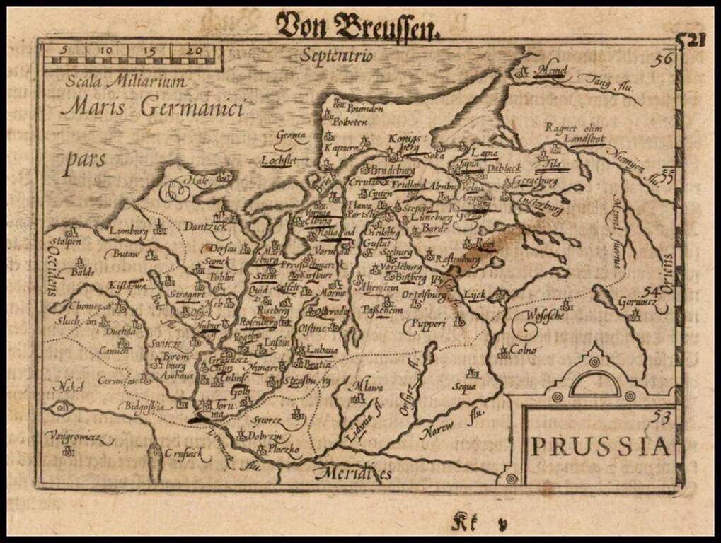
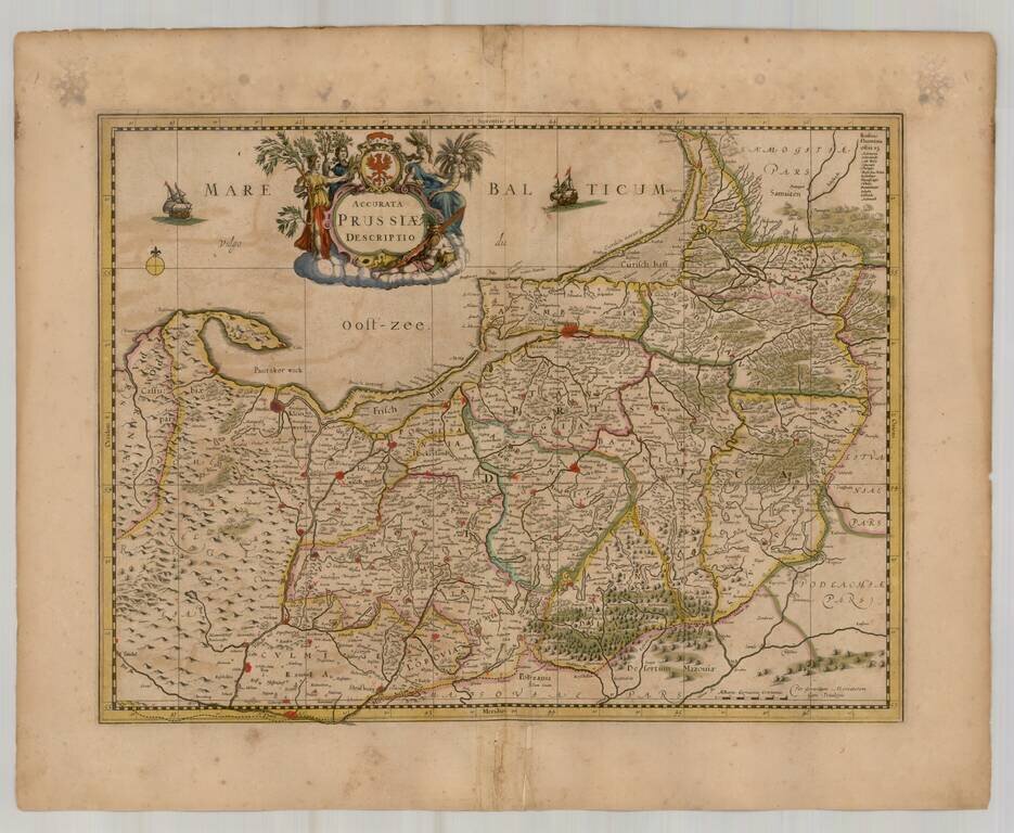
Ortelius’ Maps of Prussia and Holstein, from the First Modern Atlas Fine maps of Prussia and Holstein, printed on the same plate, that featured in Ortelius’ famous and groundbreaking atlas Theatrum Orbis Terrarum. The map on the right shows...
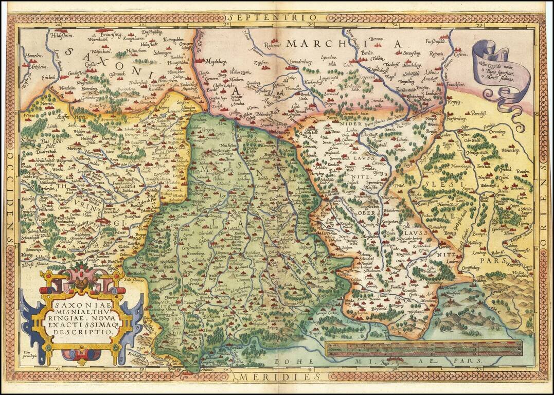
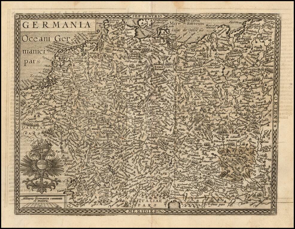
Nice example of Ortelius' regional map of Germany, extending from Prague to Berlin and Brandenberg, and from Mulhausen and Erpach to Goltberg, Sagan, Furstenberg, Leipzig and Frankfurt am Oder. Wide margins and nice old color. From the 1581 French...
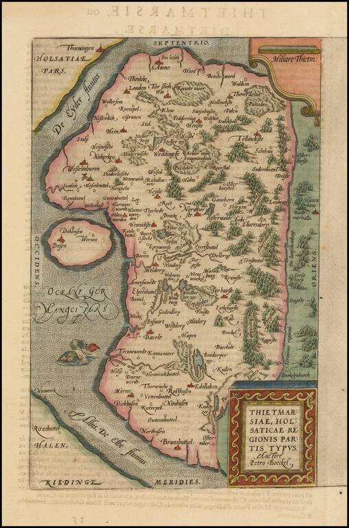
A nice full color example of Ortelius's regional map of the region known as Dietmarschen in Schleswig Holstein, at the mouths of the Elbe and Eider rivers, including Brunsbuttel and Meldorf. This map appeared in Abraham Ortelius's Theatrum Orbis...
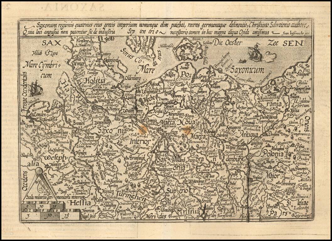
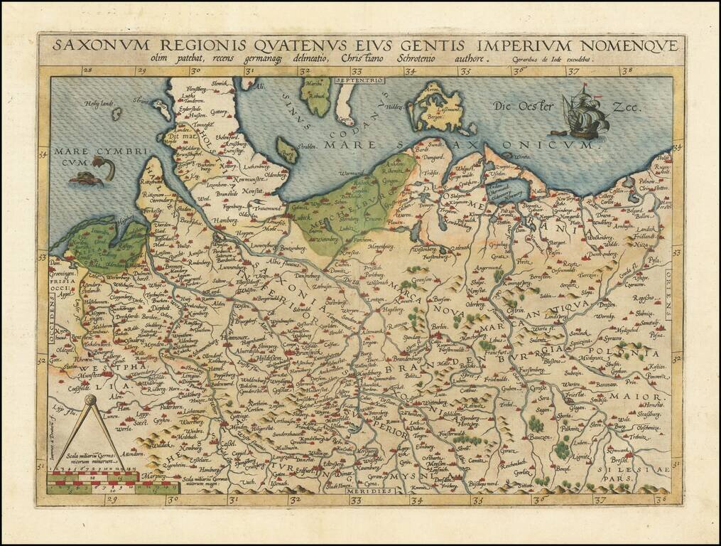
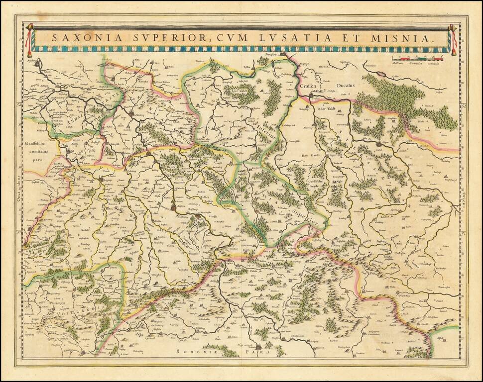
Detailed map of the north part of Germany from Westfalia to Poland. The map is centered on Saxonia Superior. Evidence of an old plate break. The present map was produced by two of the primary Cologne School mapmakers, Johann Bussemacher and...

Detailed map of the north part of Germany, incluiding Brandenburg and Pomerania. Includes a portrait of Johan Georg of Brandenburg (1525 – 1598) Prince-elector of the Margraviate of Brandenburg (1571–1598) and a Duke of Prussia. The present map...
Nice example of this scarce map of the Holy Roman Empire, published in Cologne. The present map was produced by two of the primary Cologne School mapmakers, Johann Bussemacher and Matthias Quad. The Cologne School of cartography, was perhaps the only...
Fine old color example of Gerard de Jode's map of Northern Germany and Western Poland. The North Sea is adorned by a fish and the Baltic Sea by a sailing ship, and the borders of Schleswig-Posen-Dresden-Groningen are featured. The map is based on...
![Turingiae Noviss Descript. Per Iohannem Mellinger Halens [with] Misniae et Lustaiae Tabula Descripta a. M Bartholomeao Sculteto Gorlit.](/map/small/61448.jpg)
Nice old color example of Ortelius' regional maps of Germany. The first map shows the regions of the Sala, Hel and Werra Rivers, from Hall, Merburg and Naumburg to Cruetzberg and Saltzungen, centered on Erfundt. The second shows the region centered...
Nice example of the scarce third state Ruscelli's map of Poland, Lithuania and the Baltic Region. The map is bounded by the Vistula River and Prussia in the west, Livonia in the east, and Lithuania in the southeast. Centered on Riga and Vilna....
Nice example of this early state of Barent Langenes's map of Prussia, which first appeared in the 1598 edition of Langenes's Caert-Thresoor, published in Middelburg. The present map is one of the earliest obtainable maps to focus on Prussia....
Scarce map of Prussia, published by Gerard Mercator in Amsterdam. Covers most of the North of Poland and parts of Kalingrad and Southern Lithuania.
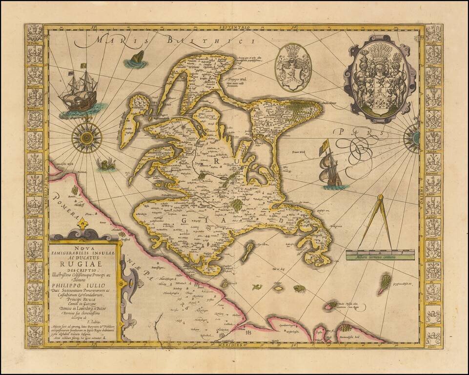
Striking hand-colored example of this decorative map, including two compass roses, sailing ships, sea monsters and massive coat of arms, plus the smaller coat of arms along both side borders, filled with the coats of arms of the island's leading...
Detailed map of the region of northeastern Germany and Western Poland, showing rivers, towns, woods, mountains, ports, etc. Dresden, Leipzig, Wittenberg, Torgaw, Hall, Glogaw, Crossen, and Meissen shown. Decorative banner cartouche.
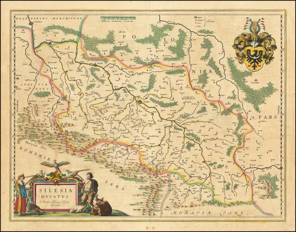
Nice example of Blaeu's map of Silesia, centered on Breslau. The map extends to Cracow in the southeast, and includes Racibórz, Glogaw, and Krosno. Follows the course of the Oder. Two cartouches and coat of arms.