
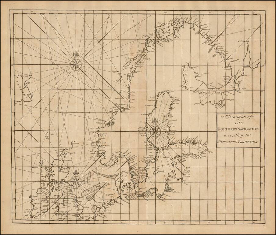
Fine Chart of the Far North Atlantic from an Influential Atlas Scarce sea chart of the north Atlantic covering the British Isles, North Sea, Scandinavia, Iceland (here "Iseland"), the German coast, and the Baltic. This chart is on a Mercator...
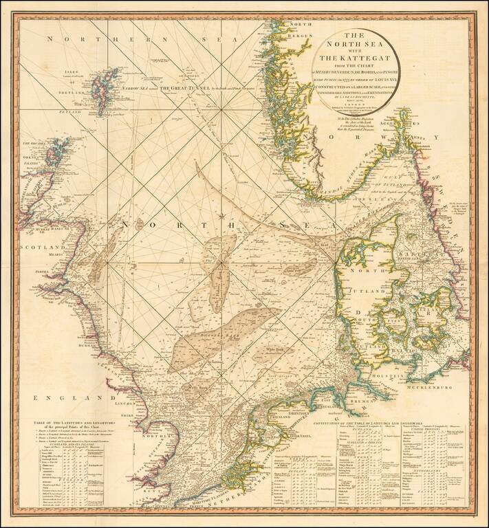
Striking and highly detailed sea chart of the North Sea from the Straits of Dover to the Shetlands and North Bergen in Norway, and east through the Kattegat to Copenhagen. Highly detailed sea chart, with extensive tables and annotations. Shows...
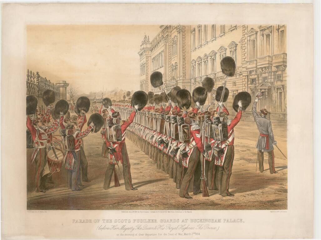
Decorative view of the parade of the Scots Fusileer Guards, prior to their departure for the Crimean War. First established in 1805, the Scots Fusileer Guards were deployed in the Napoleonic Wars and later in the Crimean War. In 1854, the Crimean War...
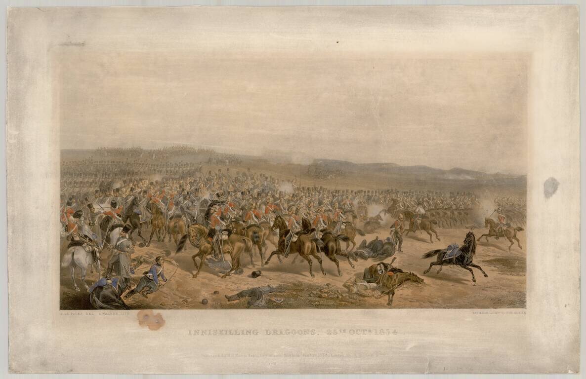
View showing the Inniskilling Dragoons during the Battle of Balaclava. The 6th (Inniskilling) Dragoons was a cavalry regiment in the British Army, first raised in 1689. It saw service for three centuries, before being amalgamated into the 5th/6th...
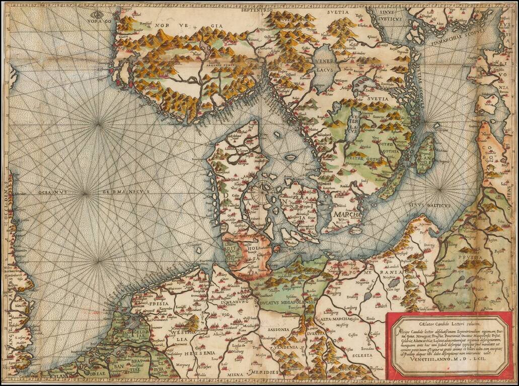
"Beyond all comparison the best map of the Southern Baltic and the North Sea." (A.E. Nordenskold) Extraordinary old color example of this rare Lafreri School Map of Scandinavia, the Baltic and contiguous parts of Poland, Germany, the Low Countries...
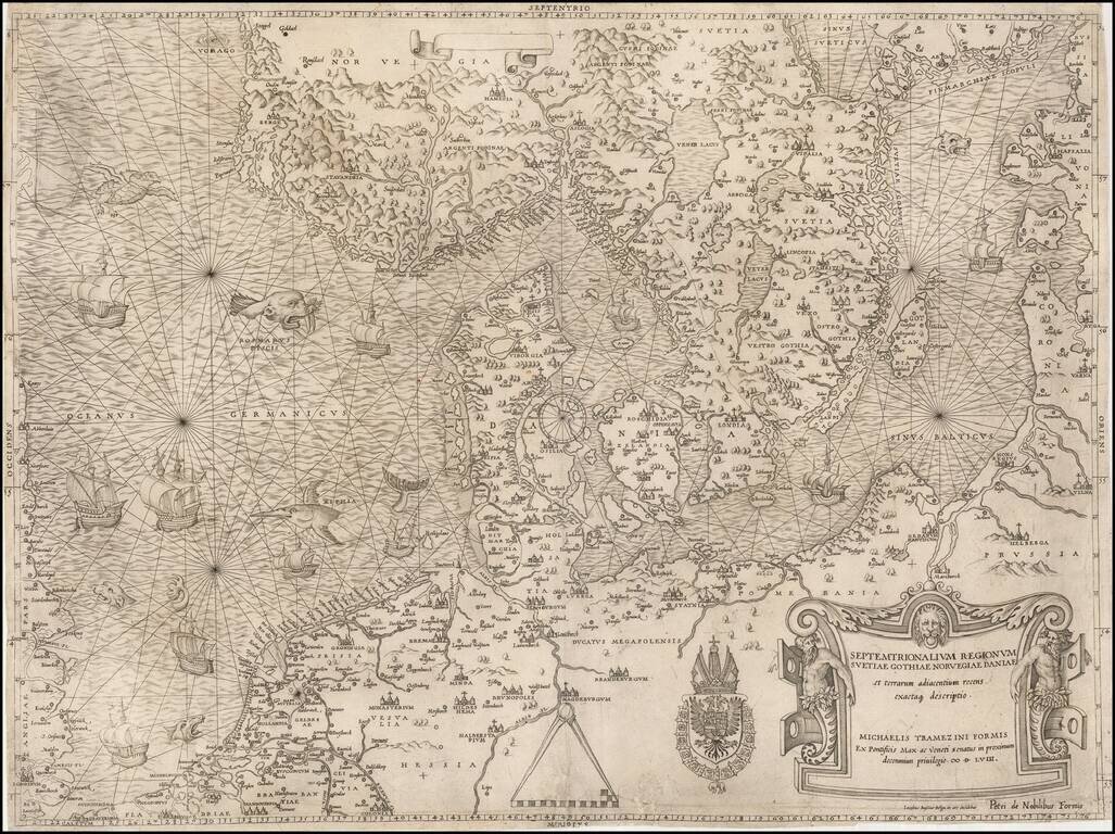
The most important modern map of Scandinavia and the Baltic Regions published in the mid-16th century. Rare and highly important early map of Scandinavia, the Baltic Sea and the North Sea by Michael Tramezini, based upon Cornelis Anthoniszoon's lost...
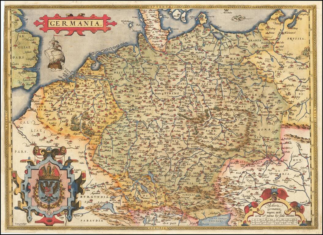
Fine old example of Ortelius' map of the German Empire, from his Theatrum Orbis Terrarum, the first modern atlas of the world. The map extends from The English Channel to the Baltic, the Vistula and Poland in the northeast, Budapest, Venice and the...
Rare map of the Holy Roman Empire, published in Paris by Jean Le Clerc. Le Clerc's map is based upon Willem Janszoon Blaeu's map of the same title, first issued in 1606, which includes town views across the top.
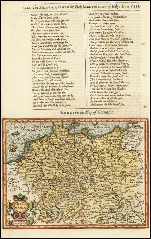
Decorative map of the German Empire, from the Low Countries to Prussia, Poland, Hungary, Austria and Switzerland. Decorative cartouche, sailing ship and coat of arms. From the 1625-26 edition of Purchas His Pilgrims, one of the seminal early 17th...
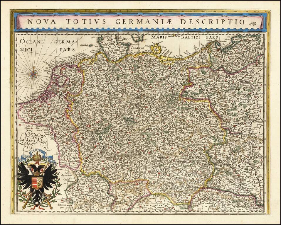
No Text on Verso! Rare edition of Blaeu's map of the German Empire, lacking text on the verso. The map includes the Netherlands, Germany, Switzerland, Austria, Bohemia, Moravia and Poland. This map is scarce, more so without text on the verso.
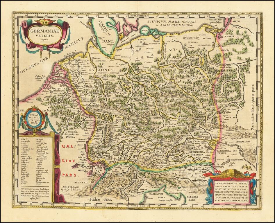
A Plethora of Anicent Place Names Striking example Blaeu's map of the Ancient German Empire in Northern Europe, based upon an earlier map by Ortelius. Extends from the Adriatic (Hadriatici Sinus) to the Baltic (Suevicum Mare) and the Vistula and...
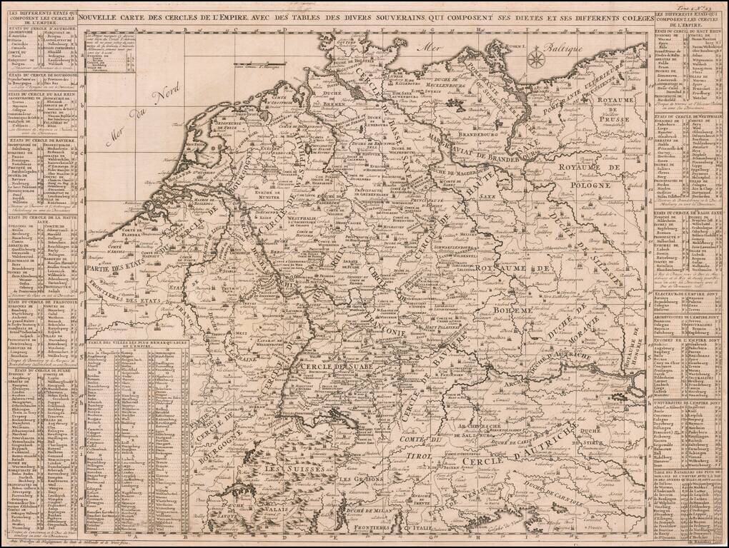
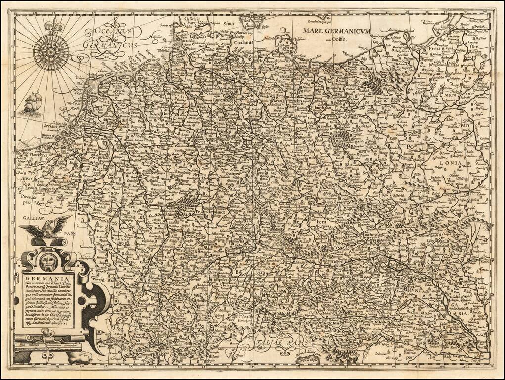
A very detailed map of the German Empire with a list of it's important cities and nobility in tables at the sides. This handsome copper engraved map includes today's Poland, Germany, Switzerland, Austria, Holland, Belgium and Luxembourg.

Decorative example of this fine map of Northern Italy and contiguous regions, extending from Venice on the Adriatic, to Pisa and Nice on the Mediterranean, to Lake Geneva in the west, and the Alps in the North, from Ortelius' Theatrum Orbis Terrarum,...
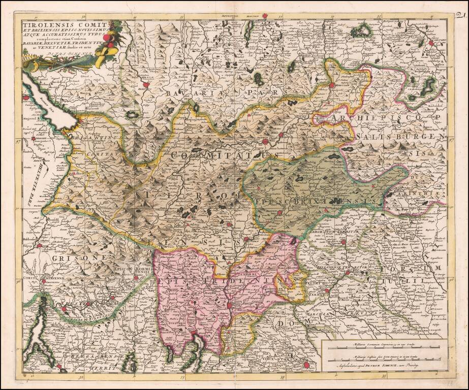
Fine old color example of the Tirolia region, published by Peter Schenk in Amsterdam.
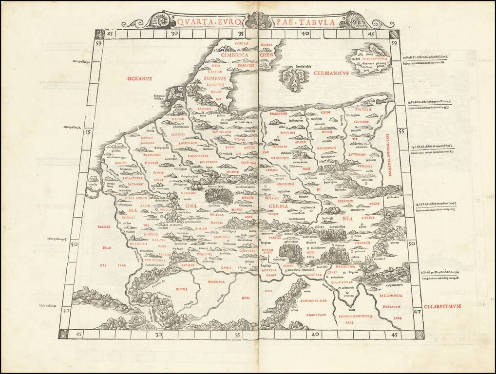
This is Sylvanus's scarce map of northern Europe, depicting the region encircled by the Rhine in the west, the Danube in the south, and the Vistula in the east. One of the earliest obtainable maps of the region, and the first printed in two colors,...
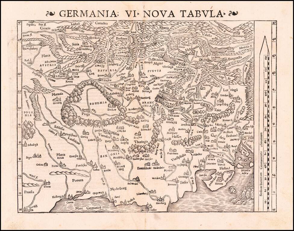
Excellent modern map of German Europe, with South oriented at the top of the map. The map extends from the Baltic (Danzig, Kolberg, Rostok and Lubec) and Vistula to the Low Countries (Amsterdam, Rotterdam, Selandie Insulae, and Ghent) in the North to...