Map size in jpg-format: 44.7502MiB
Click to open in high resolution (open in new tab).
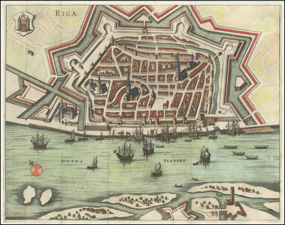
Gorgeous early plan of Riga, including coat of arms and sailing ships in the harbor.
The map shows the town plan and the Duina River, with several places identified by name.
Jansson's plan appeared in two different publications, Jansson's rare 6 volume town book, Illustriorum Principumque Urbium Septentrionalium Europae Tabulae and a second work, published by Leti. This edition appeared in Leti's work, as determined by the fact that it was folded to fit in a quarto sized book.
If you are a student, write to us in telegram: @antiquemaps and indicate what material you need and for what work you need a map in high detail. We are ready to provide material on special terms. For students only!


