Map size in jpg-format: 50.5288MiB
Click to open in high resolution (open in new tab).
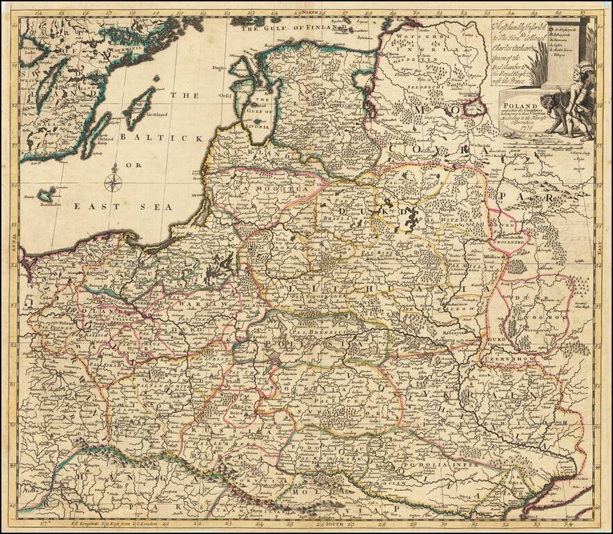
Detailed map of the Polish Empire, published by John Senex.
This is the second edition of the map, which was first published by Morden & Browne in 1710. The remnants of the earlier printing , which have been burnished out of the cartouche, are still evident. The 1710 edition is extremely rare on the market.
The map is "Most humbly Inscribed to The Honorable Collonel Charles Cathcart, Groom of the Bed Chamber to His Royal Highness the Prince."
John Senex (1678-1740) was one of the foremost mapmakers in England in the early eighteenth century. He was also a surveyor, globemaker, and geographer. As a young man, he was apprenticed to Robert Clavell, a bookseller. He worked with several mapmakers over the course of his career, including Jeremiah Seller and Charles Price. In 1728, Senex was elected as a Fellow of the Royal Society, a rarity for mapmakers. The Fellowship reflects his career-long association as engraver to the Society and publisher of maps by Edmund Halley, among other luminaries. He is best known for his English Atlas (1714), which remained in print until the 1760s. After his death in 1740 his widow, Mary, carried on the business until 1755. Thereafter, his stock was acquired by William Herbert and Robert Sayer (maps) and James Ferguson (globes).
If you are a student, write to us in telegram: @antiquemaps and indicate what material you need and for what work you need a map in high detail. We are ready to provide material on special terms. For students only!


![[Hand Drawn Prussian Military Encampment at Opole, Poland] Special Grund-Riss Des Kaeyserl Feldl Lagers bey Oppeln in Ober Schlesien](/map/small/59726.jpg)