Map size in jpg-format: 45.0089MiB
Click to open in high resolution (open in new tab).
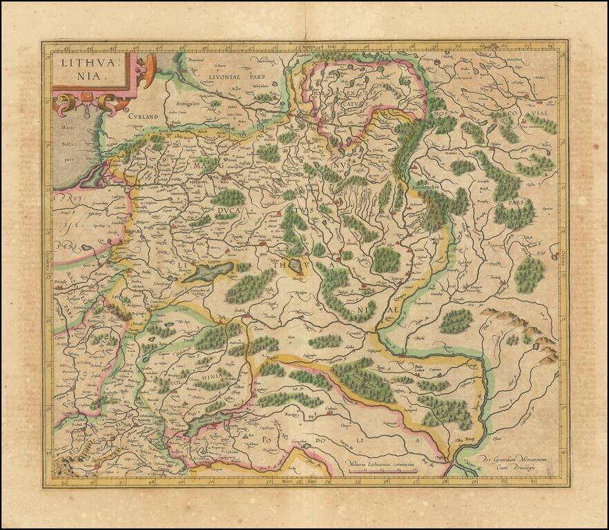
Nice old color map of Lithuania, with parts of Poland, Prussia, Ukraine and Belarus, published by Gerard Mercator.
This is one of the maps which includes Gerhard Marcator's name as the map maker. Extends from the Baltic, including part of Prussia, to the Carpathian mountains at the headwaters of the Vistula in the southwest, confluence of the Bug and Dnieper Rivers in the Southeast and the headwaters of the Volga in Belarus.
The map is centered on Lithuania and shows many cities, towns, rivers, mountains, forests, lakes, etc.
If you are a student, write to us in telegram: @antiquemaps and indicate what material you need and for what work you need a map in high detail. We are ready to provide material on special terms. For students only!


![[Hand Drawn Prussian Military Encampment at Opole, Poland] Special Grund-Riss Des Kaeyserl Feldl Lagers bey Oppeln in Ober Schlesien](/map/small/59726.jpg)