
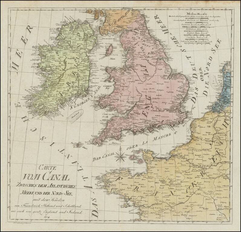
Rare chart of the British Isles, published in Hannover in 1804. The map exhibits a unique cartographic style.
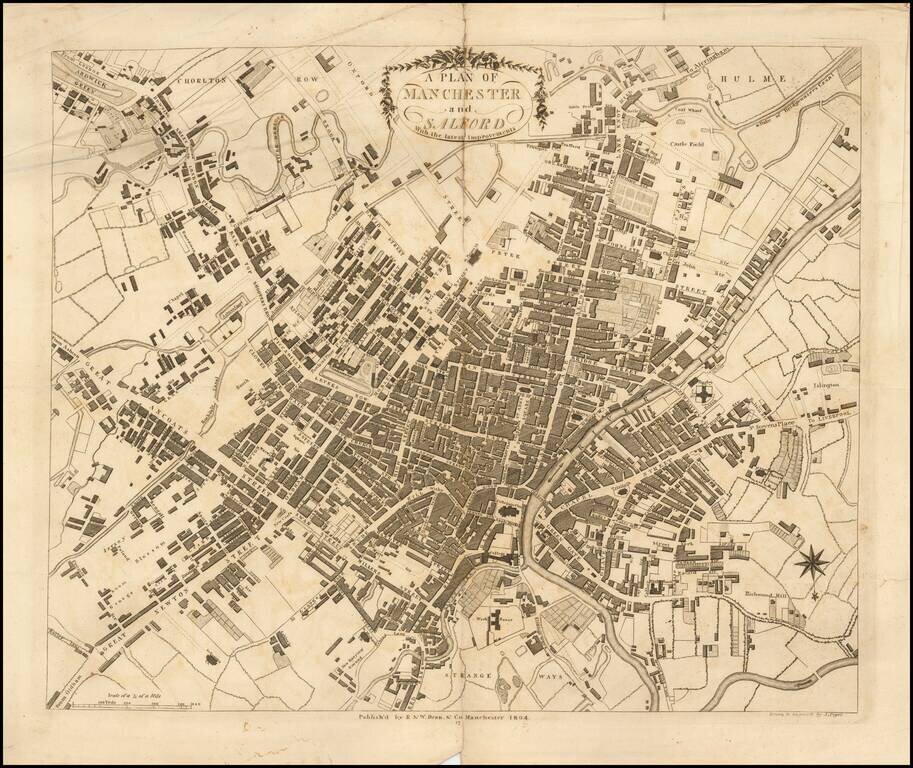
Detailed map of Manchester, pubilshed in Dean & Co.'s Manchester and Salford Directory: or alphabetical list of the merchants, manufacturers, and inhabitants in general, . . . The map is on a scale of about eight inches to the mile; is "drawn and...
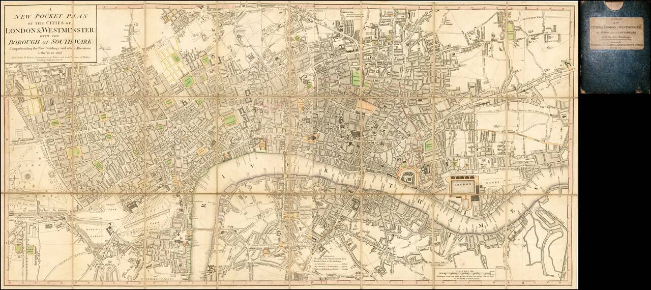
Dissected in 24 panels and laid on linen, with original slip case. A detailed and well executed folding plan of London showing the extents from Islington to Newington and Stepney to Hyde Park. Faden's plan of London was first published in the 1780s...
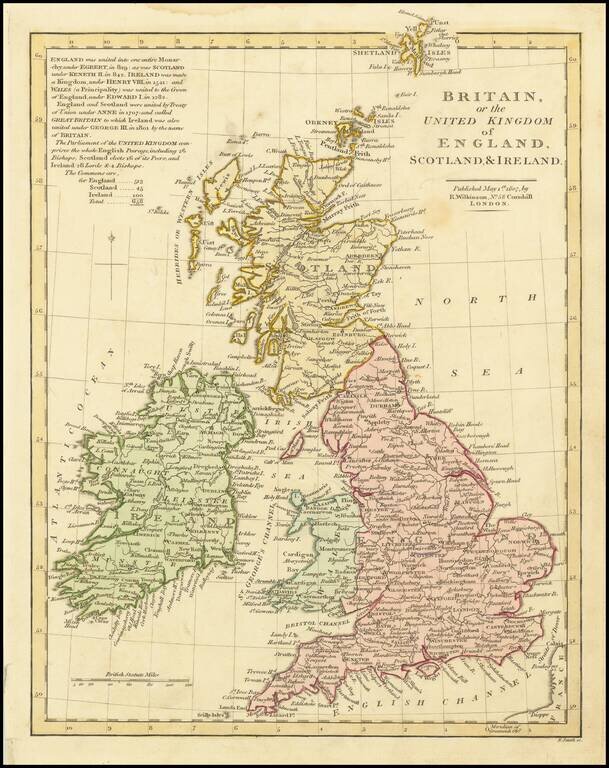
Attractive map of the British Isles, showing counties, towns, rivers, lakes, islands, etcetera. Lengthy note regarding the History of the British Isles, beginning with the unification under King Egbert in 1829, through George III. Robert Wilkinson was...
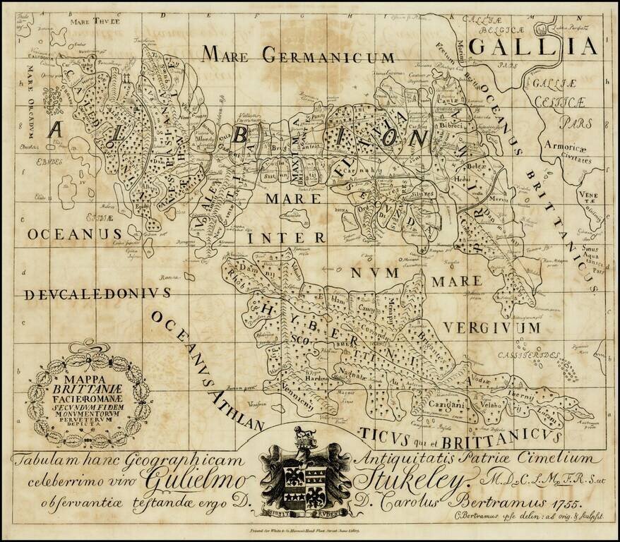
Scarce map of the British Isles in Roman times, based upon the manuscript map of the 18th Century British forger, Charles Julius Bertram. Bertram was a 23 year old Englsh language teacher at the Royal Marine Academy in Copenhagen when he began...
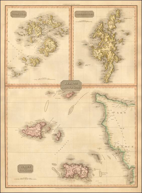
Detailed map of the remote British Isles. Excellent detail. One of the best large format English atlas maps of the period. Pinkerton's maps reflect the fine copperplate engraving work being done in Britain at the beginning of the 19th century, with...
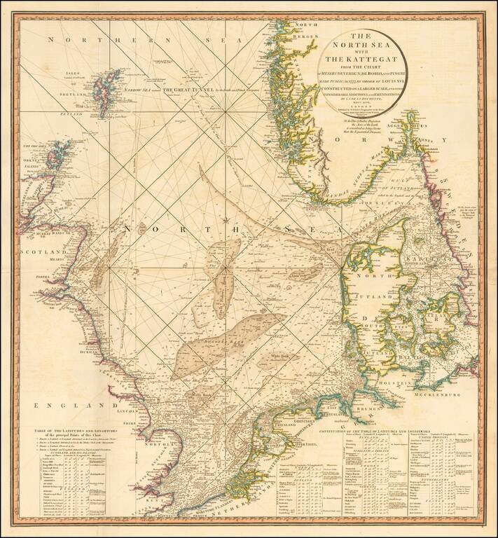
Striking and highly detailed sea chart of the North Sea from the Straits of Dover to the Shetlands and North Bergen in Norway, and east through the Kattegat to Copenhagen. Highly detailed sea chart, with extensive tables and annotations. Shows...
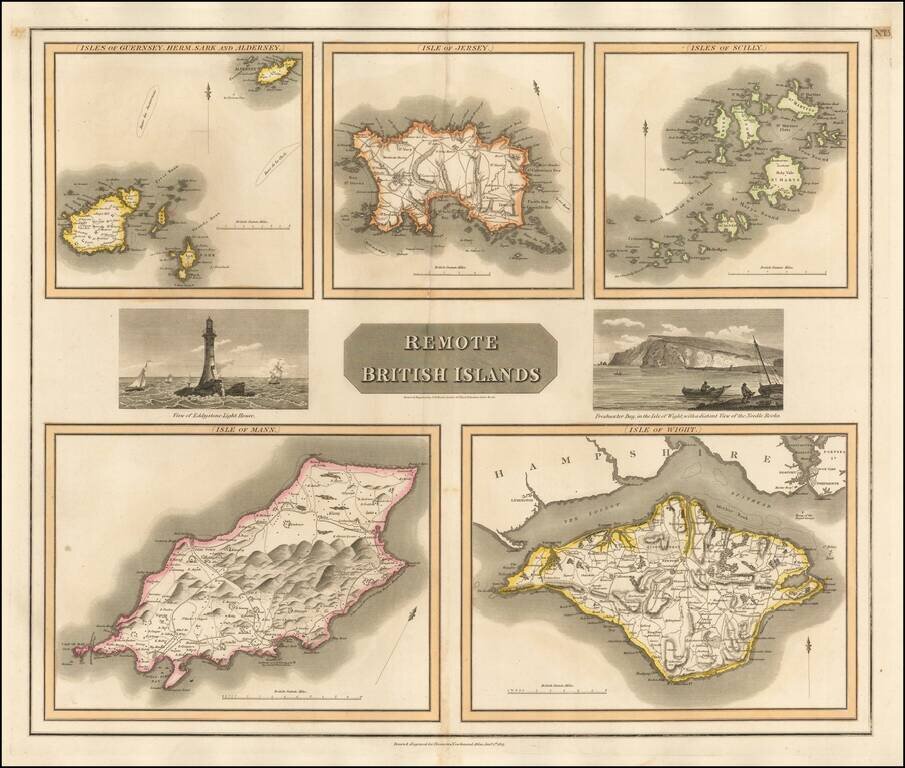
Group of 5 maps of the Channel Islands, Scilly, Jersey, the Isle of Mann and the Isle of Wight. Engraved views of the Eddystone Lighthouse and Freshwater Bay on the Isle of Wight, with Needle Rock in the background.
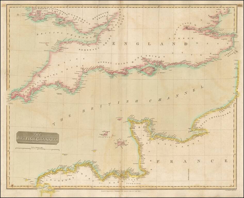
Detailed map of the Channel and the features along the French and British Coastlines. Large detailed map.
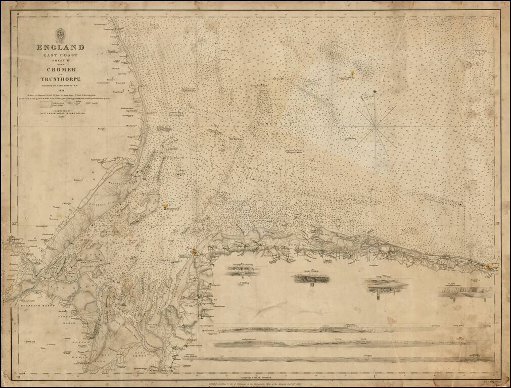
Detailed chart of the Northeastern English Coastline, from Mablethorpe and Trusthorpe to Cromer LIght House, first published by the British Admiralty in 1828 and revised by Captain I. Washington in the H.M.S. Blazer in 1843. The chart provides a...
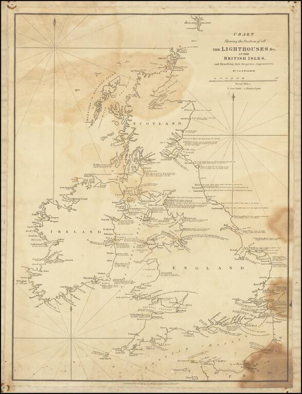
Fine, Rare Sea Chart Highlighting the Lighthouses of the British Isles Rare J & A Walker sea chart locating all of the lighthouses in the British Isles, including extensive notes on the appearances of the lights. The chart includes the southern...
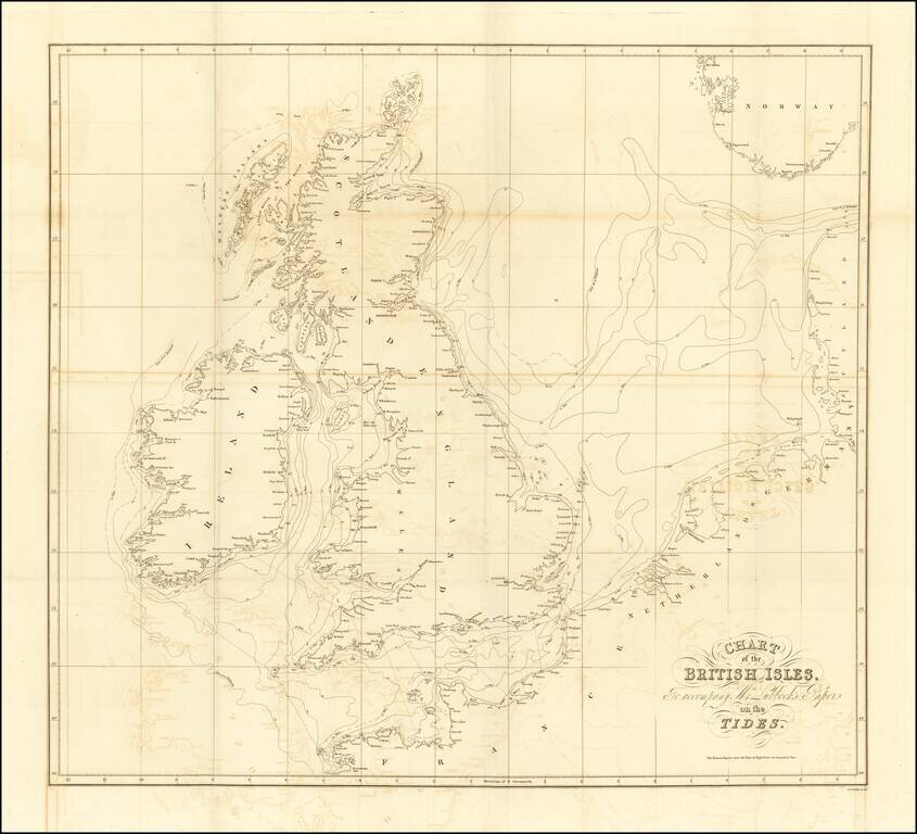
Lubbock’s Map of the Tides—the Early Work of a Skilled Man of Science Finely-engraved map of the British Isles and its tides, published to illustrate a paper on tidal flows presented by John William Lubbock to the Royal Society of London in 1831....
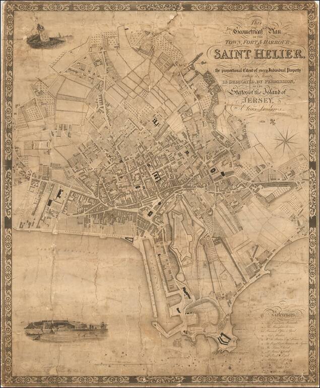
The First Large Scale Map of Saint Helier. Rare early map of Saint Helier on Jersey, the largest of the Channel Islands in the English Channel. The map was engraved by C. Coble of 6 Church Terrace, St Pancras, 13 Paternoster Row, London. The map...
![[Map of Great Britain and Ireland] Карта Великобританіи и Ирландіи](/map/small/67013.jpg)
Detailed and very rare Russian-language map of England, Wales, Scotland, and Ireland, published in Saint Petersburg in 1836. The map includes an inset of the Channel Islands. Rarity The map is very scarce. We have been unable to find any other...
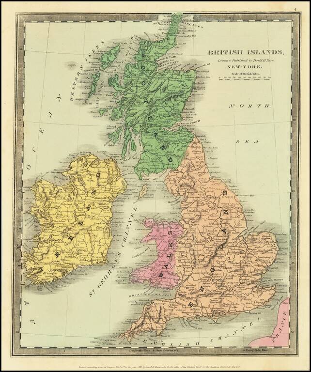
Scarce map of the British Isles, published in New York by David Burr. Burr would go on to become the Topographer of the United States and one of the most important 19th Century American mapmakers.
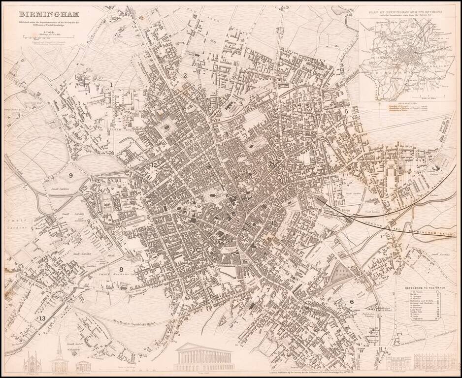
Highly detailed town plan of Birmingham, England. A generally nice example with inset of the environs and boundaries taken from the Reform Act. One of the best examples published in a commercial atlas in the 19th Century.