Map size in jpg-format: 1.91931MiB
Click to open in high resolution (open in new tab).

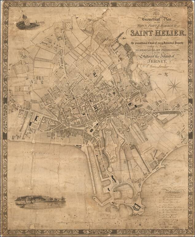
The First Large Scale Map of Saint Helier.
Rare early map of Saint Helier on Jersey, the largest of the Channel Islands in the English Channel. The map was engraved by C. Coble of 6 Church Terrace, St Pancras, 13 Paternoster Row, London.
The map includes decorative vignettes of the harbor and Fort Regent, coat of arms of Jersey (showing three lions) positioned on an anchor, and a lettered reference at lower right.
St. Helier is the largest city on Jersey and in the Channel Islands generally.
Not in British Library. OCLC lists only the copy at Cambridge University. We have seen another example of the map offered by an English dealer for £5000.
If you are a student, write to us in telegram: @antiquemaps and indicate what material you need and for what work you need a map in high detail. We are ready to provide material on special terms. For students only!


