
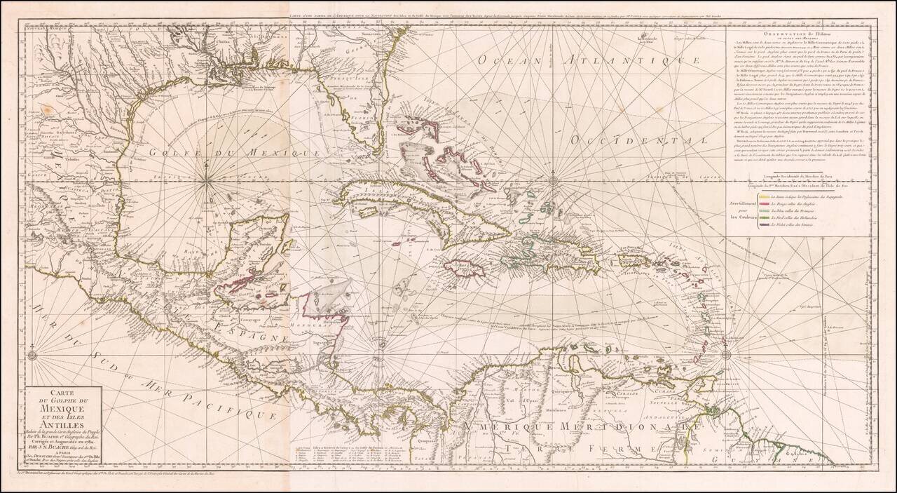
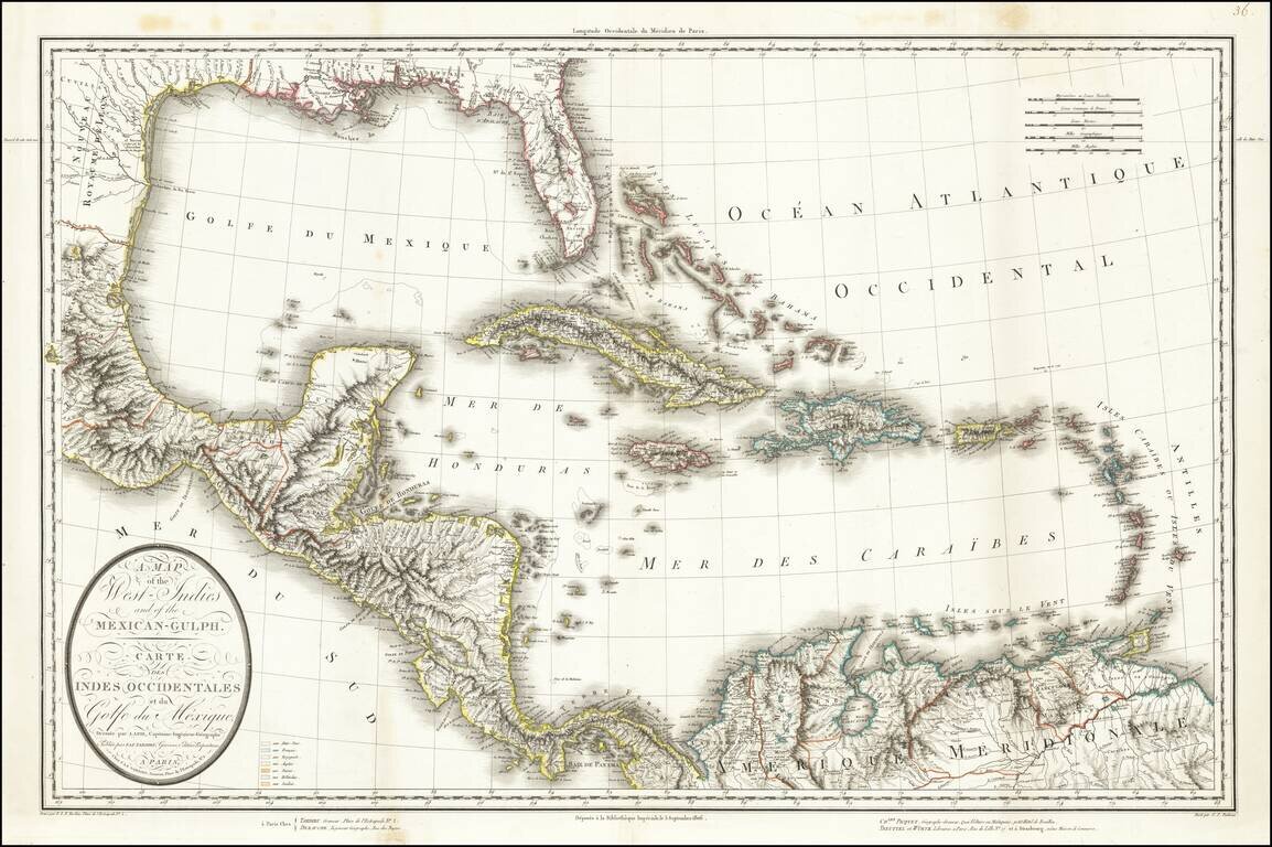
Striking, Intricate Map of the Caribbean Region Scarce and highly-detailed map of the Gulf Coast, Florida, Central America and the Caribbean from J.A. Dezauche, successor to Philippe Buache and Guillaume De L'Isle. The map is incredibly detailed, not...
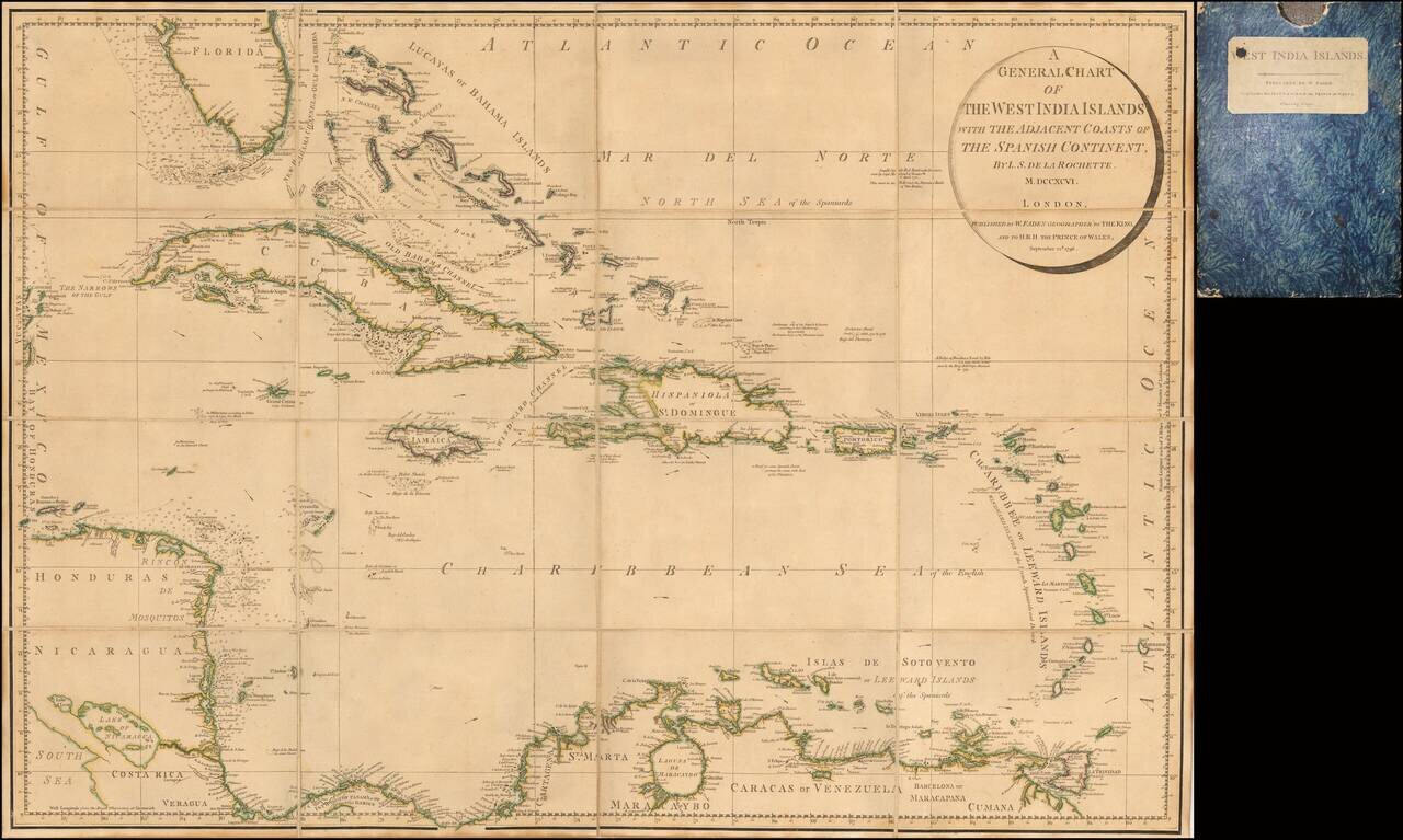
John Cary's First Printed Map Nice example of John Cary's map of the Southeastern United States, Florida and the Caribbean, published on August 1, 1783. Published in August, 1783, the map was issued one month prior to the signing of the Treaty of...
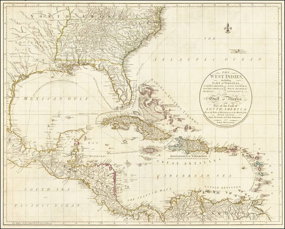
Rare Separately Issued Faden Map of the Caribbean &c. Detailed large format chart of the West Indies, Florida, Honduras, Nicaragua, Coast Rica, Panama and the Bahamas drawn by Louis Stanislas Delarochette, and published by William Faden in 1796....
Interesting map of the West Indies and Gulf Coast region, showing Florida, the Yucatan, coast of Central America and South America. Fort Louis and Lake St. Joseph are shown along with St. Louis Bay and Bernard's Bay, near modern Galveston. Nice detail...
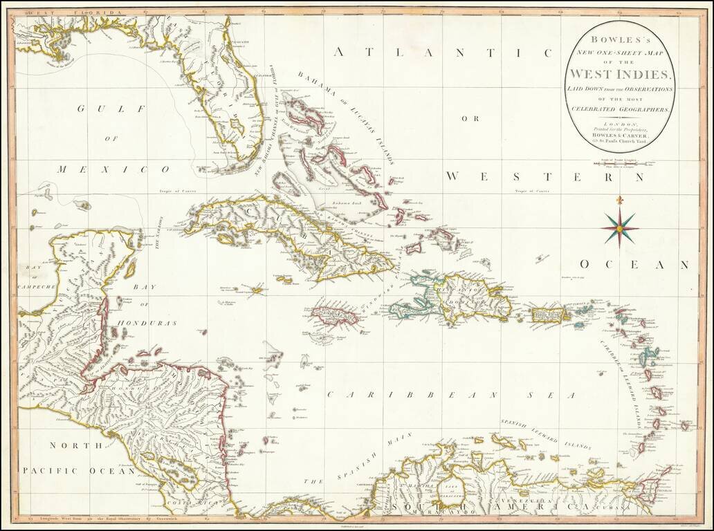
Large detailed map of Florida and the Caribbean, published by Bowles & Carver. The map extends from Florida, the Yucatan and Central America to the Windward and Leeward Islands. Centered on Cuba and the Bahamas. The map references the "Supposed...
Scarce antique map of Florida, the Gulf Coast, and the Caribbean from Mentelle & Chanlaire's Atlas Universel…, engraved by Tardieu and drawn by Valet. Includes nice detail throughout the map.
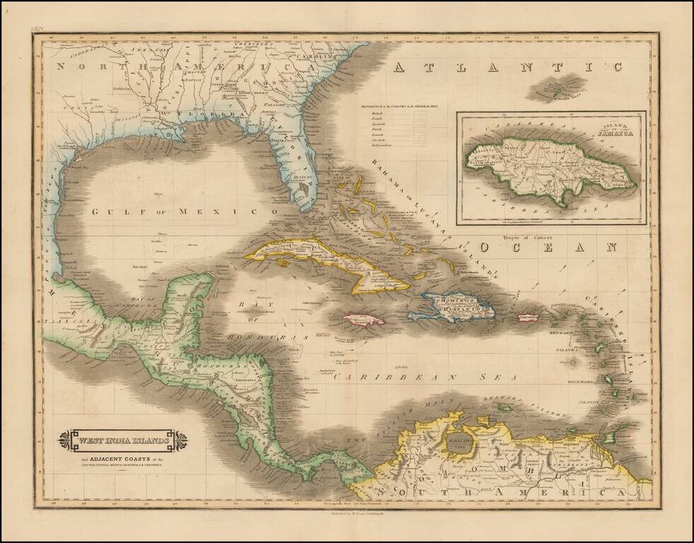
Scarce early edition of Lizars map of the Caribbean and contiguous coasts of Florida, the Gulf Coast, Central and South America, with a large inset of Jamaica. East and West Florida still appear, but both Missisippi and Alabama Territories are...
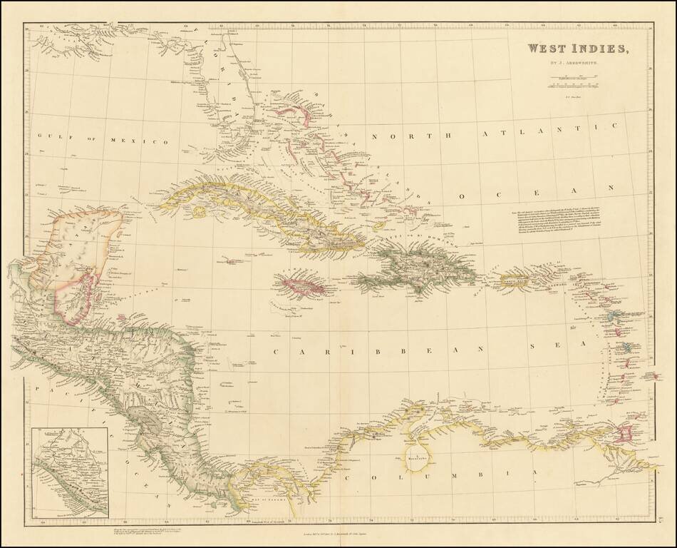
Arrowsmith's London Atlas Map of the Florida, the West Indies & Central America Nice example of this fine map of Florida, the Caribbean and Central America, published in Arrowsmith's London Atlas. In Florida, the map notes the "Cape Florida...
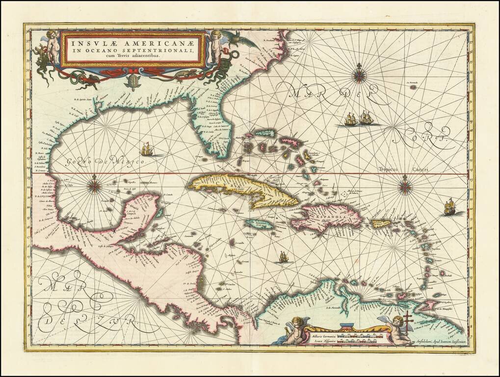
Finely colored example of Jansson's edition of Hessel Gerritsz' rare chart of 1631. The area covered is exactly the same as the original Gerritsz map, except for the addition of the west coat of Central America. The nomenclature in North America is...
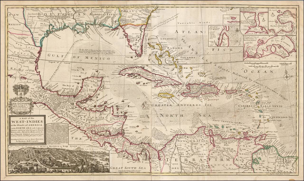
Highly detailed and decorative large format engraved map of the Caribbean by Herman Moll. Moll's map was the most popular large English map of the Caribbean, Florida, the Gulf Coast, Texas, and Central America in its day. It was a central image in the...
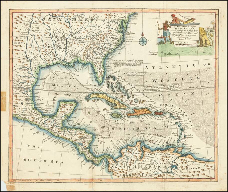
Decorative example of Bowen's map of the Southeastern United States, Florida, Gulf Coast, Texas, Caribbean and Central America. The map is embellished by an elaborate native American scene, along with a depiction of a lion and other indigenous...
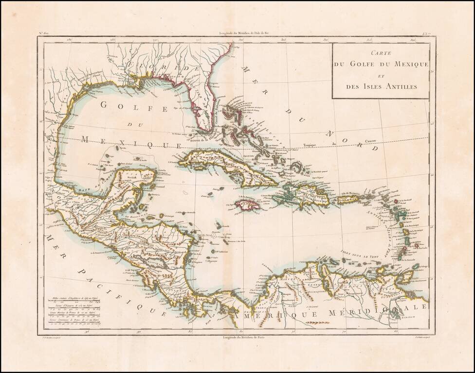
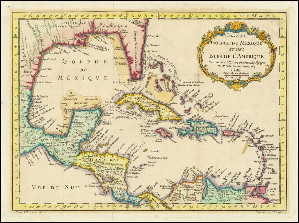
This is a rare separately issued map of the Gulf Coast and the Caribbean by Tardieu. The map was issued shortly after the Louisiana Purchase (1803) and the creation of the Mississippi Territory (1804). The map demonstrates the remarkably fine engraving...
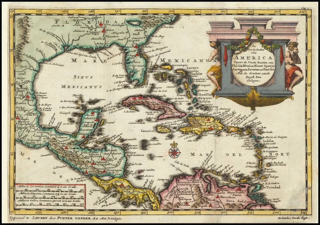
Detailed regional map of Florida and the Caribbean, used by Vander Aa to illustrate a Dutch translation of the narrative of one of Columbus' Voyages to the New World. Shows Central America and the Caribbean in full, with small parts of South America...
Interesting and detailed map of Florida, the Gulf Coast, Central America, and the Caribbean. The map shows the route of Ponce de Leon when he discovered Florida, Cortez's route in 1519, and that of De Cordova in 1517. The map features a decorative...
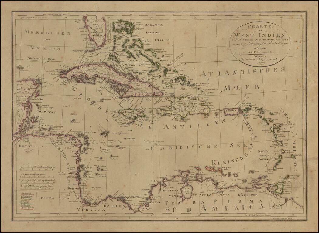
Rare edition of Gussefeld's map of South Florida, the Caribbean and coastlines of Central America. The map would be updated and re-issued for at least the next 20 years, with corrections. A comparison of this edition to the 1816 edition which we...
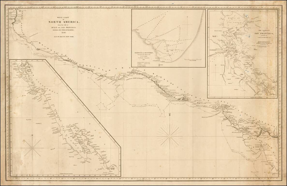
Rare sea chart of California, Mexico and Central American coastline, showing the southern sea route to San Francisco printed on the eve of the California Gold Rush. This fine chart depicts the length of the Pacific Coast of North and Central America,...