
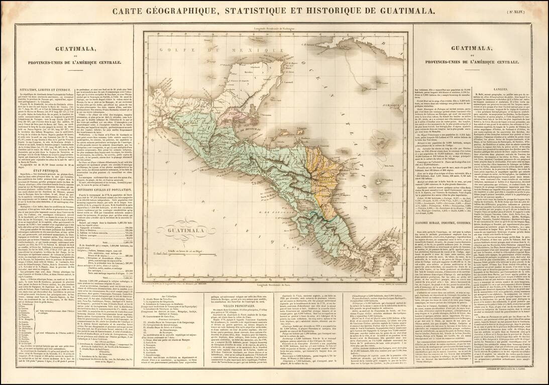
Nice example of the Buchon's map of Guatemala, pubilshed in Paris in 1825. The map also shows Honduras, Belize, Nicaragua and Costa Rica, with Belize called Colonie Anglre de Balize. At the time of the map, these countries were part of the United...
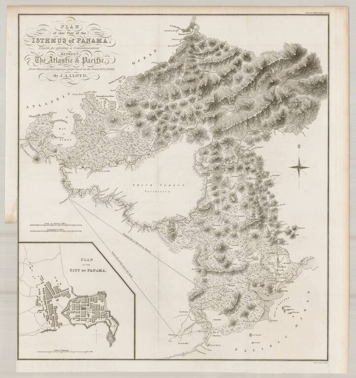
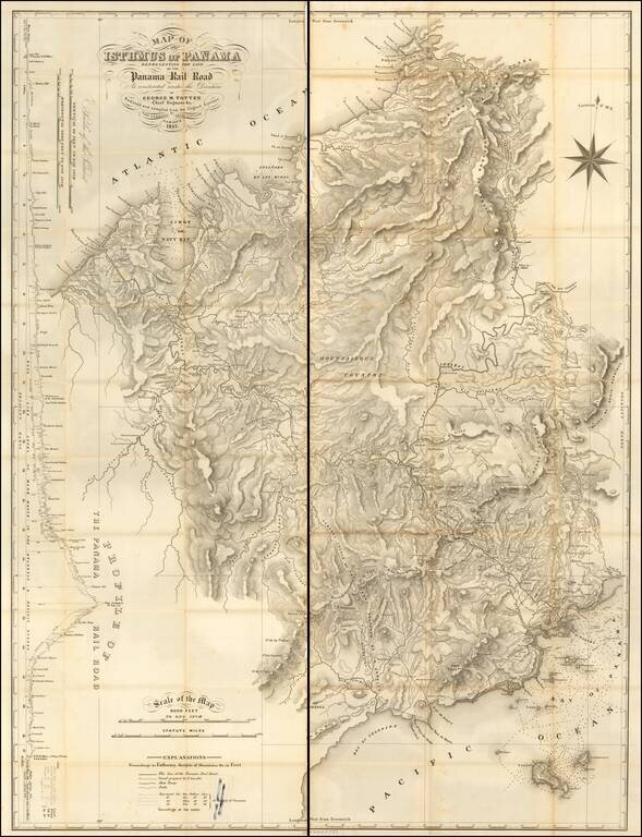
Finely detailed map of a portion of Panama, prepared to illustrate John Augustus Lloyd's article Account of Levellings Carried Across the Isthmus of Panama, presented at the Royal Geographical Society in 1830. This detailed topographical map depicts...
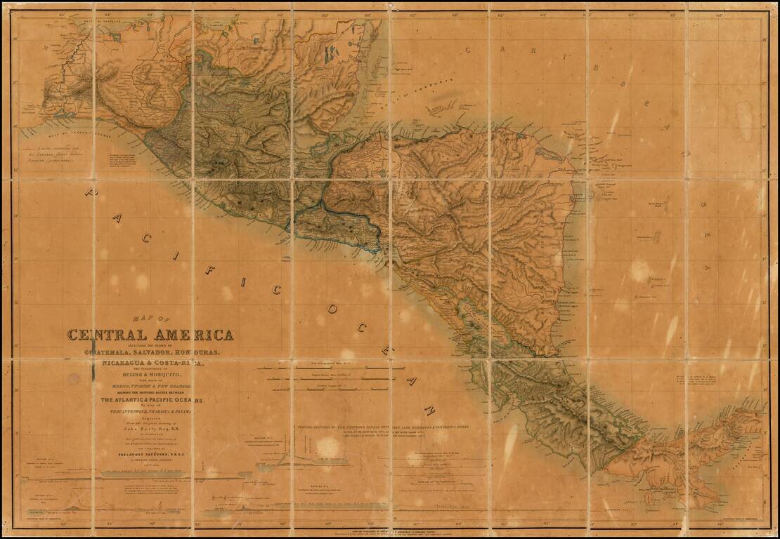
Unique annotated example of this finely detailed map of Central America, prepared by John Baily, who served as a surveyor of Nicaragua and was an early proponent of a canal across Central America, published in London by Trelawney Saunders. The present...
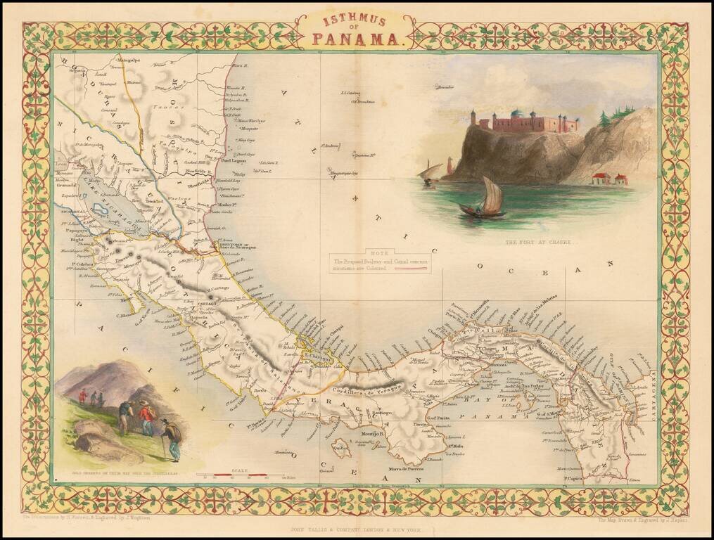
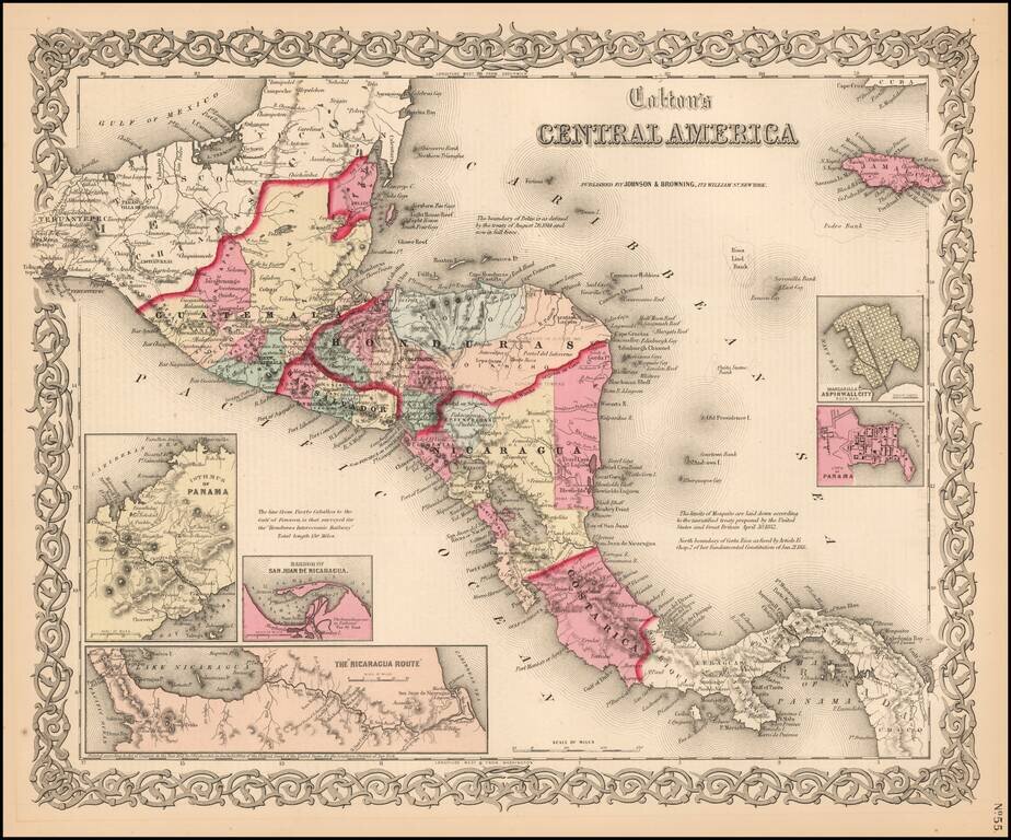
Striking full color example of this marvelous map. Showing vignettes of the Fort at Chagres and Gold seekers on their way over the cordilleras, also showing proposed railways. Engraved for R. Montgomery Martin's Illustrated Atlas of the World. Tallis...
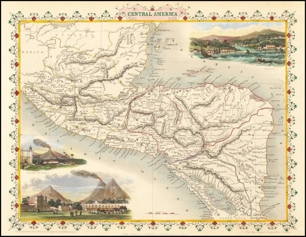
Striking full color example of this wonderful decorative map of Central America, including Guatemala, Honduras, El Salvador, Nicaragua and "Mosquito Territory." In the body of the map is outline color by country. The map features vignettes of Volcano...
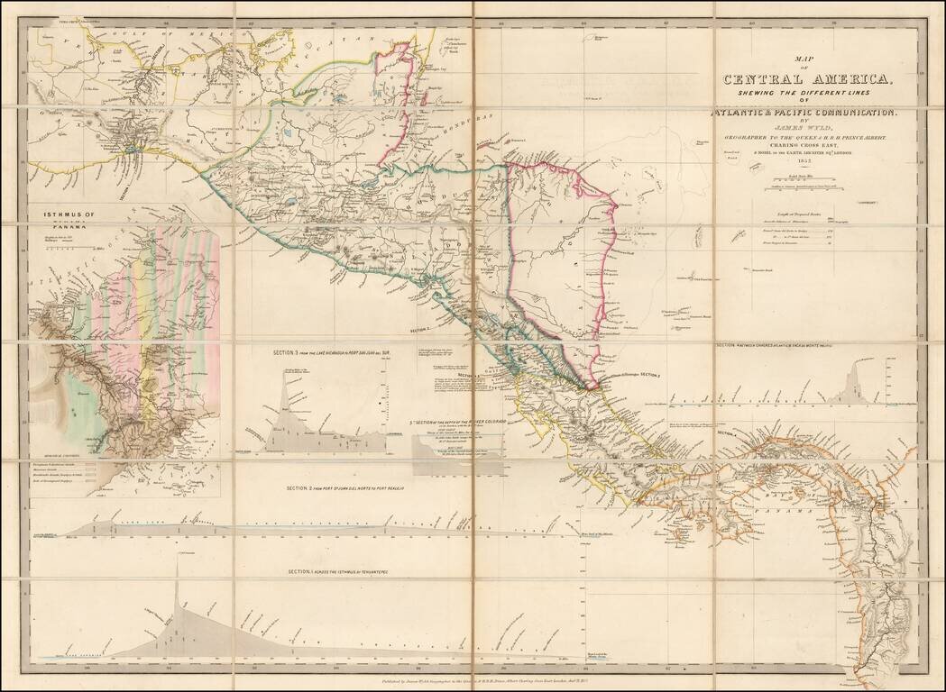
Early Edition of Wyld's map of Central America -- Including the first geological survey of Panama. Fine map of Central America, which includes the first geological survey of Panama published in London by James Wyld. This is the earliest edition of...
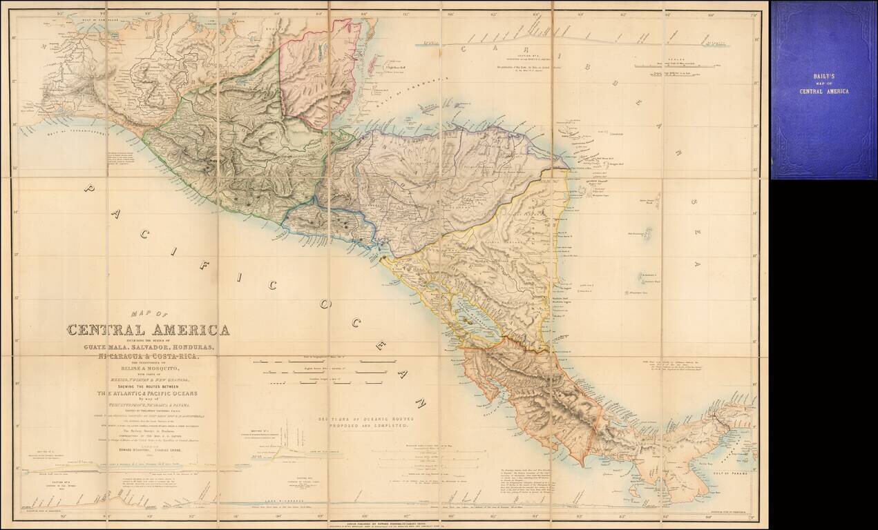
Fine example of the second edition of this finely detailed map of Central America, prepared by John Baily, who served as a surveyor of Nicaragua and was an early proponent of a canal across Central America, published in London by Trelawney Saunders....
Detailed map of Central America, colored by country and province. Insets of the Republic of Nicaragua, Harbor of San Juan Nicaragua, Manzanilla Island, Aspinwall City and the City of Panama. Interesting text annotations.
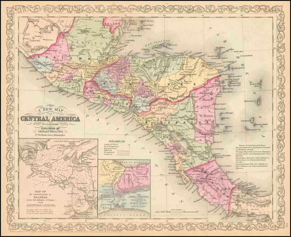
Detailed map of Central America, colored by country and states, with insets of the Railroad across the Isthmus of Darien and The Isthmus of Tehuantepec. Text annotations and other interesting details are noted.
A Jamaican Surveyor's Map of the Panama Rail Road Highly detailed map of the Panama Railroad, published two years after its completion in 1857. This is one of the earliest maps to show in detail the successful completion of the Railroad line...
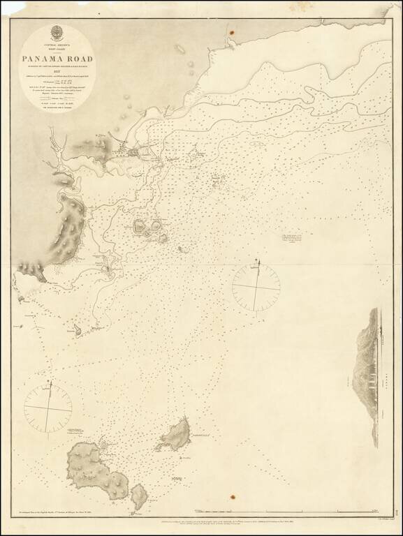
Detailed sea chart of the approaches to Panama City, published by the British Admiralty in 1858. The chart extends to Taboga Island and the smaller neighboring islands. Includes sailing directions, soundings, and some topographical features.
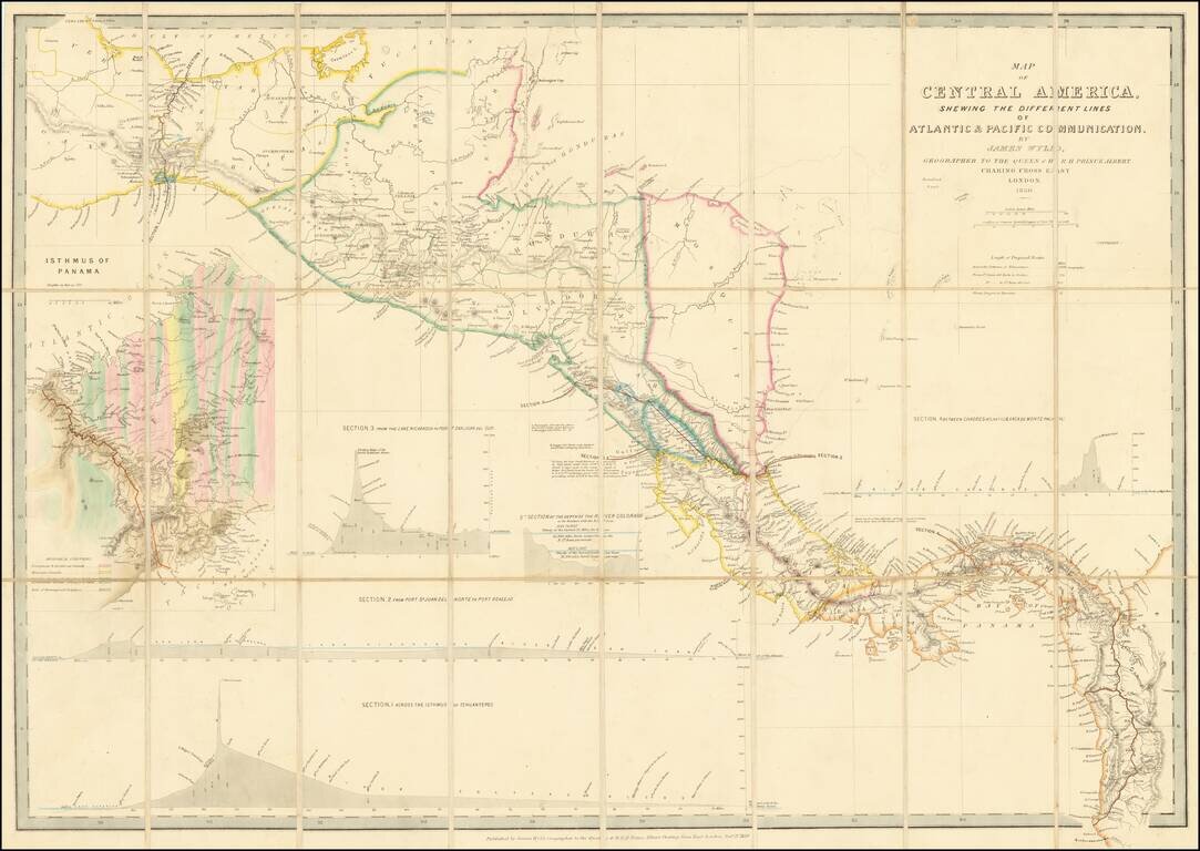
Early Edition of Wyld's map of Central America -- Including the first geological survey of Panama. Fine map of Central America, which includes the first geological survey of Panama published in London by James Wyld. This is the earliest edition of...
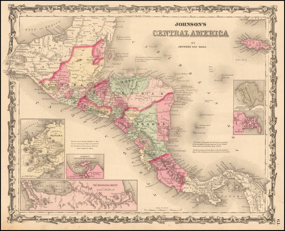
Detailed map of Central America, colored by provinces. Includes towns, roads, rivers, lakes, mountains, islands, etc. Includes insets showing the Isthmus of Panama, Harbor of San Juan De Nicaragua, The Nicaragua Rute, Manzanilla I. Aspinwall City Navy...
![[Galapagos] Carte de la Cote Occidentale D'Amerique Comprise Entre Le Golfe de Tehuantepec et le Golfe de Guayaquil (Amerique Centrale, Nlle Grenade, Equateru) . . . .1864](/map/small/57942.jpg)
Scarce sea chart of Central America and the coasts of Colombia, Equador and Peru, published by the French Hydrographical Office. Includes a relatively large treatment of the Galapagos Islands, just five years after Charles Darwin's publication of his...
The Canal Survey of Napoleon Garella Scarce map of the Isthmus of Panama, illustrating a proposed Canal from the Atlantic to the Pacific Ocean, prepared to illustrate the Report of Rear Admiral Charles Henry Davis. Map shows towns, roads, physical...
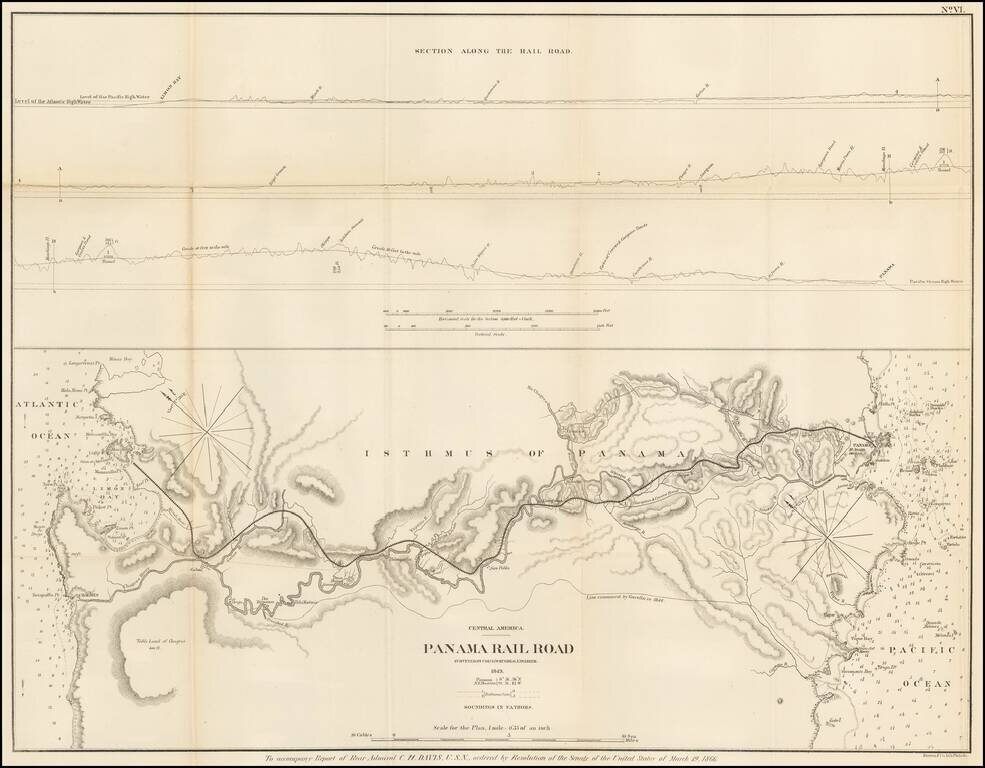
Detailed map of the proposed route of the Panama Railroad, from Manzanilla Island to Panama City, as surveyed by G.W. Hughes in 1849. The map also identifies the route examined by Garella in 1844 and a profile view above. At the outset of the...