

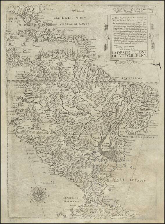
Rare Contemporary-Colored Example of Linschoten's Map of South America Striking example of this spectacular map of South America, the Caribbean, Florida and the Gulf Coast, along with a marvelous treatment of the unknown southern continent. Engraved...
![[Blaeu Atlas of America] America, Quae Est Geographiae Blavianae Pars Quinta Liber Unus Volumen Undecimum](/map/small/66852.jpg)
A Beautiful, Clean Example in the Publisher's Gilt-Vellum Binding. Johannes Blaeu's atlas of the Americas is an attractive and important atlas that deftly blended contemporary geographical knowledge with rich decorative imagery. Blaeu's maps set the...

"A scientific and artistic document of the first order" -- One of the most important sea charts of the 17th century. Exceptionally rare Johannes Loots issue of Guillaume Blaeu's landmark sea chart of the Atlantic Ocean, America and Africa, printed on...
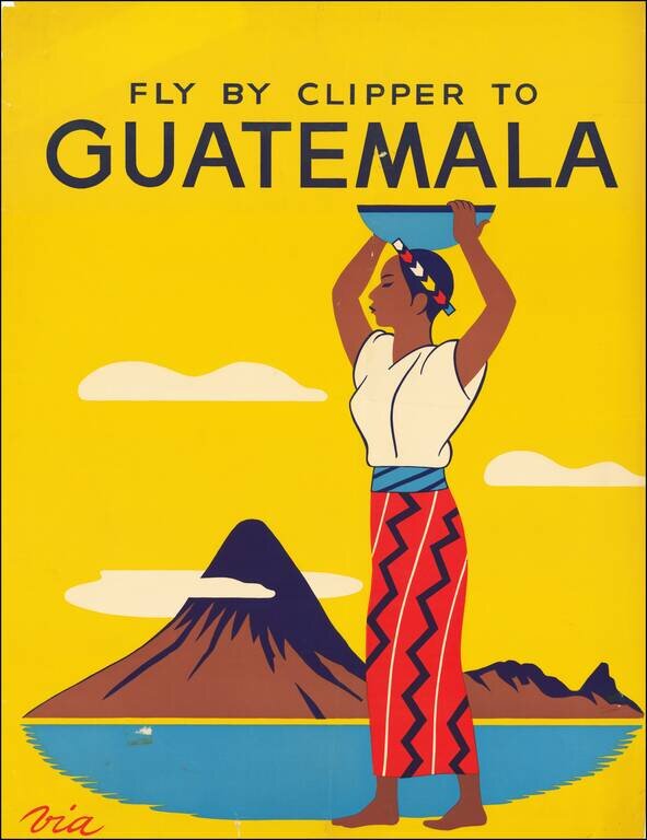
Attractive promotional travel poster, promoting air travel to Guatemala. The map promotes travel via Pan Am's Clipper Service to Central America.

The Rare and Classic Rogers & Johnston Atlas. With its Famous Maps of Utah and Nebraska Territories, Among Many Other Good American Maps. This is an example of one of the most important atlases of North America published just before the start of...
![[Early Photographic Facsimile of the Egerton Portolan of circa 1510]](/map/small/65127.jpg)
"It appears to be not only the oldest known portolan atlas on whose charts any part of the New World is laid down, but the oldest known atlas in which the coast regions of a very large part of the entire world are represented with a fair approach to...
![[Early Facsimile] Esta Carta General en Plano Hizo Sancho Gutierrez Cosmographo de Su. S.C.C. Magt Del Īperador Y Rei Nuestro Señor [dō Carlos] Quinto Deste Nōbre. En la Qual Esta Todo Lo Hasta Oy Descubrierto. Imitando Alto Tomeo en Parte Y Alos Modernos](/map/small/66534.jpg)
Early photographic facsimile of the Western Hemisphere of the famed 1551 Sancho Gutierrez planisphere. Sancho Gutiérrez is the author, in 1551, of a world map addressed to Carlos Quinto and based on the Padrón Real. It includes many details of the...
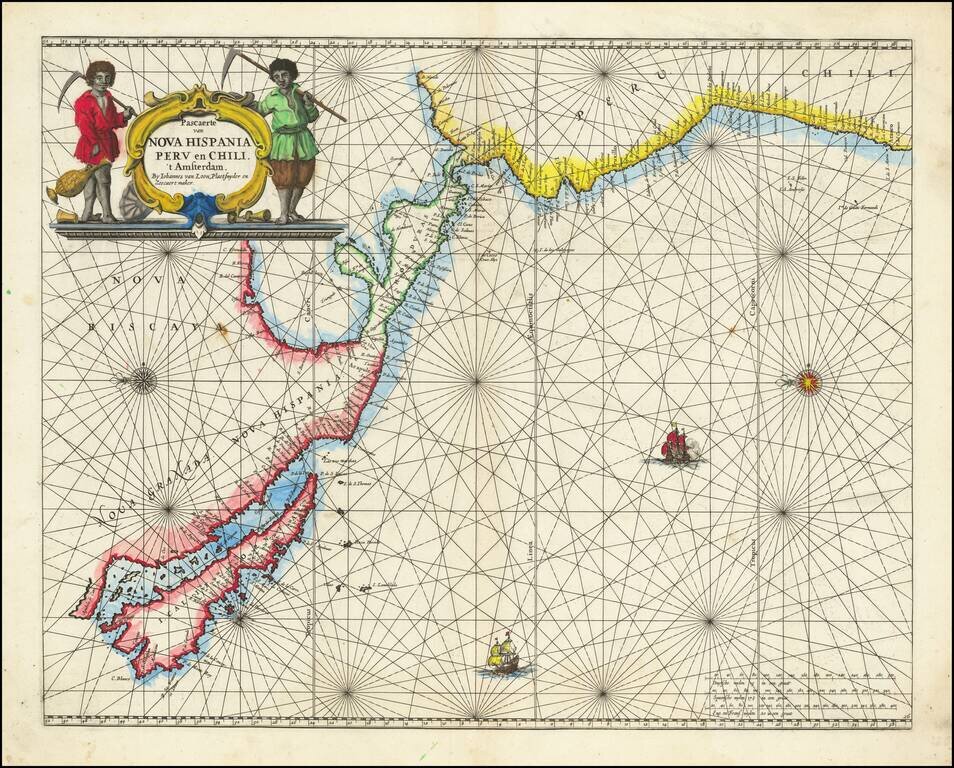
Rare Golden Age Dutch Sea Chart of the Island of California and Western Pacific Rare Johannes Van Loon sea chart of the Western Pacific. The map appeared in the first edition of Van Loon's Zee Atlas. It derives from Doncker's map of the Western...
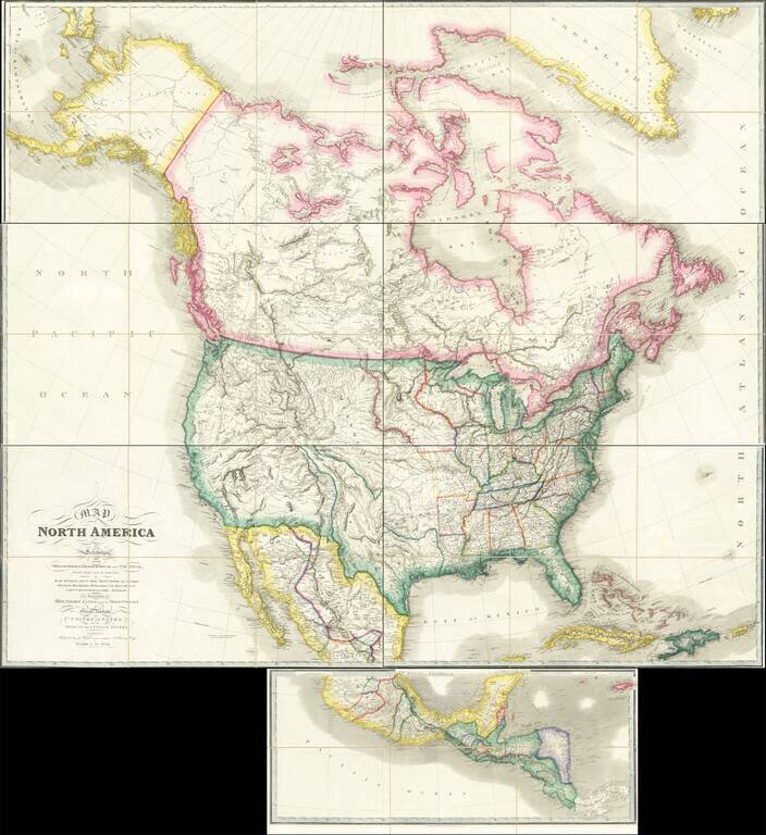
Rare Large Map of North America from a Royal Library Fine example of the circa 1850 (our dating) edition of Wyld's massive map of North America, which includes the extra panel at the bottom, adding Central America, first issued in 1824. John Wyld was...

A highly decorative and important sea chart showing Florida, the Gulf Coast, Caribbean, Central America and the region from south of the mouth of the Delaware River. This fine separately published map was first engraved around 1650, but is based...
Forlani’s Map of South America—The Only Lafreri School Map of The Continent Rare map of South America by Paolo Forlani. It was the first map of South America to show the interior in considerable detail and is the only map of the continent produced...
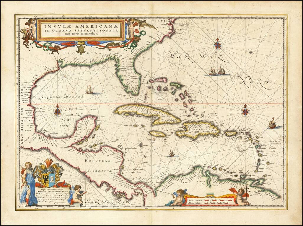
Blaeu's Chart of the Caribbean Nice example of Blaeu's chart of the Caribbean, based on a section of Blaeu's own West Indische Paskaert (ca. 1630) and Hessel Gerritsz' rare chart of 1631. The chart was the most accurate for its time and was used...

The First Sea Chart Focused on the Coast of California Rare first edition of the earliest map to focus on the California Coast, published in Florence by Robert Dudley. The map appeared in Dudley's landmark sea atlas, the Arcana del mare, the first...
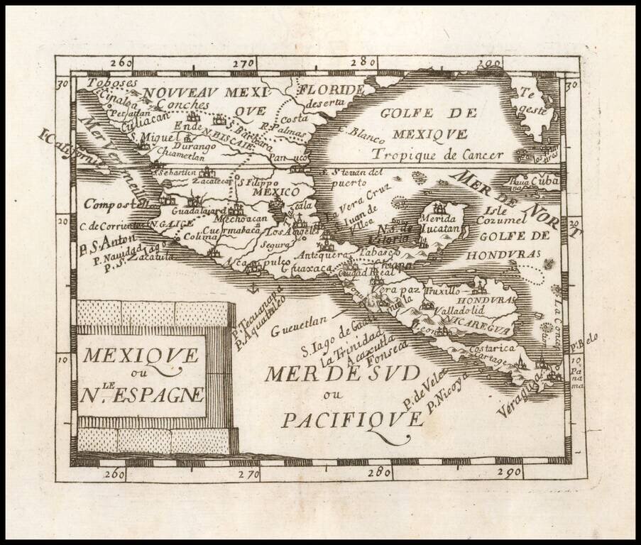
Nice example of Du Val's map of New Spain, extending from the American Southwest and Florida to Costa Rica and Panama.
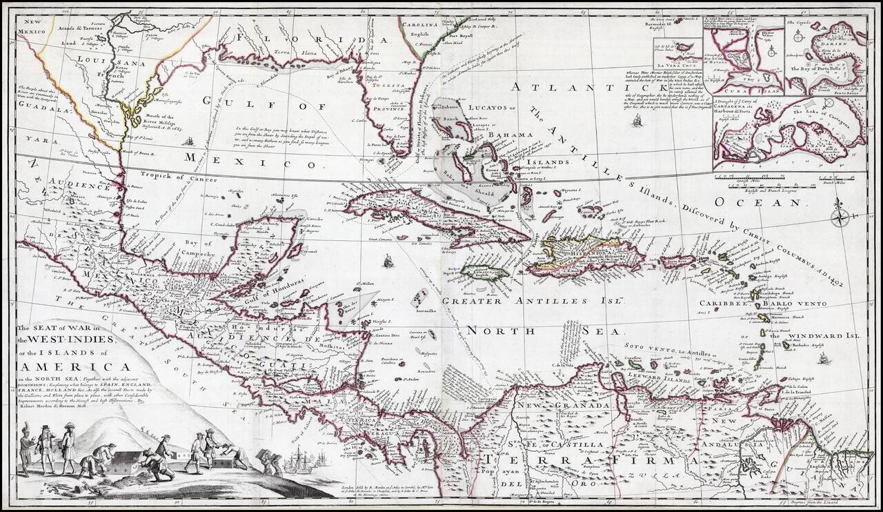
Striking old color example of this rare separately issued map of the Theater of War during the War of Jenkins Ear, published in London circa 1702, by Robert Morden & Herman Moll. A separately published and very rare English produced map of the War...
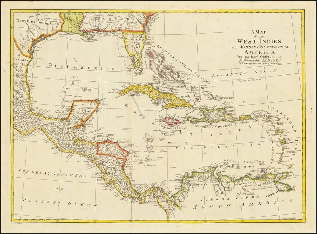
Detailed map of Florida, the Gulf Coast and Caribbean, centered on Cuba colored by regions. Florida is shown as an Archipelago. Georgia extends to the Mississippi River. Massive Kingdom of Leon (Texas). Nice detail in the Bahamas.