
![[Fruit Crate Label Advertising Map] Panama Brand (North America & Panama Canal)](/map/small/48860.jpg)
Decorative Fruit Crate Label, showing various routes through the Panama Canal, published for the Johnson Fruit Company of Santa Barbara, California.
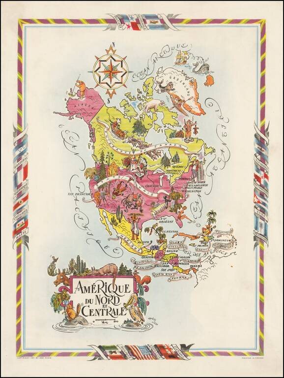
Decorative map of North and Central America, published by Jacques Lizou. Lizou published a number of maps in this style in 1951, including maps of the French provinces, etc. The map was also used in a Pan American Airways menu in the 1960s.
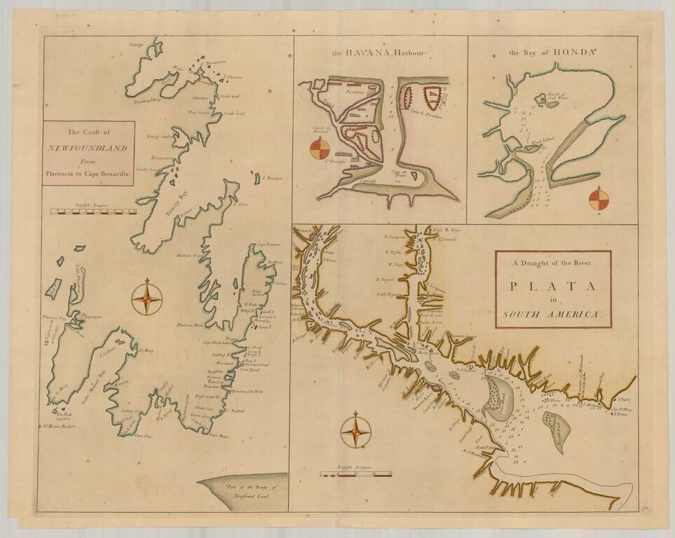
Rare Sea Charts of North and South American Ports from an Influential Atlas This composite sea chart shows Newfoundland, Havana Harbor and the Bay of Honda, both in Cuba, and the River Plata in South America. The chart shows the coastlines and...
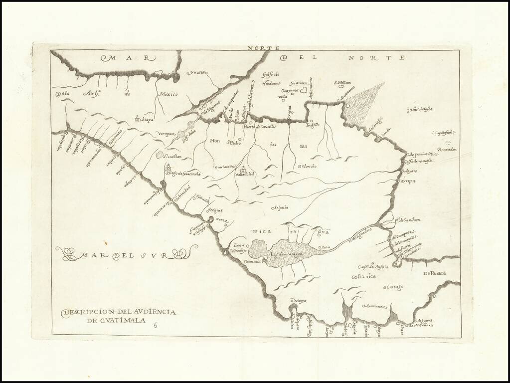
Fine engraved map from Herrera's Descripcion de las Indias Ocidentales, showing part of Central America, including present-day Mexico, Honduras, Nicaragua, Costa Rica, and Panama. The present example is from the second Spanish edition, published in...
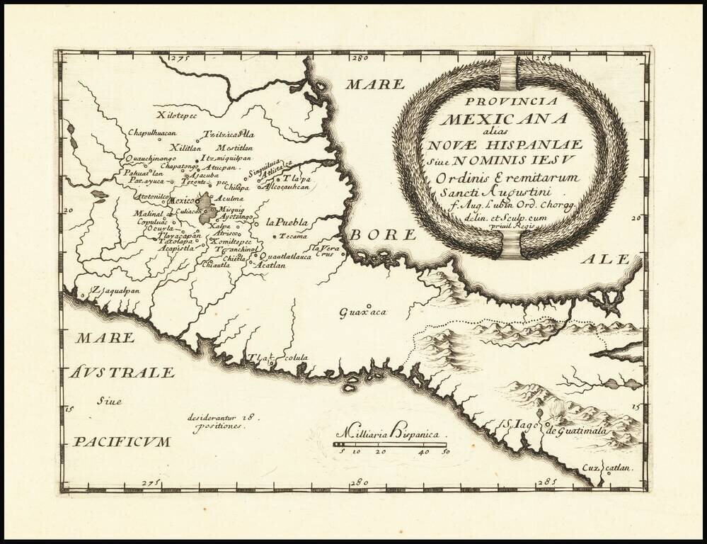
Rare map of the southern part of Mexico and Guatemala, published in Bologna. The map is intended to illustrate the Augustinian Missionary work and influence in Southern Mexico and Central America. The map appeared in a rare Augustian work entitled...
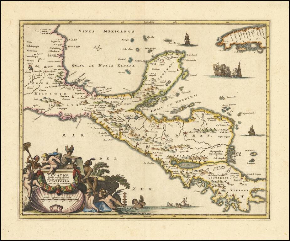
Nice old color example of Blaeu's map of the Yucatan peninsula, which appeared only in the late editions of Blaeu's atlases. This is one of the earliest Dutch maps to focus on the region centered on the Yucatan Peninsula. Includes decorative cartouche...
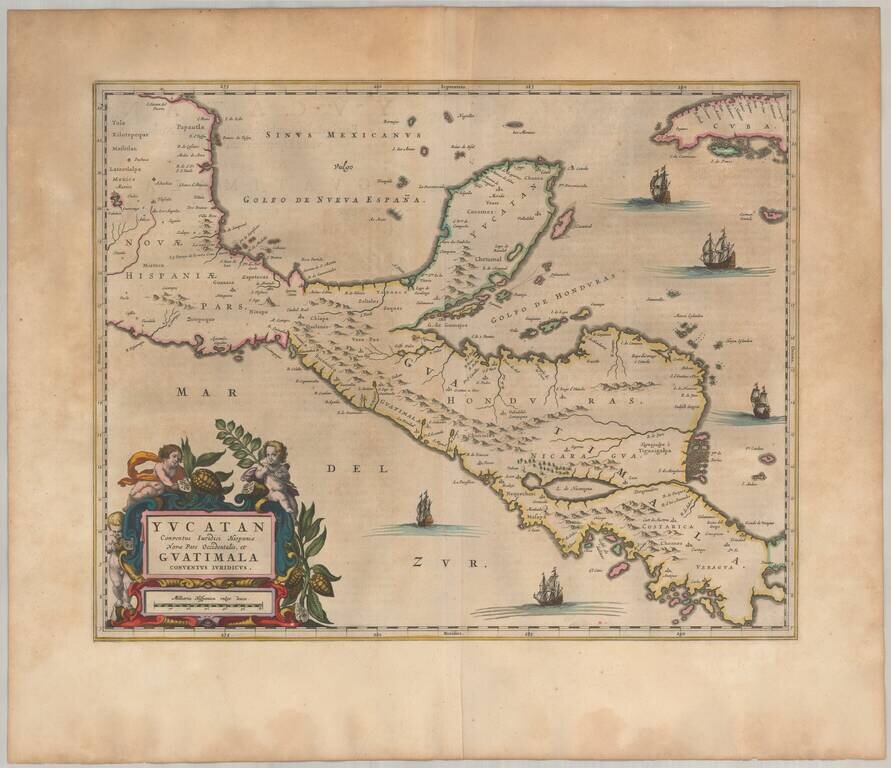
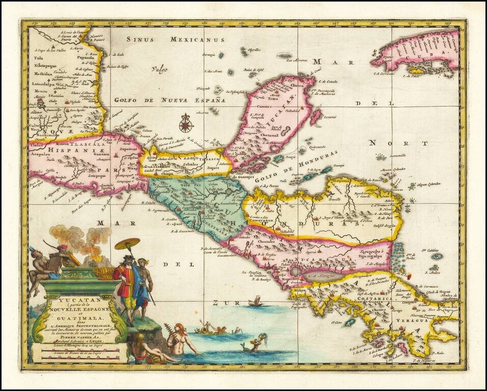
An Early Decorative Map of the Yucatan and Central America Striking full color example of Ogilby's regional map, centered on the Yucatan, Guatimala and Honduras, and extending south to Costa Rica and Panama City and North to Mexico City (and showing...
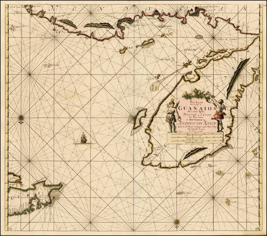
Fine old color example of Van Keulen's sea chart of the Yucatan and Vicinity, including Cozumel, and parts of the Coast of Belize, Nicaragua, Honduras and the western part of Cuba, from De Nieuwe Groote Lichtende Zee-Fakkel . . . . A very attractive...
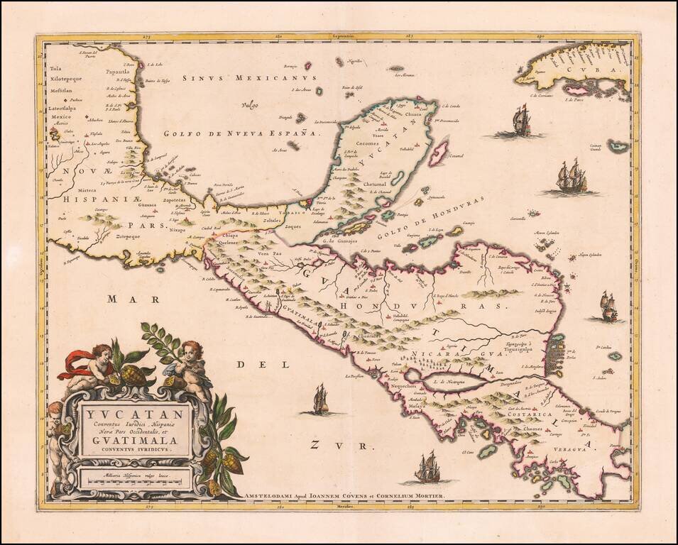
Rare example of Covens & Mortier's map of the Yucatan Peninsula. First issued by Joannes Blaeu, this edition is very rare on the market. This is one of the earliest Dutch maps to focus on the region centered on the Yucatan Peninsula. Includes...
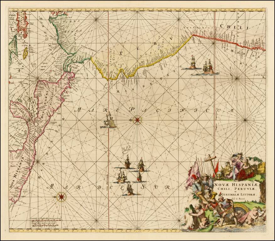
Nice example of this sea chart of the western coastlines of South and Central America, published by Louis Renard. The map covers the Pacific Coast from Xalisco, Mexico, to Puerta Bairres and Rio Cachapool in Chile, covering over two thirds of the...
Rare early map of Central America and the Caribbean, published by Vander Aa in Amsterdam. Decorative map of the region from Mexico City to Panama City, extending to include part of Cuba, and is based on Blaeu's map of the Yucatan peninsula. Cozumel...
![[Volcanos] The Bay of Honduras. By Thos. Jefferys Geographer to His Majesty](/map/small/70861.jpg)
With Volcanos in El Salvador and Guatemala shown Nice example of Thomas Jefferys chart of the coastline from Salamanca de Bacalar to Brewer's Lagoon and the Moskito Coast, centered on the Gulf of Honduras and the Rio Balize. Extends to the Port of...
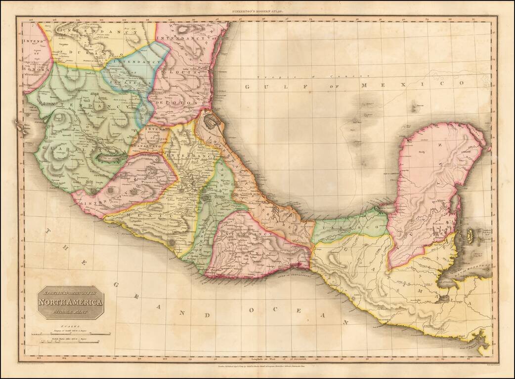
Fine example of John Pinkerton's finely detailed map of Southern Mexico, the Yucatan and Guatemala, published in 1811. The map provides a fine depiction of the heart of Mexico, just months after the Grito de Dolores, on September 16, 1810, and...
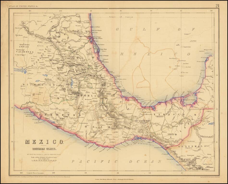
Lithographed map of Southern Mexico by Rogers & Johnston. The map covers the states of Queretaro, Mexico, Puebla, Veracruz, Oajaca, Guerrero, Tehuantepec, Tabasco, Chiapas.
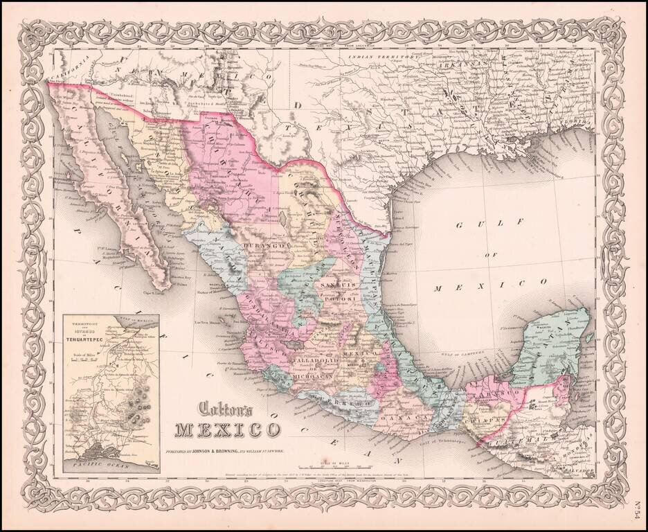
Very detailed map showing towns, counties, Gulf of Mexcico and Gulf of California with lovely decorative border and inset of Territory and Isthmus of Tehuantepec. An excellent pre-Civil War map. From the scarce 1859 edition of Colton's atlas, which is...
![A Map of British Honduras... [bound in:] Tratado de Limites Entre Los Estados-Unidos Mexicanos y Honduras Britanica Seguido de los principales documentos que a el se refieren. Edicion Oficial.](/map/small/70984.jpg)
Determining Belize's Northern Limits. Frist official Mexican edition of the treaty with Great Britain establishing the Mexico-Belize border. Belize's borders have long been an issue for the country and its neighbors. The Belize-Mexico and...